Toggle navigation
LMEC Home
Exhibitions
Georeferencing
Tools for Teachers
Collections
My Favorites
Sign Up / Log In
Search
Search the map portal
Map Collection
Map Collection
Map Sets
Search
Search
Search for
Search In
All Fields
Creator
Title
Subject
Place
Search All Digital Collections
Advanced Search
8552 Results
My Search
Start Over
More Like
commonwealth:7h14b4616
Remove constraint More Like: commonwealth:7h14b4616
Filter your Search
Place
North and Central America
5,847
United States
4,771
Massachusetts
2,052
Europe
1,359
Suffolk (county)
1,034
Boston
1,007
Canada
448
Asia
422
more
Place
»
Topic
Boston (Mass.)--Maps
577
United States--Maps
273
Real property--Massachusetts--Boston--Maps
174
Massachusetts--Maps
160
Landowners--Massachusetts--Boston--Maps
132
North America--Maps--Early works to 1800
103
New England--Maps
99
Europe--Maps
78
more
Topic
»
Date
Date range begin
–
Date range end
Current results range from
1482
to
2023
View distribution
Creator
United States. Hydrographic Office
594
O.H. Bailey & Co
148
Des Barres, Joseph F. W. (Joseph Frederick Wallet), 1722-1824
123
United States. Post Office Dept
120
Ptolemy, 2nd cent
100
Walling, Henry Francis, 1825-1888
94
Geological Survey (U.S.)
86
Jefferys, Thomas, -1771
85
more
Creator
»
Format
Maps/Atlases
8,493
Manuscripts
215
Prints
56
Books
36
Objects/Artifacts
10
Drawings/Illustrations
8
Posters
4
Georeferenced
Yes
868
No
7,684
Collection
Norman B. Leventhal Map & Education Center Collection
8,549
Boston and New England Maps
2,204
Urban Maps
1,936
Maritime Charts and Atlases
1,081
American Revolutionary War-Era Maps
619
Boston Redevelopment Authority Collection
87
William L. Clements Library Collection
3
Available to use
No known restrictions
8,408
Creative Commons license
46
Search Constraints
Sort by relevance
relevance
title
date (asc)
date (desc)
Number of results to display per page
20 per page
10
per page
20
per page
50
per page
100
per page
View results as:
grid view
map view
Search Results
1741.
Complete map of the rail roads and water courses in the United States & Canada
1742.
Complete map of Vermont showing highways & natural features with an index of all cities, villages, post-offices and railroad...
1743.
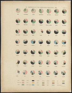
Composition of the foreign-born population : 1890
1744.
A comprehensive atlas geographical, historical & commercial [title page]
1745.
Compromise of 1850, September 6, 1850, vote on passage of Texas-New Mexico provisions
1746.
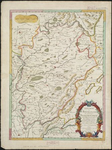
Le comté de Bourgogne, dit autrement Franche-comté conquise par le Roy, en moins de 15 jours de temps, dans le mois de...
1747.
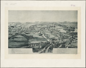
Concord Junction, Mass : 1893
1748.
Connecticut
1749.
Connecticut
1750.
Connecticut
1751.
Connecticut
1752.
Connecticut
1753.
Connecticut, from actual survey
1754.
Connecticut from the best authorities
1755.
Connecticut with portions of New York & Rhode Island
1756.
Constantinople
1757.
Constantinople, or Stambol
1758.
Contado di Molise et principato vltra
1759.
The contending states - boundaries of 350 B.C.
1760.
Contents of composite atlas
‹ Prev
Next ›
1
2
…
84
85
86
87
88
89
90
91
92
…
427
428


![A comprehensive atlas geographical, historical & commercial [title page]](https://bpldcassets.blob.core.windows.net/derivatives/images/commonwealth:3f463182f/image_thumbnail_300.jpg)