Toggle navigation
LMEC Home
Exhibitions
Georeferencing
Tools for Teachers
Collections
My Favorites
Sign Up / Log In
Search
Search the map portal
Map Collection
Map Collection
Map Sets
Search
Search
Search for
Search In
All Fields
Creator
Title
Subject
Place
Search All Digital Collections
Advanced Search
8779 Results
My Search
Start Over
More Like
commonwealth:7h14b147r
Remove constraint More Like: commonwealth:7h14b147r
Filter your Search
Place
North and Central America
6,010
United States
4,907
Massachusetts
2,150
Europe
1,396
Suffolk (county)
1,047
Boston
1,020
Canada
450
Asia
438
more
Place
»
Topic
Boston (Mass.)--Maps
590
United States--Maps
282
Massachusetts--Maps
235
Real property--Massachusetts--Boston--Maps
175
Landowners--Massachusetts--Boston--Maps
133
New England--Maps
104
North America--Maps--Early works to 1800
103
Europe--Maps
79
more
Topic
»
Date
Date range begin
–
Date range end
Current results range from
1482
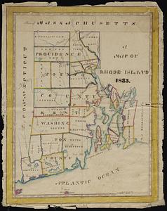
to
2023
View distribution
Creator
United States. Hydrographic Office
595
O.H. Bailey & Co
148
Des Barres, Joseph F. W. (Joseph Frederick Wallet), 1722-1824
123
United States. Post Office Dept
120
Ptolemy, 2nd cent
100
Walling, Henry Francis, 1825-1888
95
Geological Survey (U.S.)
93
Jefferys, Thomas, -1771
85
more
Creator
»
Format
Maps/Atlases
8,718
Manuscripts
217
Prints
56
Books
36
Objects/Artifacts
10
Drawings/Illustrations
8
Posters
5
Ephemera
1
Georeferenced
Yes
879
No
7,900
Collection
Norman B. Leventhal Map & Education Center Collection
8,739
Boston and New England Maps
2,281
Urban Maps
2,024
Maritime Charts and Atlases
1,083
American Revolutionary War-Era Maps
643
Boston Redevelopment Authority Collection
90
Applied Geographics, Inc. Records
20
David Judkins Weaver Papers
20
more
Collection
»
Available to use
No known restrictions
8,597
Creative Commons license
51
Search Constraints
Sort by relevance
relevance
title
date (asc)
date (desc)
Number of results to display per page
20 per page
10
per page
20
per page
50
per page
100
per page
View results as:
grid view
map view
Search Results
61.
Massachusetts and Rhode Island
62.
The Commonwealth of Connecticut
63.
Connecticut
64.
Connecticut
65.
Connecticut
66.
Connecticut, from actual survey
67.
Connecticut from the best authorities
68.
Manuscript maps of U.S. states, possibly drawn by a schoolchild
69.
Map of Connecticut
70.
Preliminary geological map of Connecticut
71.
The state of New York with part of the adjacent states
72.
Dinsmore's new railroad map of the United States and the Canadas, showing all the railroads completed and in progress,...
73.
Map of the eastern junc. Broad Sound Pier, & Pt. Shirley railroad : steamboat lines and connections : established for the...
74.
The North Shore and part of Middlesex County, Mass
75.
Geographical, statistical, and historical map of Rhode Island
76.
A map of Rhode Island
77.
A map of the State of Rhode Island
78.
Map of the State of Rhode Island and Providence Plantations
79.
Map of the State of Rhode Island, and Providence Plantations
80.
Rhode Island
‹ Prev
Next ›
1
2
3
4
5
6
7
8
…
438
439