Toggle navigation
LMEC Home
Exhibitions
Georeferencing
Tools for Teachers
Collections
My Favorites
Sign Up / Log In
Search
Search the map portal
Map Collection
Map Collection
Map Sets
Search
Search
Search for
Search In
All Fields
Creator
Title
Subject
Place
Search All Digital Collections
Advanced Search
8755 Results
My Search
Start Over
More Like
commonwealth:7h14b109b
Remove constraint More Like: commonwealth:7h14b109b
Filter your Search
Place
North and Central America
5,986
United States
4,902
Massachusetts
2,085
Europe
1,396
Suffolk (county)
1,048
Boston
1,021
Canada
461
Asia
438
more
Place
»
Topic
Boston (Mass.)--Maps
588
United States--Maps
282
Real property--Massachusetts--Boston--Maps
175
Massachusetts--Maps
166
Landowners--Massachusetts--Boston--Maps
133
New England--Maps
127
North America--Maps--Early works to 1800
103
Europe--Maps
79
more
Topic
»
Date
Date range begin
–
Date range end
Current results range from
1482
to
2023
View distribution
Creator
United States. Hydrographic Office
595
O.H. Bailey & Co
148
Des Barres, Joseph F. W. (Joseph Frederick Wallet), 1722-1824
123
United States. Post Office Dept
120
Ptolemy, 2nd cent
100
Walling, Henry Francis, 1825-1888
94
Geological Survey (U.S.)
90
Jefferys, Thomas, -1771
86
more
Creator
»
Format
Maps/Atlases
8,695
Manuscripts
218
Prints
56
Books
36
Objects/Artifacts
10
Drawings/Illustrations
8
Posters
5
Georeferenced
Yes
870
No
7,885
Collection
Norman B. Leventhal Map & Education Center Collection
8,702
Boston and New England Maps
2,242
Urban Maps
2,023
Maritime Charts and Atlases
1,083
American Revolutionary War-Era Maps
663
Boston Redevelopment Authority Collection
87
Maps from AAS
25
William L. Clements Library Collection
15
more
Collection
»
Available to use
No known restrictions
8,560
Creative Commons license
50
Search Constraints
Sort by relevance
relevance
title
date (asc)
date (desc)
Number of results to display per page
20 per page
10
per page
20
per page
50
per page
100
per page
View results as:
grid view
map view
Search Results
7381.
Septima Europa tabula continet Sardininiam & Sicilia insulas
7382.
Septima Europae tabula
7383.
Ser. Reg. Caroli Gustavi victoriolus e Sialandia disccssus facta pace Rothschildenli d. 5 Martij 1658 ; Ser. Reg. Sueciæ...
7384.
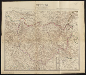
Serbien : nach Österreichischen und Russischen aufnahmen und ortsbestimmungen, und den karten von Viquesnel und Bugarski
7385.
Serio-comic war map for the year 1877
7386.
Al sermo. Ferdinando. II. Grandvca di Toscana svo signore Don Roberto Dudleo, Duca di Northumbria
7387.
Seven miles around Jerusalem : from original surveys and observations
7388.
The Seven United Provinces of Holland, Groningen, Gelders, Friesland, Overyssel, Utrecht and Zealand : from the best authorities
7389.
The Seven United Provinces of Netherland : with its circumjacent borders
7390.
The seven United Provinces, with their roads and divisions
7391.
The Seventh Ward of Philadelphia : the distribution of Negro inhabitants throughout the ward, and their social conditions
7392.
Sexta Asiae tabula
7393.
Sexta Asie tabula continet Arabiam, Felice atq[ue] Carmania cu adiacentibus insulis
7394.
Sexta Europa tabula continet Italiam
7395.
Sexta Europae tabula
7396.
Shadow analysis
7397.
Shah Bay, Loo Choo I.
7398.
Shaker Village
7399.
Shall Union Square overshadow the United States? : America's other 60 families : the real rulers of America
7400.
Shamokin : Pennsylvania, 1884
‹ Prev
Next ›
1
2
…
366
367
368
369
370
371
372
373
374
…
437
438


![Sexta Asie tabula continet Arabiam, Felice atq[ue] Carmania cu adiacentibus insulis](https://bpldcassets.blob.core.windows.net/derivatives/images/commonwealth:7h14b122w/image_thumbnail_300.jpg)


