Toggle navigation
LMEC Home
Exhibitions
Georeferencing
Tools for Teachers
Collections
My Favorites
Sign Up / Log In
Search
Search the map portal
Map Collection
Map Collection
Map Sets
Search
Search
Search for
Search In
All Fields
Creator
Title
Subject
Place
Search All Digital Collections
Advanced Search
8627 Results
My Search
Start Over
More Like
commonwealth:7h14b012f
Remove constraint More Like: commonwealth:7h14b012f
Filter your Search
Place
North and Central America
5,865
United States
4,784
Massachusetts
2,052
Europe
1,359
Suffolk (county)
1,034
Boston
1,007
Canada
453
Asia
422
more
Place
»
Topic
Boston (Mass.)--Maps
577
United States--Maps
273
North America--Maps--Early works to 1800
180
Real property--Massachusetts--Boston--Maps
174
Massachusetts--Maps
160
Landowners--Massachusetts--Boston--Maps
132
New England--Maps
99
Europe--Maps
78
more
Topic
»
Date
Date range begin
–
Date range end
Current results range from
1482
to
2023
View distribution
Creator
United States. Hydrographic Office
594
O.H. Bailey & Co
148
Des Barres, Joseph F. W. (Joseph Frederick Wallet), 1722-1824
123
United States. Post Office Dept
120
Ptolemy, 2nd cent
100
Walling, Henry Francis, 1825-1888
94
Jefferys, Thomas, -1771
90
Geological Survey (U.S.)
86
more
Creator
»
Format
Maps/Atlases
8,568
Manuscripts
217
Prints
56
Books
36
Objects/Artifacts
10
Drawings/Illustrations
8
Posters
4
Georeferenced
Yes
872
No
7,755
Collection
Norman B. Leventhal Map & Education Center Collection
8,558
Boston and New England Maps
2,205
Urban Maps
1,936
Maritime Charts and Atlases
1,081
American Revolutionary War-Era Maps
679
Boston Redevelopment Authority Collection
87
New York Public Library Collection
32
Richard H. Brown Revolutionary War Map Collection at Mount Vernon
18
more
Collection
»
Available to use
No known restrictions
8,411
Creative Commons license
110
Search Constraints
Sort by relevance
relevance
title
date (asc)
date (desc)
Number of results to display per page
20 per page
10
per page
20
per page
50
per page
100
per page
View results as:
grid view
map view
Search Results
7601.
State of Iowa
7602.
State of Kansas
7603.
State of Kansas
7604.
State of Kentucky coal fields and producing districts
7605.
State of Kentucky, stations and transmission lines used in public service in 1921
7606.
State of Louisiana
7607.
State of Louisiana, highlighting low-lying areas derived from USGS digital elevation data
7608.
State of Maine
7609.
State of Maine
7610.
The state of Maryland, from the best authorities
7611.
The state of Massachusetts : compiled from the best authorities
7612.
The state of Massachusetts from the best information
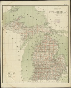
7613.
State of Michigan
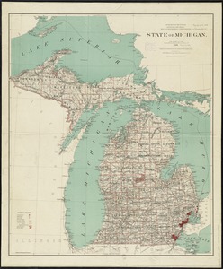
7614.
State of Michigan
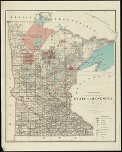
7615.
State of Minnesota
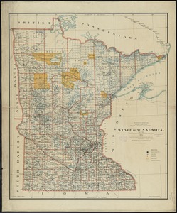
7616.
State of Minnesota
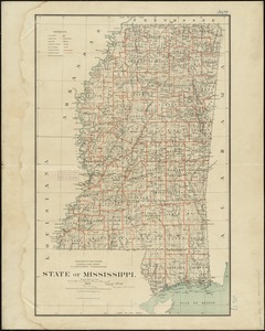
7617.
State of Mississippi
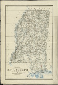
7618.
State of Mississippi
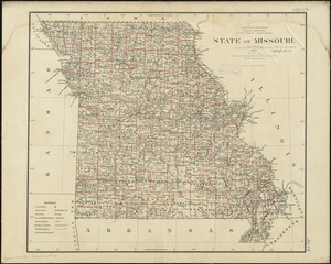
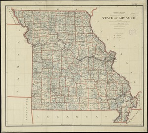
7619.
State of Missouri
7620.
State of Missouri
‹ Prev
Next ›
1
2
…
377
378
379
380
381
382
383
384
385
…
431
432