Toggle navigation
LMEC Home
Exhibitions
Georeferencing
Tools for Teachers
Collections
My Favorites
Sign Up / Log In
Search
Search the map portal
Map Collection
Map Collection
Map Sets
Search
Search
Search for
Search In
All Fields
Creator
Title
Subject
Place
Search All Digital Collections
Advanced Search
8207 Results
My Search
Start Over
More Like
commonwealth:7h149z386
Remove constraint More Like: commonwealth:7h149z386
Filter your Search
Place
North and Central America
4,945
United States
3,783
Suffolk (county)
1,026
Boston
999
Europe
963
Canada
441
Massachusetts
294
France
269
more
Place
»
Topic
Boston (Mass.)--Maps
574
United States--Maps
314
Real property--Massachusetts--Boston--Maps
174
Massachusetts--Maps
160
Landowners--Massachusetts--Boston--Maps
132
North America--Maps--Early works to 1800
103
New England--Maps
99
Europe--Maps
78
more
Topic
»
Date
Date range begin
–
Date range end
Current results range from
1482
to
2023
View distribution
Creator
United States. Hydrographic Office
357
O.H. Bailey & Co
148
Des Barres, Joseph F. W. (Joseph Frederick Wallet), 1722-1824
123
United States. Post Office Dept
120
Ptolemy, 2nd cent
100
Walling, Henry Francis, 1825-1888
94
Jefferys, Thomas, -1771
84
Geological Survey (U.S.)
83
more
Creator
»
Format
Maps/Atlases
8,148
Manuscripts
215
Prints
52
Books
36
Objects/Artifacts
10
Drawings/Illustrations
8
Posters
4
Georeferenced
Yes
871
No
7,336
Collection
Norman B. Leventhal Map Center Collection
8,170
Boston and New England Maps
2,184
Urban Maps
1,925
Maritime Charts and Atlases
750
American Revolutionary War-Era Maps
651
Boston Redevelopment Authority Collection
86
American Antiquarian Society Collection
20
William L. Clements Library Collection
13
more
Collection
»
Available to use
No known restrictions
8,027
Creative Commons license
49
Search Constraints
Sort by relevance
relevance
title
date (asc)
date (desc)
Number of results to display per page
20 per page
10
per page
20
per page
50
per page
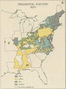
100
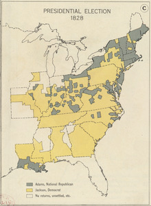
per page
View results as:
grid view
map view
Search Results
141.
Nuclear America
142.
The nuclear weapons complex transportation routes
143.
Oil in America : a pictorial story of the petroleum industry in the United States
144.
Paul Sample's America, its soil
145.
Phelps & Ensign's travellers' guide, and map of the United States, containing the roads, distances, steam boat and canal routes &c
146.
Phelps & Ensign's travellers' guide, and map of the United States, containing the roads, distances, steam boat and canal routes &c
147.
Phelps & Watson's new map of the United States
148.
Pictorial map of the United States, 1849
149.
The pictorial map, stamps of America
150.
The pictorial map, stamps of the U.S.A.
151.
The pictorial map, United States stamps
152.
Portugal is not a small country
153.
Presidential and other elections, 1800
154.
Presidential and other elections, 1804
155.
Presidential and other elections, 1808
156.
Presidential and other elections, 1812
157.
Presidential and other elections, 1816
158.
Presidential election 1820
159.
Presidential election 1824
160.
Presidential election 1828
‹ Prev
Next ›
1
2
…
4
5
6
7
8
9
10
11
12
…
410
411