Toggle navigation
LMEC Home
Exhibitions
Georeferencing
Tools for Teachers
Collections
My Favorites
Sign Up / Log In
Search
Search the map portal
Map Collection
Map Collection
Map Sets
Search
Search
Search for
Search In
All Fields
Creator
Title
Subject
Place
Search All Digital Collections
Advanced Search
8608 Results
My Search
Start Over
More Like
commonwealth:7h149z386
Remove constraint More Like: commonwealth:7h149z386
Filter your Search
Place
North and Central America
5,893
United States
4,822
Massachusetts
2,056
Europe
1,359
Suffolk (county)
1,038
Boston
1,011
Canada
462
Asia
422
more
Place
»
Topic
Boston (Mass.)--Maps
580
United States--Maps
320
Real property--Massachusetts--Boston--Maps
175
Massachusetts--Maps
160
Landowners--Massachusetts--Boston--Maps
133
North America--Maps--Early works to 1800
103
New England--Maps
101
Europe--Maps
78
more
Topic
»
Date
Date range begin
–
Date range end
Current results range from
1482
to
2023
View distribution
Creator
United States. Hydrographic Office
594
O.H. Bailey & Co
148
Des Barres, Joseph F. W. (Joseph Frederick Wallet), 1722-1824
123
United States. Post Office Dept
120
Ptolemy, 2nd cent
100
Walling, Henry Francis, 1825-1888
94
Geological Survey (U.S.)
87
Jefferys, Thomas, -1771
85
more
Creator
»
Format
Maps/Atlases
8,549
Manuscripts
215
Prints
56
Books
36
Objects/Artifacts
10
Drawings/Illustrations
8
Posters
4
Georeferenced
Yes
871
No
7,737
Collection
Norman B. Leventhal Map & Education Center Collection
8,571
Boston and New England Maps
2,210
Urban Maps
1,940
Maritime Charts and Atlases
1,081
American Revolutionary War-Era Maps
651
Boston Redevelopment Authority Collection
87
American Antiquarian Society Collection
20
William L. Clements Library Collection
13
more
Collection
»
Available to use
No known restrictions
8,428
Creative Commons license
49
Search Constraints
Sort by relevance
relevance
title
date (asc)
date (desc)
Number of results to display per page
20 per page
10
per page
20
per page
50
per page
100
per page
View results as:
grid view
map view
Search Results
3461.
Map and profile of the proposed Birmingham Canal : from Warrior River to Five Mile Creek, Alabama
3462.
Map, boundary, Michigan and Ohio
3463.
Map City of Baltimore
3464.
A map containing the towns, villages, gentlemens houses, roads, rivers & other remarks for 20 miles round London
3465.
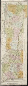
[Map depicting early land division and ownership in Barnard, Vermont]
3466.
Map eighth division railway mail service
3467.
Map eleventh division railway mail service
3468.
A map exhibiting a general view of the roads and inland navigation of Pennsylvania, and part of the adjacent states :...
3469.
Map exhibiting the country between Lakes Michigan and Erie, and the contested boundary lines
3470.
Map exhibiting the Farmington & Hampshire & Hampden canals : together with the line of their proposed continuation through the...
3471.
Map, exhibiting the position of the several lines connected with the settlement of the Ohio boundary question
3472.
Map exhibiting the rail road, canal, lake and river routes from New York and Boston to the west, via Ogdensburgh, Buffalo and...
3473.
Map exhibiting the rail road routes leading from Boston, to Ogdensburg and Buffalo, N.Y
3474.
Map fifth division railway mail service
3475.
Map first division railway mail service
3476.
Map for the interior travels through America, delineating the march of the army
3477.
Map fourth division railway mail service
3478.
Map from the Pacific Ocean across the Rocky Mountain zone : to accompany report on the exploratory survey
3479.
Map illustrating the defence [sic] of Savannah, Ga. and the operations resulting in its capture by the army commanded by Maj....
3480.
Map illustrating the distribution of some of the more important trees in British Columbia
‹ Prev
Next ›
1
2
…
170
171
172
173
174
175
176
177
178
…
430
431


![[Map depicting early land division and ownership in Barnard, Vermont]](https://bpldcassets.blob.core.windows.net/derivatives/images/commonwealth:kk91ft09h/image_thumbnail_300.jpg)


![Map illustrating the defence [sic] of Savannah, Ga. and the operations resulting in its capture by the army commanded by Maj. Genl. W.T. Sherman, Dec. 21st, 1864](https://bpldcassets.blob.core.windows.net/derivatives/images/commonwealth:4m90f544n/image_thumbnail_300.jpg)
