Toggle navigation
LMEC Home
Exhibitions
Georeferencing
Tools for Teachers
Collections
My Favorites
Sign Up / Log In
Search
Search the map portal
Map Collection
Map Collection
Map Sets
Search
Search
Search for
Search In
All Fields
Creator
Title
Subject
Place
Search All Digital Collections
Advanced Search
8608 Results
My Search
Start Over
More Like
commonwealth:7h149x36f
Remove constraint More Like: commonwealth:7h149x36f
Filter your Search
Place
North and Central America
5,893
United States
4,822
Massachusetts
2,056
Europe
1,359
Suffolk (county)
1,038
Boston
1,011
Canada
462
Asia
422
more
Place
»
Topic
Boston (Mass.)--Maps
580
United States--Maps
320
Real property--Massachusetts--Boston--Maps
175
Massachusetts--Maps
160
Landowners--Massachusetts--Boston--Maps
133
North America--Maps--Early works to 1800
103
New England--Maps
101
Europe--Maps
78
more
Topic
»
Date
Date range begin
–
Date range end
Current results range from
1482
to
2023
View distribution
Creator
United States. Hydrographic Office
594
O.H. Bailey & Co
148
Des Barres, Joseph F. W. (Joseph Frederick Wallet), 1722-1824
123
United States. Post Office Dept
120
Ptolemy, 2nd cent
100
Walling, Henry Francis, 1825-1888
94
Geological Survey (U.S.)
87
Jefferys, Thomas, -1771
85
more
Creator
»
Format
Maps/Atlases
8,549
Manuscripts
215
Prints
56
Books
36
Objects/Artifacts
10
Drawings/Illustrations
8
Posters
4
Georeferenced
Yes
871
No
7,737
Collection
Norman B. Leventhal Map & Education Center Collection
8,571
Boston and New England Maps
2,210
Urban Maps
1,940
Maritime Charts and Atlases
1,081
American Revolutionary War-Era Maps
651
Boston Redevelopment Authority Collection
87
American Antiquarian Society Collection
20
William L. Clements Library Collection
13
more
Collection
»
Available to use
No known restrictions
8,428
Creative Commons license
49
Search Constraints
Sort by relevance
relevance
title
date (asc)
date (desc)
Number of results to display per page
20 per page
10
per page
20
per page
50
per page
100
per page
View results as:
grid view
map view
Search Results
1801.
China, military regions
1802.
China, north east coast, Shantung Promontory, Kyau-Chau Bay to Miau-Tau Strait : from Brit. surveys in 1857-66, corrected to...
1803.
China Sea
1804.
China Sea, channel between Lamtia Island and House Hill
1805.
China Sea, Gaspar Strait with its three channels
1806.
China Sea, Hongkong, Man of War Anchorage : from a British survey in 1877
1807.
China, south coast, principal ethnic groups and dialects
1808.
China's situation in the world
1809.
[Chippewa] National Forest, Minnesota
1810.
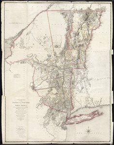
A chorographical map of the Province of New-York in North America, divided into counties, manors, patents and townships :...
1811.
A chorographical map of the Province of New-York in North America, divided into counties, manors, patents and townships :...
1812.
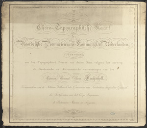
Choro-topographische kaart der Noordelijke provincien van het Koningrijk der Nederlanden
1813.
Chūseki keishi chizu
1814.
A cidade de Angra na ilha de Iesu xpō da Tercera que esta em 39. graos
1815.
Circulation plan of parking lot at the corner of VFW Parkway and Spring Street, West Roxbury
1816.
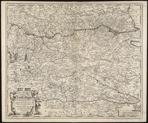
Circuli Austriaci pars septentrionalis in qua Archiducatus Austriae et Ducatus Stiriae accuratissime divisi ostenduntur
1817.
Circuli Saxoniae superioris pars meridionalis in qua sunt ducatus Saxoniae, comitatus Mansfeldiae, et Voitlandiae, landgraviat...
1818.
Circulus Bavaricus in quo sunt Ducatus, Electoratus, & Palatinat Bavariae, Archiepisc: Salisburgi, Episcopatus Ratisbonaw,...
1819.
Circulus electorum Rheni sive Rhenanus Inferior complectens accuratam descriptionem Archiepiscopatus Moguntini Coloniensis et...
1820.
Circulus Franconius, in quo sunt episcopatus Wurtzburg, Bamberg et Aichstet : status equitum Teutonicor ducatus Coburgensis :...
‹ Prev
Next ›
1
2
…
87
88
89
90
91
92
93
94
95
…
430
431


![[Chippewa] National Forest, Minnesota](https://bpldcassets.blob.core.windows.net/derivatives/images/commonwealth:th83pg40d/image_thumbnail_300.jpg)