Toggle navigation
LMEC Home
Exhibitions
Georeferencing
Tools for Teachers
Collections
My Favorites
Sign Up / Log In
Search
Search the map portal
Map Collection
Map Collection
Map Sets
Search
Search
Search for
Search In
All Fields
Creator
Title
Subject
Place
Search All Digital Collections
Advanced Search
8814 Results
My Search
Start Over
More Like
commonwealth:7h149w35z
Remove constraint More Like: commonwealth:7h149w35z
Filter your Search
Place
North and Central America
6,013
United States
4,892
Massachusetts
2,079
Europe
1,396
Suffolk (county)
1,046
Boston
1,019
Canada
463
Asia
438
more
Place
»
Topic
Boston (Mass.)--Maps
586
United States--Maps
330
Real property--Massachusetts--Boston--Maps
175
Massachusetts--Maps
162
Landowners--Massachusetts--Boston--Maps
133
North America--Maps--Early works to 1800
103
New England--Maps
102
North America--Maps
85
more
Topic
»
Date
Date range begin
–
Date range end
Current results range from
1482
to
2023
View distribution
Creator
United States. Hydrographic Office
595
O.H. Bailey & Co
148
Des Barres, Joseph F. W. (Joseph Frederick Wallet), 1722-1824
123
United States. Post Office Dept
120
Ptolemy, 2nd cent
100
Walling, Henry Francis, 1825-1888
94
Jefferys, Thomas, -1771
88
Geological Survey (U.S.)
87
more
Creator
»
Format
Maps/Atlases
8,754
Manuscripts
216
Prints
56
Books
36
Objects/Artifacts
10
Drawings/Illustrations
8
Posters
5
Georeferenced
Yes
876
No
7,938
Collection
Norman B. Leventhal Map & Education Center Collection
8,702
Boston and New England Maps
2,233
Urban Maps
2,023
Maritime Charts and Atlases
1,085
American Revolutionary War-Era Maps
725
Boston Redevelopment Authority Collection
87
Maps from AAS
54
William L. Clements Library Collection
32
more
Collection
»
Available to use
No known restrictions
8,558
Creative Commons license
61
Search Constraints
Sort by relevance
relevance
title
date (asc)
date (desc)
Number of results to display per page
20 per page
10
per page
20
per page
50
per page
100
per page
View results as:
grid view
map view
Search Results
381.
A Correct chart of the West India islands : engraved for Malham's naval gazetteer
382.
Map of the European settlements in the West Indies
383.
A new and correct map of the American islands, now called the West Indies, with the whole coast of the neighbouring continent
384.
A new map of the West Indian islands; : as they are possessed by the European powers; drawn from the most recent authorities
385.
Plan of the bay of Tortuga
386.
West Indies
387.
The West Indies, : exhibiting the English French Spanish Dutch & Danish settlements with the adjacent parts of North & South...
388.
West Indies, : with the harbour & fort of Omoa. From the best authorities
389.
The Windward Passage, with the several passages from the east end of Cuba : & from the north part of St. Domingo
390.
An accurate map of North America
391.
L'Amérique Septentrionale
392.
Amerique Septentrionale
393.
Amerique Septentrionale avec les routes, distances en miles, villages et etablissements françois et anglois = North America
394.
Amerique septentrionale divisée en ses principales parties
395.
Amérique Septentrionale divisée en ses principaux etats
396.
Amérique Septentrionale publiée sous les auspices de Monseigneur le Duc d'Orleans prémier prince du sang
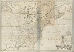
397.
The British colonies in North America
398.
Canada, Louisiane et terres angloises
399.
Canada, Louisiane et terres angloises
400.
Canada, Louisiane et terres angloises
‹ Prev
Next ›
1
2
…
16
17
18
19
20
21
22
23
24
…
440
441