Toggle navigation
LMEC Home
Exhibitions
Georeferencing
Tools for Teachers
Collections
My Favorites
Sign Up / Log In
Search
Search the map portal
Map Collection
Map Collection
Map Sets
Search
Search
Search for
Search In
All Fields
Creator
Title
Subject
Place
Search All Digital Collections
Advanced Search
9052 Results
My Search
Start Over
More Like
commonwealth:7d27c9549
Remove constraint More Like: commonwealth:7d27c9549
Filter your Search
Place
North and Central America
6,283
United States
5,201
Massachusetts
2,155
Suffolk (county)
1,403
Europe
1,396
Boston
1,376
Canada
449
Asia
438
more
Place
»
Topic
Boston (Mass.)--Maps
677
City planning--Massachusetts--Boston--Maps
418
United States--Maps
282
Urban renewal--Massachusetts--Boston--Maps
252
Real property--Massachusetts--Boston--Maps
217
Massachusetts--Maps
162
Landowners--Massachusetts--Boston--Maps
136
North America--Maps--Early works to 1800
103
more
Topic
»
Date
Date range begin
–
Date range end
Current results range from
1482
to
2023
View distribution
Creator
United States. Hydrographic Office
595
Boston Redevelopment Authority
390
O.H. Bailey & Co
148
Des Barres, Joseph F. W. (Joseph Frederick Wallet), 1722-1824
123
United States. Post Office Dept
120
Ptolemy, 2nd cent
100
Walling, Henry Francis, 1825-1888
94
Geological Survey (U.S.)
86
more
Creator
»
Format
Maps/Atlases
8,991
Manuscripts
215
Prints
56
Books
36
Objects/Artifacts
10
Drawings/Illustrations
9
Posters
5
Georeferenced
Yes
870
No
8,182
Collection
Norman B. Leventhal Map & Education Center Collection
8,696
Boston and New England Maps
2,586
Urban Maps
2,373
Maritime Charts and Atlases
1,083
American Revolutionary War-Era Maps
620
Boston Redevelopment Authority Collection
438
William L. Clements Library Collection
3
Mapping Boston Collection
2
more
Collection
»
Available to use
No known restrictions
8,904
Creative Commons license
49
Search Constraints
Sort by relevance
relevance
title
date (asc)
date (desc)
Number of results to display per page
20 per page
10
per page
20
per page
50
per page
100
per page
View results as:
grid view
map view
Search Results
5541.
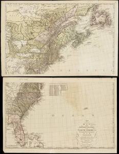
A new map of part of the United States of North America, containing those of New York, Vermont, New Hampshire, Massachusets...
5542.
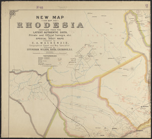
New map of Rhodesia : compiled from the latest authentic data, private and official surveys, etc. with special inset maps
5543.
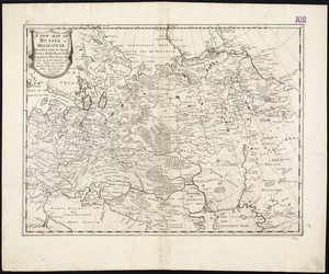
A new map of Russia or Moscovie divided into its Kingdoms, Dukedoms, Principalities, Provinces, &c
5544.
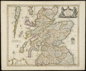
A new map of Scotland with the roads
5545.
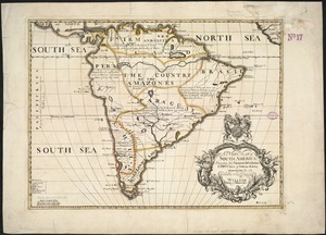
A new map of South America : shewing it's general divisions, chief cities & towns, rivers, mountains &c
5546.
A new map of Texas, Oregon, and California with the regions adjoining
5547.
New map of the American overland route showing its connections, and land grants of 30,000,000 acres
5548.
A new map of the Baltick &c : shewing all the dominions about it with ye great or post roads and principal cross-roads
5549.
A new map of the British colonies in North America, shewing the seat of the present war, taken from the best surveys, compared...
5550.
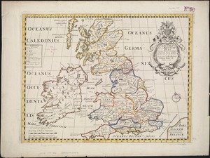
A new map of the Brittish Isles shewing their antient people, cities, and towns of note, in the time of the Romans : dedicated...
5551.
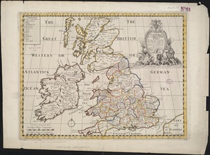
A new map of the Brittish Isles shewing their present genl. divisions, cities, and such other towns, or places, as answer to...
5552.
New map of the central portion of Boston
5553.
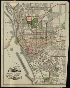
New map of the City of Buffalo
5554.
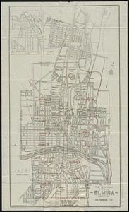
The new map of the City of Elmira
5555.
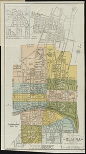
The new map of the City of Elmira
5556.
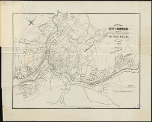
New map of the city of Norwich
5557.
New map of the city of Philadelphia from the latest city surveys
5558.
A new map of the country of Louisiana and of ye river Missisipi in North America discou'd by Mons. de la Salle in ye years...
5559.
New map of the Dominion of Canada
5560.
A new map of the East Indies and China from the best authorities
‹ Prev
Next ›
1
2
…
274
275
276
277
278
279
280
281
282
…
452
453
![A new map of part of the United States of North America, containing those of New York, Vermont, New Hampshire, Massachusets [sic], Connecticut, Rhode Island, Pennsylvania, New Jersey, Delaware, Maryland and Virginia](https://bpldcassets.blob.core.windows.net/derivatives/images/commonwealth:6t053p06v/image_thumbnail_300.jpg)