Toggle navigation
LMEC Home
Exhibitions
Georeferencing
Tools for Teachers
Collections
My Favorites
Sign Up / Log In
Search
Search the map portal
Map Collection
Map Collection
Map Sets
Search
Search
Search for
Search In
All Fields
Creator
Title
Subject
Place
Search All Digital Collections
Advanced Search
8723 Results
My Search
Start Over
More Like
commonwealth:6t053q283
Remove constraint More Like: commonwealth:6t053q283
Filter your Search
Place
North and Central America
5,954
United States
4,861
Massachusetts
2,079
Europe
1,396
Suffolk (county)
1,046
Boston
1,019
Canada
451
Asia
438
more
Place
»
Topic
Boston (Mass.)--Maps
586
United States--Maps
282
Real property--Massachusetts--Boston--Maps
175
Massachusetts--Maps
162
Landowners--Massachusetts--Boston--Maps
133
North America--Maps--Early works to 1800
104
New England--Maps
102
Europe--Maps
79
more
Topic
»
Date
Date range begin
–
Date range end
Current results range from
1482
to
2023
View distribution
Creator
United States. Hydrographic Office
595
O.H. Bailey & Co
148
Des Barres, Joseph F. W. (Joseph Frederick Wallet), 1722-1824
123
United States. Post Office Dept
120
Ptolemy, 2nd cent
100
Walling, Henry Francis, 1825-1888
94
Geological Survey (U.S.)
86
Jefferys, Thomas, -1771
86
more
Creator
»
Format
Maps/Atlases
8,663
Manuscripts
217
Prints
56
Books
36
Objects/Artifacts
10
Drawings/Illustrations
8
Posters
5
Georeferenced
Yes
871
No
7,852
Collection
Norman B. Leventhal Map & Education Center Collection
8,696
Boston and New England Maps
2,233
Urban Maps
2,023
Maritime Charts and Atlases
1,083
American Revolutionary War-Era Maps
640
Boston Redevelopment Authority Collection
87
MacLean Collection Map Library
9
New York Public Library Collection
8
more
Collection
»
Available to use
No known restrictions
8,552
Creative Commons license
65
Search Constraints
Sort by relevance
relevance
title
date (asc)
date (desc)
Number of results to display per page
20 per page
10
per page
20
per page
50
per page
100
per page
View results as:
grid view
map view
Search Results
21.
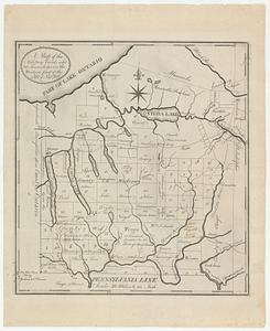
A map of the military lands and 20 townships in the western part of the state of New York
22.
A map of the Province of New-York : reduc'd from the large drawing of that province, compiled from actual surveys by order of...
23.
Lauff des flusses St. Laurentzi von Quebec bis an den See Ontario : 2. bladt
24.
A map of New England and New York
25.
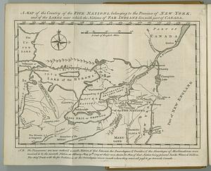
A map of the country of the Five Nations, belonging to the province of New York; and of the lakes near which the nations of far...
26.
A map of the eastern part of the province of New York with part of New Jersey, & c
27.
A map of the eastern part of the province of New York with part of New Jersey, & c
28.
A map of the inhabited part of Canada from the French surveys : with the frontiers of New York and New England from the large...
29.
A map of the Province of New York, with part of Pensilvania, and New England : from an actual survey by Captain Montresor,...
30.
A map of the Province of New York, with part of Pensilvania, and New England : from an actual survey by Captain Montresor,...
31.
A map of the province of New York, with part of Pensilvania, and New England
32.
Map of western New York state, marking land plots around Lac Oneida
33.
New England and New York
34.
Noua Anglia, Nouum Belgium, et Virginia
35.
Nouvelle Angleterre et Nouvel York
36.
La Pensilvania, la Nuova York, il Jersey Settentrio[na]le : con la parte occidentale del Connecticut, Massachusset-s-bay e...
37.
Province de New-York en 4. feuilles
38.
Province de New-York en 4. feuilles
39.
Province de New-York en 4. feuilles par Montresor
40.
The provinces of New York, and New Jersey; with part of Pensilvania, and the governments of Trois Rivieres, and Montreal
‹ Prev
Next ›
1
2
3
4
5
6
…
436
437


![La Pensilvania, la Nuova York, il Jersey Settentrio[na]le](https://bpldcassets.blob.core.windows.net/derivatives/images/commonwealth:z603vq53g/image_thumbnail_300.jpg)