Toggle navigation
LMEC Home
Exhibitions
Georeferencing
Tools for Teachers
Collections
My Favorites
Sign Up / Log In
Search
Search the map portal
Map Collection
Map Collection
Map Sets
Search
Search
Search for
Search In
All Fields
Creator
Title
Subject
Place
Search All Digital Collections
Advanced Search
8762 Results
My Search
Start Over
More Like
commonwealth:6h446z087
Remove constraint More Like: commonwealth:6h446z087
Filter your Search
Place
North and Central America
6,001
United States
4,920
Massachusetts
2,080
Europe
1,392
Suffolk (county)
1,155
Boston
1,128
Canada
449
Asia
437
more
Place
»
Topic
Boston (Mass.)--Maps
603
United States--Maps
279
Real property--Massachusetts--Boston--Maps
254
Landowners--Massachusetts--Boston--Maps
170
Massachusetts--Maps
161
City planning--Massachusetts--Boston--Maps
138
North America--Maps--Early works to 1800
103
New England--Maps
101
more
Topic
»
Date
Date range begin
–
Date range end
Current results range from
1482
to
2023
View distribution
Creator
United States. Hydrographic Office
595
O.H. Bailey & Co
148
Boston Redevelopment Authority
141
Des Barres, Joseph F. W. (Joseph Frederick Wallet), 1722-1824
123
United States. Post Office Dept
120
Ptolemy, 2nd cent
100
Walling, Henry Francis, 1825-1888
94
Geological Survey (U.S.)
86
more
Creator
»
Format
Maps/Atlases
8,702
Manuscripts
215
Prints
56
Books
36
Objects/Artifacts
10
Drawings/Illustrations
8
Posters
5
Georeferenced
Yes
870
No
7,892
Collection
Norman B. Leventhal Map & Education Center Collection
8,651
Boston and New England Maps
2,300
Urban Maps
2,070
Maritime Charts and Atlases
1,083
American Revolutionary War-Era Maps
615
Boston Redevelopment Authority Collection
163
Massachusetts Real Estate Atlases
35
Applied Geographics, Inc. Records
2
more
Collection
»
Available to use
No known restrictions
8,584
Creative Commons license
48
Search Constraints
Sort by relevance
relevance
title
date (asc)
date (desc)
Number of results to display per page
20 per page
10
per page
20
per page
50
per page
100
per page
View results as:
grid view
map view
Search Results
3801.
Map of Forest Park, showing [St. Louis]
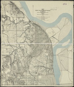
3802.
Map of Fort Leavenworth, Kansas and vicinity
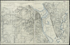
3803.
Map of Fort Leavenworth, Kas. and vicinity
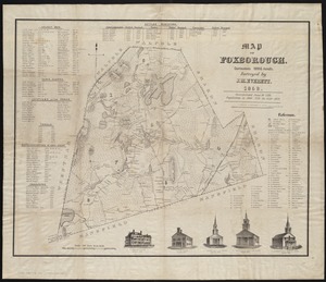
3804.
Map of Foxborough : containing 12806 acres
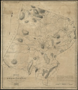
3805.
Map of Framingham : from actual surveys taken by Jonas Clayes & Warren Nixon in the years 1830 and 1831
3806.
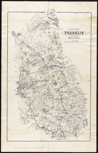
Map of Franklin County, Maine
3807.
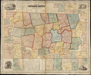
Map of Franklin County, Massachusetts : based upon the trigonometrical survey of the state
3808.
Map of Fresh Pond : showing the division lines of the proprietors extended into the pond and defining their right to the same...
3809.
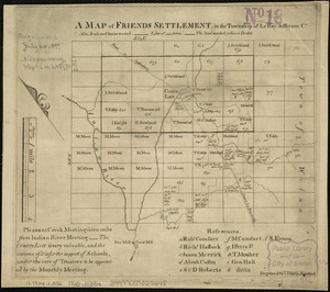
A map of Friends settlement, in the township of Le Ray Jefferson Co
3810.
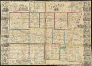
Map of Genesee County, New York
3811.
Map of Gloucester, Cape Ann : shewing the roads, harbours, rivers, coves, islands & ledges surrounding that important cape,...
3812.
Map of Great Brewster Island, Boston Harbor : showing the abrasion from 1820 to 1851 inclusive
3813.
Map of greater Baltimore, compiled from official records : area 91.93 sq. mi
3814.
Map of greater New York : Map of the borough of Manhattan
3815.
Map of Greene County, Ohio
3816.
Map of Greene County, Virginia
3817.
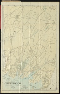
Map of Greenwich, township and borough, Fairfield County, Connecticut
3818.
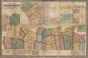
Map of Hampden County, Massachusetts : based upon the trigonometrical survey of the state
3819.
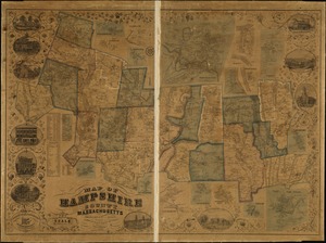
Map of Hampshire County, Massachusetts
3820.
Map of Hampton Roads and Norfolk Harbor : showing the location of Fortress Monroe & Forts Calhoun & Norfolk : from the latest...
‹ Prev
Next ›
1
2
…
187
188
189
190
191
192
193
194
195
…
438
439
![Map of Forest Park, showing [St. Louis]](https://bpldcassets.blob.core.windows.net/derivatives/images/commonwealth:4m90fb114/image_thumbnail_300.jpg)