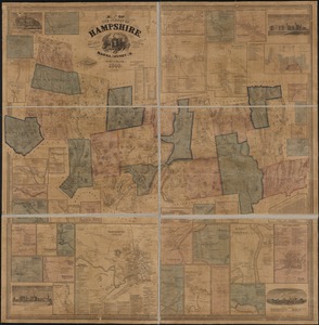
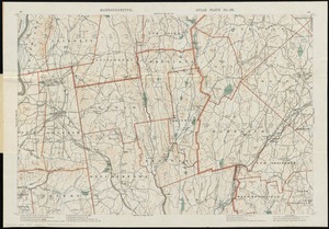
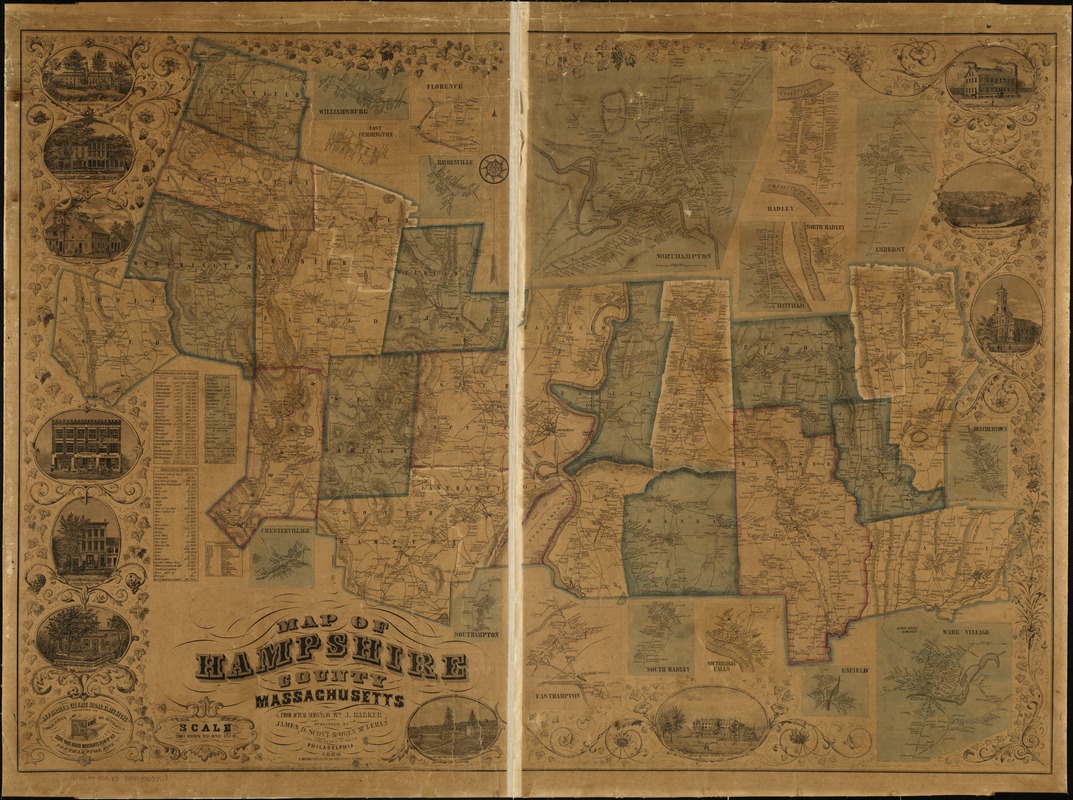
Map of Hampshire County, Massachusetts
Item Information
- Title:
- Map of Hampshire County, Massachusetts
- Creator:
- Barker, Wm. J. (William J.), surveyor
- Name on Item:
-
from actual surveys by Wm. J. Barker.
- Date:
-
1854
- Format:
-
Maps/Atlases
- Location:
-
Boston Public Library
Norman B. Leventhal Map & Education Center - Collection (local):
-
Norman B. Leventhal Map & Education Center Collection
- Subjects:
-
Real property--Massachusetts--Hampshire County--Maps
Central business districts--Massachusetts--Northampton--Maps
Landowners--Massachusetts--Hampshire County--Maps
Hampshire County (Mass.)--Maps
- Places:
-
MassachusettsHampshire (county)Northampton
- Extent:
- 1 map : col. ; 97 x 133 cm.
- Terms of Use:
-
No known copyright restrictions.
No known restrictions on use.
- Publisher:
-
Philadelphia :
James D. Scott & Owen McLeran
- Scale:
-
Scale [1:55,440]. 280 rods = 1 in.
- Language:
-
English
- Notes:
-
Relief shown by hachures.
General map showing buildings and householders' names.
Includes ill. of buildings, advertisement, miscellaneous statistical tables, inset of downtown Northampton, and 16 insets of villages.
- Identifier:
-
06_01_005160
- Call #:
-
G3763.H4 1854 .B3
- Barcode:
-
39999059009918
- LCCN:
-
2008624301