Toggle navigation
LMEC Home
Exhibitions
Georeferencing
Tools for Teachers
Collections
My Favorites
Sign Up / Log In
Search
Search the map portal
Map Collection
Map Collection
Map Sets
Search
Search
Search for
Search In
All Fields
Creator
Title
Subject
Place
Search All Digital Collections
Advanced Search
8714 Results
My Search
Start Over
More Like
commonwealth:6h446x056
Remove constraint More Like: commonwealth:6h446x056
Filter your Search
Place
North and Central America
5,945
United States
4,862
Massachusetts
2,080
Europe
1,396
Suffolk (county)
1,064
Boston
1,037
Canada
449
Asia
438
more
Place
»
Topic
Boston (Mass.)--Maps
587
United States--Maps
282
Real property--Massachusetts--Boston--Maps
181
Massachusetts--Maps
163
Landowners--Massachusetts--Boston--Maps
139
North America--Maps--Early works to 1800
103
New England--Maps
102
Europe--Maps
79
more
Topic
»
Date
Date range begin
–
Date range end
Current results range from
1482
to
2023
View distribution
Creator
United States. Hydrographic Office
595
O.H. Bailey & Co
148
Des Barres, Joseph F. W. (Joseph Frederick Wallet), 1722-1824
123
United States. Post Office Dept
120
Ptolemy, 2nd cent
100
Walling, Henry Francis, 1825-1888
94
Geological Survey (U.S.)
87
Jefferys, Thomas, -1771
85
more
Creator
»
Format
Maps/Atlases
8,654
Manuscripts
215
Prints
56
Books
36
Objects/Artifacts
10
Drawings/Illustrations
8
Posters
5
Georeferenced
Yes
870
No
7,844
Collection
Norman B. Leventhal Map & Education Center Collection
8,695
Boston and New England Maps
2,245
Urban Maps
2,035
Maritime Charts and Atlases
1,083
American Revolutionary War-Era Maps
616
Boston Redevelopment Authority Collection
99
Massachusetts Real Estate Atlases
7
Available to use
No known restrictions
8,565
Creative Commons license
47
Search Constraints
Sort by relevance
relevance
title
date (asc)
date (desc)
Number of results to display per page
20 per page
10
per page
20
per page
50
per page
100
per page
View results as:
grid view
map view
Search Results
21.
West Roxbury Park : West Roxbury district
22.
Atlas of the city of Boston : Roxbury : from actual surveys and official plans
23.
Atlas of the city of Boston : Roxbury : from actual surveys and official plans
24.
Atlas of the city of Boston : Roxbury : from actual surveys and official plans
25.
Atlas of the city of Boston : Roxbury : from actual surveys and official plans
26.
Atlas of the city of Boston : Roxbury : volume two : from actual surveys and official records
27.
Atlas of the city of Boston : Roxbury, Mass. : volume three : from actual surveys and official records
28.
Atlas of the county of Suffolk, Massachusetts : vol. 2nd late city of Roxbury, now wards 13-14 and 15, city of Boston
29.
Chart of Jamaica Pond and plan of surroundings
30.
Forest Hills Cemetery : consecrated June 28th, 1848 : area 203 acres
31.
Jamaica Park and Bussey Farm Parkway : West Roxbury district
32.
Jamaica Plain view of the world
33.
Jamaica Pond master plan
34.
Map of Arnold Arboretum showing location of the trees and shrubs
35.
Map of Arnold Arboretum showing location of the trees and shrubs
36.
Map of proposed arboretum, showing its outlines and local connections, with a study for public drive passing through it
37.
Olmsted Park master plan
38.
Plan of the Arnold Arboretum Jamaica Plain Mass
39.
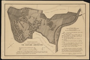
Proposition as to a public ground to include the Harvard Arboretum
40.
Washington Street corridor : South Cove to Forest Hills
‹ Prev
Next ›
1
2
3
4
5
6
…
435
436