Toggle navigation
LMEC Home
Exhibitions
Georeferencing
Tools for Teachers
Collections
My Favorites
Sign Up / Log In
Search
Search the map portal
Map Collection
Map Collection
Map Sets
Search
Search
Search for
Search In
All Fields
Creator
Title
Subject
Place
Search All Digital Collections
Advanced Search
8777 Results
My Search
Start Over
More Like
commonwealth:6h446v194
Remove constraint More Like: commonwealth:6h446v194
Filter your Search
Place
North and Central America
6,008
United States
4,925
Massachusetts
2,090
Europe
1,396
Suffolk (county)
1,127
Boston
1,100
Canada
449
Asia
438
more
Place
»
Topic
Boston (Mass.)--Maps
607
United States--Maps
282
Real property--Massachusetts--Boston--Maps
254
Landowners--Massachusetts--Boston--Maps
170
Massachusetts--Maps
163
City planning--Massachusetts--Boston--Maps
110
North America--Maps--Early works to 1800
103
New England--Maps
102
more
Topic
»
Date
Date range begin
–
Date range end
Current results range from
1482
to
2023
View distribution
Creator
United States. Hydrographic Office
595
O.H. Bailey & Co
148
Des Barres, Joseph F. W. (Joseph Frederick Wallet), 1722-1824
123
United States. Post Office Dept
120
Boston Redevelopment Authority
111
Ptolemy, 2nd cent
100
Walling, Henry Francis, 1825-1888
94
Geological Survey (U.S.)
87
more
Creator
»
Format
Maps/Atlases
8,717
Manuscripts
215
Prints
56
Books
36
Objects/Artifacts
10
Drawings/Illustrations
8
Posters
5
Georeferenced
Yes
869
No
7,908
Collection
Norman B. Leventhal Map & Education Center Collection
8,696
Boston and New England Maps
2,279
Urban Maps
2,069
Maritime Charts and Atlases
1,083
American Revolutionary War-Era Maps
616
Boston Redevelopment Authority Collection
132
Massachusetts Real Estate Atlases
36
Applied Geographics, Inc. Records
1
Available to use
No known restrictions
8,599
Creative Commons license
47
Search Constraints
Sort by relevance
relevance
title
date (asc)
date (desc)
Number of results to display per page
20 per page
10
per page
20
per page
50
per page
100
per page
View results as:
grid view
map view
Search Results
761.
Bacon's military map of Central Europe, in bold print for tracing the movements of the armies
762.
Bacon's military map of the United States shewing the forts & fortifications
763.
Bacon's new army map of the seat of war in Virginia, showing the battle fields, fortifications, etc., on & near the Potomac River
764.
Bacon's new cycling road-map of Nottingham and district
765.
Bacon's new large-print map of Alaska & the Klondike : compiled from the most recent government surveys and showing routes to...
766.
Bacon's new shilling war map Paris to Berlin
767.
Bacon's steel plate map of the American states north & south : showing the railways , forts, and fortifications
768.
Bacon's topographical war map showing the battle fields of Pennsylvania, Maryland, and Virginia
769.
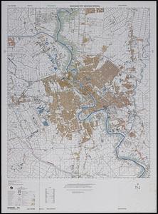
Baghdad city graphic special
770.
Bahama Islands, Crooked Island Anchorage : from a British survey in 1834
771.
Bahía y ciudad de Bayaha, o Puerto del Delfin, en la Isla de Santo Domingo
772.
Bahvsia arx Norwegiæ regi Sueciæ Carolo Gvstavo ex pactis Rodschildensibus traet in eandem Sdita. R. Mtis. introitus die 30...
773.
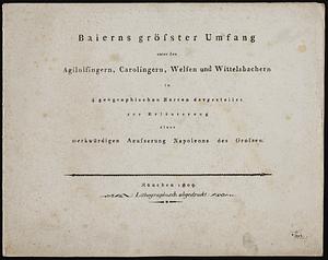
Baierns grösster umfang unter den Agilolfingern, Carolingern, Welfen und Wittelsbachern, in 4 geographischen karten...
774.
Baldwinville, Mass
775.
Balkan Peninsula
776.
Balkan peninsula
777.
Die Balkan-Halbinsel in 4 blättern : Türkei, Rumänien, Griechenland, Serbien, Montenegro, Bulgarien
778.
The Balkans
779.
The Balkans
780.
Ballardvale, Mass : 1885
‹ Prev
Next ›
1
2
…
35
36
37
38
39
40
41
42
43
…
438
439