Toggle navigation
LMEC Home
Exhibitions
Georeferencing
Tools for Teachers
Collections
My Favorites
Sign Up / Log In
Search
Search the map portal
Map Collection
Map Collection
Map Sets
Search
Search
Search for
Search In
All Fields
Creator
Title
Subject
Place
Search All Digital Collections
Advanced Search
8812 Results
My Search
Start Over
More Like
commonwealth:6h446r90z
Remove constraint More Like: commonwealth:6h446r90z
Filter your Search
Place
North and Central America
6,052
United States
4,971
Massachusetts
2,080
Europe
1,392
Suffolk (county)
1,206
Boston
1,179
Canada
449
Asia
437
more
Place
»
Topic
Boston (Mass.)--Maps
603
United States--Maps
279
Real property--Massachusetts--Boston--Maps
254
City planning--Massachusetts--Boston--Maps
186
Landowners--Massachusetts--Boston--Maps
170
Massachusetts--Maps
161
North America--Maps--Early works to 1800
103
New England--Maps
101
more
Topic
»
Date
Date range begin
–
Date range end
Current results range from
1482
to
2023
View distribution
Creator
United States. Hydrographic Office
595
Boston Redevelopment Authority
183
O.H. Bailey & Co
148
Des Barres, Joseph F. W. (Joseph Frederick Wallet), 1722-1824
123
United States. Post Office Dept
120
Ptolemy, 2nd cent
100
Walling, Henry Francis, 1825-1888
94
Geological Survey (U.S.)
86
more
Creator
»
Format
Maps/Atlases
8,753
Manuscripts
215
Prints
56
Books
36
Objects/Artifacts
10
Drawings/Illustrations
8
Posters
4
Georeferenced
Yes
870
No
7,942
Collection
Norman B. Leventhal Map & Education Center Collection
8,649
Boston and New England Maps
2,352
Urban Maps
2,122
Maritime Charts and Atlases
1,083
American Revolutionary War-Era Maps
615
Boston Redevelopment Authority Collection
215
Massachusetts Real Estate Atlases
35
Applied Geographics, Inc. Records
2
more
Collection
»
Available to use
No known restrictions
8,634
Creative Commons license
48
Search Constraints
Sort by relevance
relevance
title
date (asc)
date (desc)
Number of results to display per page
20 per page
10
per page
20
per page
50
per page
100
per page
View results as:
grid view
map view
Search Results
341.
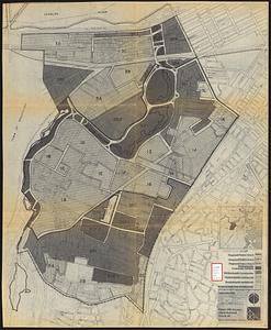
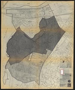
Parker Hill-Fenway urban renewal area r-48 : proposed land use
342.
Parker Hill-Fenway urban renewal area r-48 : existing land use
343.
Parker Hill-Fenway urban renewal area r-48 : development areas
344.
Parker Hill-Fenway urban renewal area r-48 : proposed title I projects
345.
Wastewater system map, Boston proper, sheet no. 21h
346.
Water distribution system map, Boston proper, sheet no. 21h
347.
Water distribution system map, Boston proper, sheet no. 22h
348.
Water system map, Boston proper, sheet no. 22h
349.
Blue Hill Avenue commercial strip
350.
Boston with Charlestown and Roxbury
351.
Campus High School urban renewal area, Mass. r- : land disposition map
352.
Campus High School urban renewal area Mass. r- : existing land use
353.
Campus High School urban renewal area Mass. r- : building conditions
354.
Campus High School urban renewal area Mass. r-129 : proposed land-use
355.
Campus High School urban renewal area Mass. r-129 : existing land-use
356.
Campus High School urban renewal area Mass. r-129 : existing and proposed zoning
357.
Campus High School urban renewal area Massachusetts R-129 : illustrative site plan
358.
Location of manufacturers in Boston sheet 4 or 6
359.
Roxbury
360.
Roxbury - N. Dorchester G.N.R.P. : preliminary land use plan
‹ Prev
Next ›
1
2
…
14
15
16
17
18
19
20
21
22
…
440
441