Toggle navigation
LMEC Home
Exhibitions
Georeferencing
Tools for Teachers
Collections
My Favorites
Sign Up / Log In
Search
Search the map portal
Map Collection
Map Collection
Map Sets
Search
Search
Search for
Search In
All Fields
Creator
Title
Subject
Place
Search All Digital Collections
Advanced Search
8839 Results
My Search
Start Over
More Like
commonwealth:6h446r896
Remove constraint More Like: commonwealth:6h446r896
Filter your Search
Place
North and Central America
6,070
United States
4,988
Massachusetts
2,091
Europe
1,396
Suffolk (county)
1,190
Boston
1,163
Canada
449
Asia
438
more
Place
»
Topic
Boston (Mass.)--Maps
607
United States--Maps
282
Real property--Massachusetts--Boston--Maps
254
Landowners--Massachusetts--Boston--Maps
170
City planning--Massachusetts--Boston--Maps
165
Massachusetts--Maps
162
North America--Maps--Early works to 1800
103
New England--Maps
102
more
Topic
»
Date
Date range begin
–
Date range end
Current results range from
1482
to
2023
View distribution
Creator
United States. Hydrographic Office
595
Boston Redevelopment Authority
166
O.H. Bailey & Co
148
Des Barres, Joseph F. W. (Joseph Frederick Wallet), 1722-1824
123
United States. Post Office Dept
120
Ptolemy, 2nd cent
100
Walling, Henry Francis, 1825-1888
94
Geological Survey (U.S.)
86
more
Creator
»
Format
Maps/Atlases
8,779
Manuscripts
215
Prints
56
Books
36
Objects/Artifacts
10
Drawings/Illustrations
8
Posters
5
Georeferenced
Yes
870
No
7,969
Collection
Norman B. Leventhal Map & Education Center Collection
8,698
Boston and New England Maps
2,342
Urban Maps
2,131
Maritime Charts and Atlases
1,083
American Revolutionary War-Era Maps
616
Boston Redevelopment Authority Collection
193
Massachusetts Real Estate Atlases
35
Applied Geographics, Inc. Records
2
more
Collection
»
Available to use
No known restrictions
8,661
Creative Commons license
48
Search Constraints
Sort by relevance
relevance
title
date (asc)
date (desc)
Number of results to display per page
20 per page
10
per page
20
per page
50
per page
100
per page
View results as:
grid view
map view
Search Results
7761.
St. Christophers or St. Kitts
7762.
St. Croix County, Wis.
7763.
St. Helena : this island belongs to ye English east India Company whose ships usually touch here for a recruit of fresh water...
7764.
St. Joe National Forest, Idaho
7765.
St. Johnsbury, county seat of Caledonia County, Vt : 1884
7766.
St. Lawrence Bay showing Lutke's Harbor
7767.
St. Lawrence Bay showing Lutke's Harbor
7768.
St. Mihiel - B
7769.
St. Pablo, Paumotu Group ; Nukutipipi or Margaret Island, Paumotu Group ; Heretua or Archangel of Quiros, Paumotu Group ; Teku...
7770.
[St. Peter's Bay, on the south shore of Cape Breton Island]
7771.
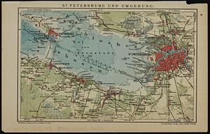
St. Petersburg und umgebung
7772.
St. Stephen, New Brunswick and Calais, Maine : 1889
7773.
St. Thomas, Province, Ontario Canada, 1875
7774.
St. Vincent, from an actual survey made in the year 1773 : after the treaty with the Caribs
7775.
Staaten am Atlantischen Ocean
7776.
Stamford, Conn
7777.
Standard railway map of South Africa = Standaard spoorwegkaart van Suidafrika
7778.
Standard Russo-Japanese war map July 1904
7779.
Stanford's enlarged map of the seat of war
7780.
Stanford's library map of the world on Mercator's projection
‹ Prev
Next ›
1
2
…
385
386
387
388
389
390
391
392
393
…
441
442


![[St. Peter's Bay, on the south shore of Cape Breton Island]](https://bpldcassets.blob.core.windows.net/derivatives/images/commonwealth:ws859h094/image_thumbnail_300.jpg)