Toggle navigation
LMEC Home
Exhibitions
Georeferencing
Tools for Teachers
Collections
My Favorites
Sign Up / Log In
Search
Search the map portal
Map Collection
Map Collection
Map Sets
Search
Search
Search for
Search In
All Fields
Creator
Title
Subject
Place
Search All Digital Collections
Advanced Search
376 Results
My Search
Start Over
More Like
commonwealth:6108vv723
Remove constraint More Like: commonwealth:6108vv723
Filter your Search
Place
North and Central America
336
United States
216
Canada
103
Essex (county)
24
Louisbourg
21
Saint Lawrence River
19
Fort Edward
16
Suffolk (county)
16
more
Place
»
Topic
United States--History--French and Indian War, 1754-1763--Maps, Manuscript--Early works to 1800
58
Louisbourg (N.S.)--Maps, Manuscript--Early works to 1800
18
Fort Edward (N.Y.)--Maps, Manuscript--Early works to 1800
16
Fort Ticonderoga (N.Y.)--Maps, Manuscript--Early works to 1800
15
Saint Lawrence River--Maps, Manuscript--Early works to 1800
15
Louisbourg (N.S.)--History--Siege, 1745--Maps, Manuscript--Early works to 1800
14
Fortification--New York (State)--Fort Edward--Maps, Manuscript--Early works to 1800
13
Fortification--New York (State)--Maps, Manuscript--Early works to 1800
13
more
Topic
»
Date
Date range begin
–
Date range end
Current results range from
1664
to
1816
View distribution
Creator
Royal United Services Institute for Defence and Security Studies
160
George, III, King of Great Britain, 1738-1820
151
George, IV, King of Great Britain, 1762-1830
150
Amherst, Jeffery Amherst, Baron, 1717-1797
128
Skinner, Monier
28
Skinner, William, 1700-1780
28
Brasier, William
16
Bastide, John Henry, approximately 1700-1770
15
more
Creator
»
Format
Maps/Atlases
360
Manuscripts
149
Drawings/Illustrations
14
Georeferenced
Yes
7
No
369
Collection
British Library Collection
376
American Revolutionary War-Era Maps
352
Boston and New England Maps
21
Urban Maps
5
Maritime Charts and Atlases
2
Available to use
Creative Commons license
376
Search Constraints
Sort by date (desc)
relevance
title
date (asc)
date (desc)
Number of results to display per page
20 per page
10
per page
20
per page
50
per page
100
per page
View results as:
grid view
map view
Search Results
221.
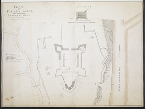
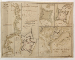
PLAN OF FORT LIGONIER with Part of the RETRANCHMENT
222.
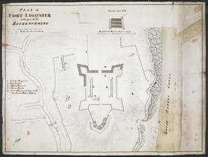
PLAN of FORT LIGONIER with part of the RETRENCHMENT
223.
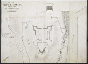
PLAN of FORT LIGONIER with part of the RETRENCHMENT
224.
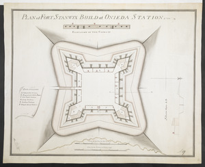
PLAN of FORT STANWIX BUILD at ONIEDA STATION 1758
225.
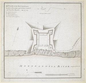
A PLAN of the Fort for 220 men built in December 1758 within 400 Yard's of Fort du Quesne
226.
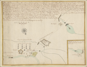
Plan of the Forts at the Onoida or Great Carrying Place in the Province of New York in North America built by Major Charles...
227.
PLAN of the Great Falls on Hudsons River
228.
Plan of the Harbour of St John's in the Bay of Fundy= Plan & Section of the Fort as it is Near Finish'd= Plan & Section's of...
229.
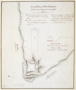
Rough PLAN of FORT DUQUESNE such as it was before it was demolish'd 1758
230.
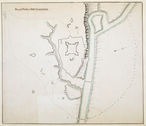
Rough PLAN of FORT LIGONIER
231.
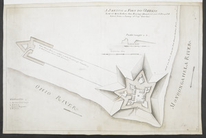
A SKETCH of FORT DU QUESNE how it was before the Enemy abandont and distryd it taken from a survey of Cap.t Gordon's
232.
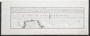
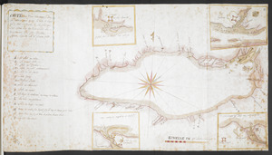
A SKETCH of LAKE ONTARO between OSWEGO and NIAGARA and from thence up the River to the upper End of the Carrying Place
233.
Sketch Of Part of S.t John's Harbour and River= Plan of Fort Frederick with the Necessary Alterations= Plan of the Ramainder of...
234.
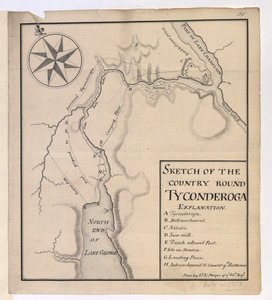
SKETCH OF THE COUNTRY ROUND TYCONDEROGA
235.
Carte Du Lac ontario nouvellement Rellevé avec ces port a grand pois a bitté Lescadre Engloisse & francoisse Leur gremant...
236.
CARTE, ou plan Nouveau du Lac Ontario, avec touttes les isles et bayes qui y Sont rénfermées : Et les forts qui Sont Scitués...
237.
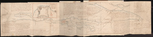
French Draught of Lake Champlain & Lake George
238.
Nouveau plan du Lac ontario depuis Le fort frontenac jusquà Chouayguin, avec les isles Et Bancs qui y Sont
239.
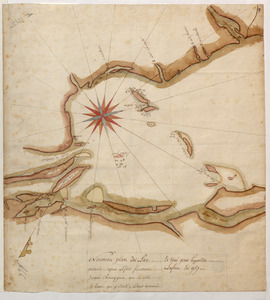
[Plan Du fort Georges appelé par les Anglois William-Henri prie par les francois en 1757 le 9 Aout]
240.
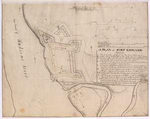
A PLAN of FORT EDWARD
‹ Prev
Next ›
1
2
…
8
9
10
11
12
13
14
15
16
…
18
19


![[Plan Du fort Georges appelé par les Anglois William-Henri prie par les francois en 1757 le 9 Aout]](https://bpldcassets.blob.core.windows.net/derivatives/images/commonwealth:hx11z1913/image_thumbnail_300.jpg)