Toggle navigation
LMEC Home
Exhibitions
Georeferencing
Tools for Teachers
Collections
My Favorites
Sign Up / Log In
Search
Search the map portal
Map Collection
Map Collection
Map Sets
Search
Search
Search for
Search In
All Fields
Creator
Title
Subject
Place
Search All Digital Collections
Advanced Search
9060 Results
My Search
Start Over
More Like
commonwealth:4m90hf890
Remove constraint More Like: commonwealth:4m90hf890
Filter your Search
Place
North and Central America
6,291
United States
5,209
Massachusetts
2,154
Suffolk (county)
1,411
Europe
1,396
Boston
1,384
Canada
449
Asia
438
more
Place
»
Topic
Boston (Mass.)--Maps
681
City planning--Massachusetts--Boston--Maps
418
United States--Maps
282
Urban renewal--Massachusetts--Boston--Maps
253
Real property--Massachusetts--Boston--Maps
221
Massachusetts--Maps
162
Landowners--Massachusetts--Boston--Maps
139
North America--Maps--Early works to 1800
103
more
Topic
»
Date
Date range begin
–
Date range end
Current results range from
1482
to
2023
View distribution
Creator
United States. Hydrographic Office
595
Boston Redevelopment Authority
392
O.H. Bailey & Co
148
Des Barres, Joseph F. W. (Joseph Frederick Wallet), 1722-1824
123
United States. Post Office Dept
120
Ptolemy, 2nd cent
100
Walling, Henry Francis, 1825-1888
94
Geological Survey (U.S.)
86
more
Creator
»
Format
Maps/Atlases
9,000
Manuscripts
215
Prints
56
Books
36
Objects/Artifacts
10
Drawings/Illustrations
8
Posters
5
Georeferenced
Yes
871
No
8,189
Collection
Norman B. Leventhal Map & Education Center Collection
8,698
Boston and New England Maps
2,594
Urban Maps
2,379
Maritime Charts and Atlases
1,083
American Revolutionary War-Era Maps
616
Boston Redevelopment Authority Collection
445
Massachusetts Real Estate Atlases
4
Applied Geographics, Inc. Records
2
more
Collection
»
Available to use
No known restrictions
8,913
Creative Commons license
48
Search Constraints
Sort by relevance
relevance
title
date (asc)
date (desc)
Number of results to display per page
20 per page
10
per page
20
per page
50
per page
100
per page
View results as:
grid view
map view
Search Results
121.
Downtown waterfront-Faneuil Hall project urban renewal area Massachusetts R-77 : existing and proposed zoning
122.
Downtown waterfront-Faneuil Hall urban area Massachusetts R-77 : existing and proposed zoning
123.
Downtown waterfront-Faneuil Hall urban area Massachusetts R-77 : proposed land use
124.
Downtown waterfront-Faneuil Hall urban renewal area Massachusetts R-77 : proposed land use
125.
Downtown waterfront-Faneuil Hall urban renewal area Massachusetts R-77 : proposed land use
126.
Downtown waterfront-Faneuil Hall urban renewal area Massachusetts R-77 : proposed land use
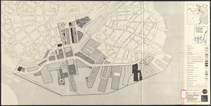
127.
Fenway urban renewal area Massachusetts : existing land use
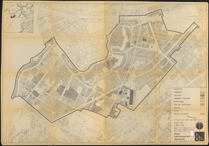
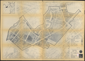
128.
Fenway urban renewal area Massachusetts : proposed land use
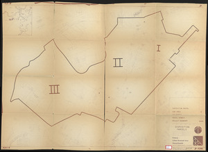
129.
Fenway urban renewal area Massachusetts : disposition parcels
130.
Fenway urban renewal area, Massachusetts R-115 : illustrative site plan
131.
Land use New York streets - South Cove 1953
132.
Metropolitan District Commission combined sewer overflow project Dorchester Bay area
133.
Midtown area plan for the public realm
134.
Plan for Boston
135.
Proposed land use plan and circulation system
136.
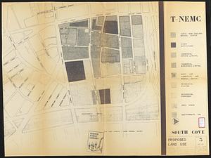
South Cove proposed land use
137.
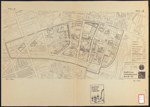
South Cove urban renewal area R-92 : disposition plan
138.
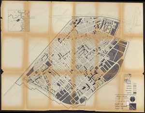
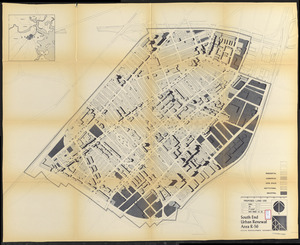
South End urban renewal area R-56 : proposed land use
139.
South End urban renewal area R-56 : proposed land use
140.
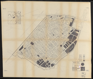
South End urban renewal area R-56 : proposed land use
‹ Prev
Next ›
1
2
3
4
5
6
7
8
9
10
11
…
452
453