Toggle navigation
LMEC Home
Exhibitions
Georeferencing
Tools for Teachers
Collections
My Favorites
Sign Up / Log In
Search
Search the map portal
Map Collection
Map Collection
Map Sets
Search
Search
Search for
Search In
All Fields
Creator
Title
Subject
Place
Search All Digital Collections
Advanced Search
8646 Results
My Search
Start Over
More Like
commonwealth:4m90fp982
Remove constraint More Like: commonwealth:4m90fp982
Filter your Search
Place
North and Central America
5,886
United States
4,805
Massachusetts
2,068
Europe
1,391
Suffolk (county)
1,041
Boston
1,014
Canada
449
Asia
437
more
Place
»
Topic
Boston (Mass.)--Maps
582
United States--Maps
279
Real property--Massachusetts--Boston--Maps
175
Massachusetts--Maps
161
Landowners--Massachusetts--Boston--Maps
133
North America--Maps--Early works to 1800
103
New England--Maps
101
Europe--Maps
79
more
Topic
»
Date
Date range begin
–
Date range end
Current results range from
1482
to
2023
View distribution
Creator
United States. Hydrographic Office
595
O.H. Bailey & Co
148
Des Barres, Joseph F. W. (Joseph Frederick Wallet), 1722-1824
123
United States. Post Office Dept
120
Ptolemy, 2nd cent
100
Walling, Henry Francis, 1825-1888
94
Geological Survey (U.S.)
86
Jefferys, Thomas, -1771
85
more
Creator
»
Format
Maps/Atlases
8,586
Manuscripts
215
Prints
56
Books
36
Objects/Artifacts
10
Drawings/Illustrations
8
Posters
5
Georeferenced
Yes
869
No
7,777
Collection
Norman B. Leventhal Map & Education Center Collection
8,646
Boston and New England Maps
2,221
Urban Maps
1,992
Maritime Charts and Atlases
1,083
American Revolutionary War-Era Maps
615
Boston Redevelopment Authority Collection
87
Available to use
No known restrictions
8,504
Creative Commons license
47
Search Constraints
Sort by relevance
relevance
title
date (asc)
date (desc)
Number of results to display per page
20 per page
10
per page
20
per page
50
per page
100
per page
View results as:
grid view
map view
Search Results
41.
Comparative map of distances between Paris & Cologne, and likewise between Dover and Cologne
42.
Comparative map of distances between Paris & Cologne, and likewise between Dover and Cologne
43.
Daily Mail map of the battlefields of France
44.
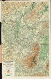
The Daily Telegraph war map no. 11
45.
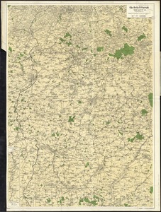
The Daily Telegraph war map no. 14 : of the western front, Arras to Nancy
46.
The Daily Telegraph war map no. 15 : of the western front, Verdun to Belfort
47.
The Daily Telegraph war map no. 16
48.
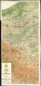
The Daily Telegraph war map no. 21 : of the Belgian and British fronts
49.
The Daily telegraph war map no. 22
50.
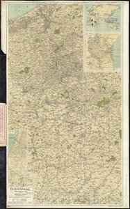
The Daily Telegraph war map no. 24 : of the British front
51.
France
52.
France
53.
France
54.
France
55.
France as divided into departments
56.
France divided into circles and departments
57.
France et états limitrophes
58.
France, from the best authorities
59.
France kilométrique : carte indiquant les distances kilométriques sur tous les réseaux de chemins de fer
60.
Frankreich
‹ Prev
Next ›
1
2
3
4
5
6
7
…
432
433