Toggle navigation
LMEC Home
Exhibitions
Georeferencing
Tools for Teachers
Collections
My Favorites
Sign Up / Log In
Search
Search the map portal
Map Collection
Map Collection
Map Sets
Search
Search
Search for
Search In
All Fields
Creator
Title
Subject
Place
Search All Digital Collections
Advanced Search
8832 Results
My Search
Start Over
More Like
commonwealth:4m90fp515
Remove constraint More Like: commonwealth:4m90fp515
Filter your Search
Place
North and Central America
6,009
United States
4,859
Massachusetts
2,079
Europe
1,396
Suffolk (county)
1,046
Boston
1,019
Canada
454
Asia
441
more
Place
»
Topic
Boston (Mass.)--Maps
586
United States--Maps
282
North America--Maps--Early works to 1800
240
Real property--Massachusetts--Boston--Maps
175
Massachusetts--Maps
162
Landowners--Massachusetts--Boston--Maps
133
New England--Maps
102
Europe--Maps
79
more
Topic
»
Date
Date range begin
–
Date range end
Current results range from
1482
to
2023
View distribution
Creator
United States. Hydrographic Office
595
O.H. Bailey & Co
148
Des Barres, Joseph F. W. (Joseph Frederick Wallet), 1722-1824
123
United States. Post Office Dept
120
Ptolemy, 2nd cent
100
Walling, Henry Francis, 1825-1888
94
Jefferys, Thomas, -1771
92
Geological Survey (U.S.)
86
more
Creator
»
Format
Maps/Atlases
8,772
Manuscripts
217
Prints
56
Books
36
Objects/Artifacts
10
Drawings/Illustrations
8
Posters
5
Georeferenced
Yes
872
No
7,960
Collection
Norman B. Leventhal Map & Education Center Collection
8,704
Boston and New England Maps
2,234
Urban Maps
2,023
Maritime Charts and Atlases
1,083
American Revolutionary War-Era Maps
738
Boston Redevelopment Authority Collection
87
MacLean Collection Map Library
59
New York Public Library Collection
32
more
Collection
»
Available to use
No known restrictions
8,556
Creative Commons license
111
Search Constraints
Sort by relevance
relevance
title
date (asc)
date (desc)
Number of results to display per page
20 per page
10
per page
20
per page
50
per page
100
per page
View results as:
grid view
map view
Search Results
6201.
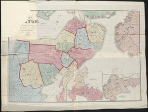
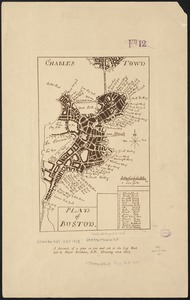
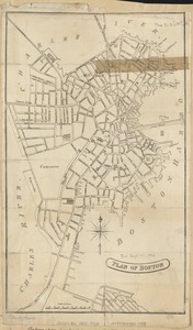
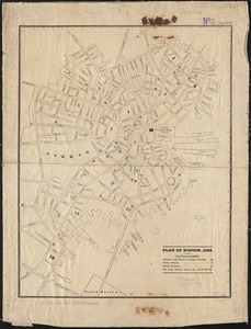
Plan of Boston
6202.
Plan of Boston
6203.
Plan of Boston
6204.
Plan of Boston
6205.
Plan of Boston & Maine Railroad terminal division Boston, Cambridge, Somerville, Everett and Medford
6206.
Plan of Boston 1828
6207.
Plan of Boston and its vicinity
6208.
Plan of Boston and its vicinity
6209.
Plan of Boston and its vicinity
6210.
Plan of Boston and its vicinity showing the connection of the Grand Junction Rail Road with the Harbor and other Rail-roads
6211.
Plan of Boston and its vicinity, showing the drainage area of Stony Brook which empties into the full basin of the Back Bay
6212.
Plan of Boston and its vicinity, showing the drainage area of Stony Brook which empties into the full basin of the Back Bay
6213.
Plan of Boston and Roxbury
6214.
Plan of Boston comprising a part of Charlestown and Cambridge
6215.
Plan of Boston comprising a part of Charlestown and Cambridge
6216.
Plan of Boston comprising a part of Charlestown and Cambridge
6217.
Plan of Boston comprising a part of Charlestown and Cambridge
6218.
Plan of Boston comprising a part of Charlestown and Cambridge
6219.
Plan of Boston comprising a part of Charlestown and Cambridge
6220.
Plan of Boston comprising a part of Charlestown and Cambridge
‹ Prev
Next ›
1
2
…
307
308
309
310
311
312
313
314
315
…
441
442