Toggle navigation
LMEC Home
Exhibitions
Georeferencing
Tools for Teachers
Collections
My Favorites
Sign Up / Log In
Search
Search the map portal
Map Collection
Map Collection
Map Sets
Search
Search
Search for
Search In
All Fields
Creator
Title
Subject
Place
Search All Digital Collections
Advanced Search
5394 Results
My Search
Start Over
More Like
commonwealth:4m90fd80z
Remove constraint More Like: commonwealth:4m90fd80z
Filter your Search
Place
North and Central America
4,022
United States
3,288
Massachusetts
1,336
Europe
655
Suffolk (county)
605
Boston
581
Canada
317
New York
232
more
Place
»
Topic
Boston (Mass.)--Maps
377
Massachusetts--Maps
124
New England--Maps
120
United States--Maps
120
Real property--Massachusetts--Boston--Maps
86
North America--Maps--Early works to 1800
83
Railroads--New England--Maps
55
America--Maps--Early works to 1800
51
more
Topic
»
Date
Date range begin
–
Date range end
Current results range from
1482
to
2015
View distribution
Creator
United States. Hydrographic Office
244
O.H. Bailey & Co
140
United States. Post Office Dept
120
Ptolemy, 2nd cent
100
Des Barres, Joseph F. W. (Joseph Frederick Wallet), 1722-1824
91
Walling, Henry Francis, 1825-1888
83
Jansson, Jan, 1588-1664
71
Moll, Herman, d. 1732
66
more
Creator
»
Format
Maps/Atlases
5,393
Manuscripts
108
Prints
7
Objects/Artifacts
2
Georeferenced
Yes
703
No
4,691
Collection
Norman B. Leventhal Map Center Collection
5,375
Boston and New England Maps
1,489
Urban Maps
1,348
Maritime Charts and Atlases
587
American Revolutionary War-Era Maps
481
American Antiquarian Society Collection
9
Sidney R. Knafel Map Collection at Phillips Academy
4
David Judkins Weaver Papers
3
more
Collection
»
Available to use
No known restrictions
5,358
Creative Commons license
13
Search Constraints
Sort by date (desc)
relevance
title
date (asc)
date (desc)
Number of results to display per page
20 per page
10
per page
20
per page
50
per page
100
per page
View results as:
grid view
map view
Search Results
1.
New England regional transportation map = Mapa do transporte regional da Nova Inglaterra = Nueva Inglaterra, mapa regional de...
2.
1630 shoreline
3.
Peters World map
4.
Africa
5.
The population map
6.
The world turned upside down
7.
What's up? South! : world map
8.
Physical map of the world, April 2001
9.
Political map of the world, April 2001
10.
Asia
11.
China, military regions
12.
Southern Asia
13.
Clothing recommendations for travel in China
14.
Louisiana, a dream state
15.
A cidade de Angra na ilha de Iesu xpō da Tercera que esta em 39. graos
16.
New England fishery, recreation and scenic resources
17.
Outline map and view of the Prudential Center area
18.
Black in New England 1840
19.
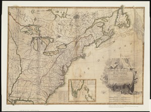
Carte des Etats-Unis de l'Amerique suivant le Traité de Paix de 1783 : dédiée et présentée a S. Excellence Mr. Benjamin...
20.
Kingston-Port-au-Prince
‹ Prev
Next ›
1
2
3
4
5
…
269
270