Toggle navigation
LMEC Home
Exhibitions
Georeferencing
Tools for Teachers
Collections
My Favorites
Sign Up / Log In
Search
Search the map portal
Map Collection
Map Collection
Map Sets
Search
Search
Search for
Search In
All Fields
Creator
Title
Subject
Place
Search All Digital Collections
Advanced Search
8227 Results
My Search
Start Over
More Like
commonwealth:4m90f286j
Remove constraint More Like: commonwealth:4m90f286j
Filter your Search
Place
North and Central America
4,966
United States
3,612
Suffolk (county)
1,026
Boston
999
Europe
963
Canada
475
France
269
Massachusetts
249
more
Place
»
Topic
Boston (Mass.)--Maps
574
United States--Maps
270
Real property--Massachusetts--Boston--Maps
174
Massachusetts--Maps
160
Landowners--Massachusetts--Boston--Maps
132
North America--Maps--Early works to 1800
103
New England--Maps
101
Europe--Maps
78
more
Topic
»
Date
Date range begin
–
Date range end
Current results range from
1482
to
2023
View distribution
Creator
United States. Hydrographic Office
357
O.H. Bailey & Co
148
Des Barres, Joseph F. W. (Joseph Frederick Wallet), 1722-1824
123
United States. Post Office Dept
120
Ptolemy, 2nd cent
100
Jefferys, Thomas, -1771
96
Walling, Henry Francis, 1825-1888
94
Geological Survey (U.S.)
82
more
Creator
»
Format
Maps/Atlases
8,168
Manuscripts
216
Prints
51
Books
36
Objects/Artifacts
10
Drawings/Illustrations
8
Posters
4
Georeferenced
Yes
869
No
7,358
Collection
Norman B. Leventhal Map Center Collection
8,162
Boston and New England Maps
2,184
Urban Maps
1,925
Maritime Charts and Atlases
750
American Revolutionary War-Era Maps
681
Boston Redevelopment Authority Collection
86
William L. Clements Library Collection
43
Library and Archives Canada Collection
14
more
Collection
»
Available to use
No known restrictions
8,021
Creative Commons license
49
Search Constraints
Sort by relevance
relevance
title
date (asc)
date (desc)
Number of results to display per page
20 per page
10
per page
20
per page
50
per page
100
per page
View results as:
grid view
map view
Search Results
41.
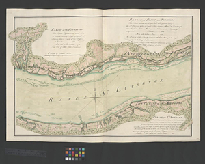
Parish of the Ecureuils. Parish of Point aux Trembles. Parish of St. Antoine. Parish of St. Croix
42.
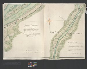
Parish of Vercheres. Parish of St. Antoine
43.
Part of the Anticosti Island; Mingan Island; Mignan Harbor
44.
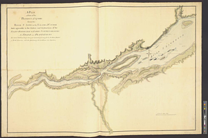
Plan of Canada or the province of Quebec from the uppermost settlements to the island of Coudre as surveyed by order of his...
45.
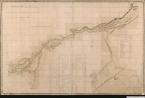
A plan of part of the province of Quebec from the Lake de Deux Montagne to River Batiscant made agreeable to the orders &...
46.
A plan of part of the province of Quebec from the river St. Anne to the island of Coudre made agreeable to the orders and...
47.
Plan of that part of Canada and the River St. Lawrence which lies between Point du Lac and Repentigny on the north shore &...
48.
A plan of the River St. Laurence from Green Island to Cape Carrouge
49.
A plan of the river St. Laurence, from Sillery to the fall of Montmerenci, with the operations of the siege of Quebec; under...
50.
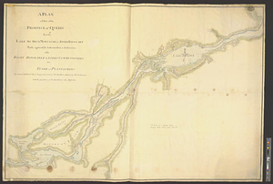
Plan of the river St Lawrence fom the Island of Anticosta to Quebec ... from a manuscript found on board ye Alcide taken June...
51.
Plan of the river St. Lawrence from the Island of Anticosta to Quebec ... from a manuscript found on board of the Alcide taken...
52.
A plan of the settled part of Canada reduced from the large survey made in the years 1760 & 1761 by order of General Murray...
53.
Plan of the town of Quebec the capital of Canada in North America : with the bason and a part of the adjacent country shewing...
54.
Plan of the town of Quebec the capital of Canada in North America : with the bason and a part of the adjacent country shewing...
55.
Plan of the town of Quebec the capital of Canada in North America : with the bason and a part of the adjacent country shewing...
56.
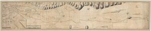
Region of Gaspee Bay
57.
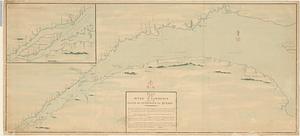
Region of Hare Island
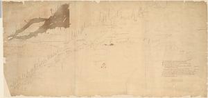
58.
The River St. Lawrence from Mal Bay to the Basin of Quebec
59.
The River St. Lawrence from the Basin of Quebec to the Falls of Richeu
60.
The Seven Islands and the Bay
‹ Prev
Next ›
1
2
3
4
5
6
7
…
411
412