Toggle navigation
LMEC Home
Exhibitions
Georeferencing
Tools for Teachers
Collections
My Favorites
Sign Up / Log In
Search
Search the map portal
Map Collection
Map Collection
Map Sets
Search
Search
Search for
Search In
All Fields
Creator
Title
Subject
Place
Search All Digital Collections
Advanced Search
8696 Results
My Search
Start Over
More Like
commonwealth:3t947c028
Remove constraint More Like: commonwealth:3t947c028
Filter your Search
Place
North and Central America
5,927
United States
4,844
Massachusetts
2,079
Europe
1,396
Suffolk (county)
1,046
Boston
1,019
Canada
449
Asia
438
more
Place
»
Topic
Boston (Mass.)--Maps
586
United States--Maps
282
Real property--Massachusetts--Boston--Maps
175
Massachusetts--Maps
162
Landowners--Massachusetts--Boston--Maps
133
North America--Maps--Early works to 1800
103
New England--Maps
102
Europe--Maps
79
more
Topic
»
Date
Date range begin
–
Date range end
Current results range from
1482
to
2023
View distribution
Creator
United States. Hydrographic Office
595
O.H. Bailey & Co
148
Des Barres, Joseph F. W. (Joseph Frederick Wallet), 1722-1824
123
United States. Post Office Dept
120
Ptolemy, 2nd cent
100
Walling, Henry Francis, 1825-1888
94
Geological Survey (U.S.)
86
Jefferys, Thomas, -1771
85
more
Creator
»
Format
Maps/Atlases
8,636
Manuscripts
217
Prints
56
Books
36
Objects/Artifacts
10
Drawings/Illustrations
8
Posters
5
Georeferenced
Yes
869
No
7,827
Collection
Norman B. Leventhal Map & Education Center Collection
8,694
Boston and New England Maps
2,233
Urban Maps
2,023
Maritime Charts and Atlases
1,083
American Revolutionary War-Era Maps
618
Boston Redevelopment Authority Collection
87
Newberry Library Collection
2
Available to use
No known restrictions
8,552
Creative Commons license
47
Search Constraints
Sort by relevance
relevance
title
date (asc)
date (desc)
Number of results to display per page
20 per page
10
per page
20
per page
50
per page
100
per page
View results as:
grid view
map view
Search Results
1.
Bahía y ciudad de Bayaha, o Puerto del Delfin, en la Isla de Santo Domingo
2.
Beschryvinghe der eylanden van Cuba, Hispaniola, Iamaica, S. Ioannis ende Margarita
3.
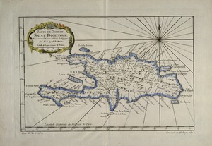
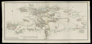
Carte de l'isle de Saint Domingue
4.
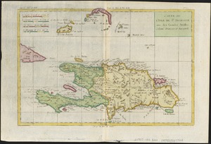
Carte de L'Isle de St. Domingue une des Grandes Antilles, Colonies Francoise et Espagnole
5.
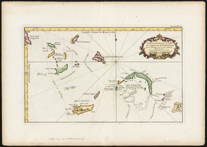
Carte des isles situées au nord de St. Domingue : avec les passages pour le retour appellés Debouqemens 1763
6.
A chart of the iland of Hispaniola : with the Windward passage from Iamaica betwene ye east end of Cuba & the west end of...
7.
Environs de Leogane et du Port Au Prince dans l'Isle de St. Domingue
8.
The island of Hispaniola called by the French St. Domingo : subject to France & Spain
9.
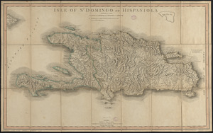
Isle of St. Domingo or Hispaniola
10.
A map of the island of St. Domingo
11.
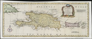
A new & accurate map of the islands of Hispaniola or St. Domingo, and Porto Rico
12.
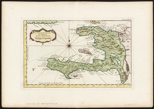
La partie Francoise de l'isle de Saint Domingue
13.
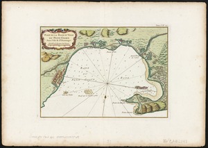
Plan de la Rade et Ville du Petit Goave dans i'Isle de St. Domingue
14.
La Spagnuola
15.
Spagnvola
16.
Spagnvola
17.
Zeilan Insula
18.
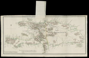
I. de St. Domingue
19.
I. de St. Domingue
20.
The 100th anniversary map of Abraham Lincoln's visit to Massachusetts, September 11-23, 1848
‹ Prev
Next ›
1
2
3
4
5
…
434
435