Toggle navigation
LMEC Home
Exhibitions
Georeferencing
Tools for Teachers
Collections
My Favorites
Sign Up / Log In
Search
Search the map portal
Map Collection
Map Collection
Map Sets
Search
Search
Search for
Search In
All Fields
Creator
Title
Subject
Place
Search All Digital Collections
Advanced Search
8638 Results
My Search
Start Over
More Like
commonwealth:3f463956g
Remove constraint More Like: commonwealth:3f463956g
Filter your Search
Place
North and Central America
5,882
United States
4,802
Massachusetts
2,065
Europe
1,388
Suffolk (county)
1,040
Boston
1,013
Canada
449
Asia
436
more
Place
»
Topic
Boston (Mass.)--Maps
581
United States--Maps
279
Real property--Massachusetts--Boston--Maps
175
Massachusetts--Maps
161
Landowners--Massachusetts--Boston--Maps
133
North America--Maps--Early works to 1800
103
New England--Maps
101
Europe--Maps
79
more
Topic
»
Date
Date range begin
–
Date range end
Current results range from
1482
to
2023
View distribution
Creator
United States. Hydrographic Office
595
O.H. Bailey & Co
148
Des Barres, Joseph F. W. (Joseph Frederick Wallet), 1722-1824
122
United States. Post Office Dept
120
Ptolemy, 2nd cent
100
Walling, Henry Francis, 1825-1888
94
Geological Survey (U.S.)
86
Jefferys, Thomas, -1771
85
more
Creator
»
Format
Maps/Atlases
8,579
Manuscripts
215
Prints
56
Books
36
Objects/Artifacts
10
Drawings/Illustrations
8
Posters
4
Georeferenced
Yes
869
No
7,769
Collection
Norman B. Leventhal Map & Education Center Collection
8,638
Boston and New England Maps
2,219
Urban Maps
1,985
Maritime Charts and Atlases
1,082
American Revolutionary War-Era Maps
615
Boston Redevelopment Authority Collection
87
Available to use
No known restrictions
8,496
Creative Commons license
47
Search Constraints
Sort by relevance
relevance
title
date (asc)
date (desc)
Number of results to display per page
20 per page
10
per page
20
per page
50
per page
100
per page
View results as:
grid view
map view
Search Results
7481.
South Perry, [Ohio]
7482.
The South Shore and Norfolk County, Mass
7483.
South west end of Lake Erie
7484.
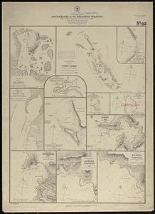
South west Pacific, anchorages in the Solomon Islands : from various authorities with corrections to 1874 ; republication of...
7485.
South western districts
7486.
South western shore of the Caribbean Sea, anchorages on the coast of Honduras : from British surveys
7487.
South Weymouth, Norfolk County, Mass. 1885 : from the fair grounds
7488.
South-east New Guinea
7489.
Southeast States road map
7490.
Southern Alberta : map showing disposition of lands
7491.
Southern Asia
7492.
Southern British Columbia : map showing disposition of lands
7493.
Southern coast of China, harbor of Hongkong and approaches : compiled from the latest information, 1886
7494.
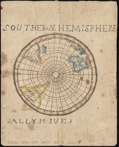
Southern hemisphere
7495.
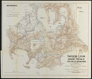
Southern Luzon : showing portion of theatre of operations ; 8th Army Corps, Major General Elwell S. Otis commanding
7496.
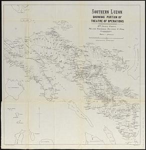
Southern Luzon, showing portion of theatre of operations : 8th Army Corps, Major General Elwell S. Otis commanding
7497.
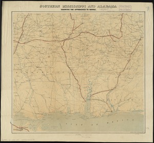
Southern Mississippi and Alabama showing the approaches to Mobile
7498.
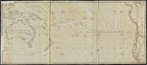
The southern or lower part of the Pacific Ocean
7499.
The southern part of the Province of New York : with part of the adjoining colonies
7500.
Southern provinces of the United States
‹ Prev
Next ›
1
2
…
371
372
373
374
375
376
377
378
379
…
431
432
![South Perry, [Ohio]](https://bpldcassets.blob.core.windows.net/derivatives/images/commonwealth:w9505r98t/image_thumbnail_300.jpg)