South western shore of the Caribbean Sea, anchorages on the coast of Honduras : from British surveys
Item Information
- Title:
- South western shore of the Caribbean Sea, anchorages on the coast of Honduras : from British surveys
- Title (alt.):
-
Anchorages on the coast of Honduras
- Issuing body:
- United States. Hydrographic Office
- Date:
-
1872
- Format:
-
Maps/Atlases
- Location:
-
Boston Public Library
Norman B. Leventhal Map & Education Center - Collection (local):
-
Norman B. Leventhal Map & Education Center Collection
- Subjects:
-
Coasts--Honduras--Maps
Harbors--Honduras--Omoa--Maps
Nautical charts--Honduras--Puerto Cortés (Bay)
Nautical charts--Guatemala--Graciosa Bay
Puerto Cortés (Honduras : Bay)--Maps
Puerto Cortés (Honduras)--Maps
Omoa (Cortés, Honduras)--Maps
Graciosa Bay (Guatemala)--Maps
- Places:
-
HondurasCortésPuerto Cortés
HondurasCortésOmoa
GuatemalaIzabal
Bahía La Graciosa
- Extent:
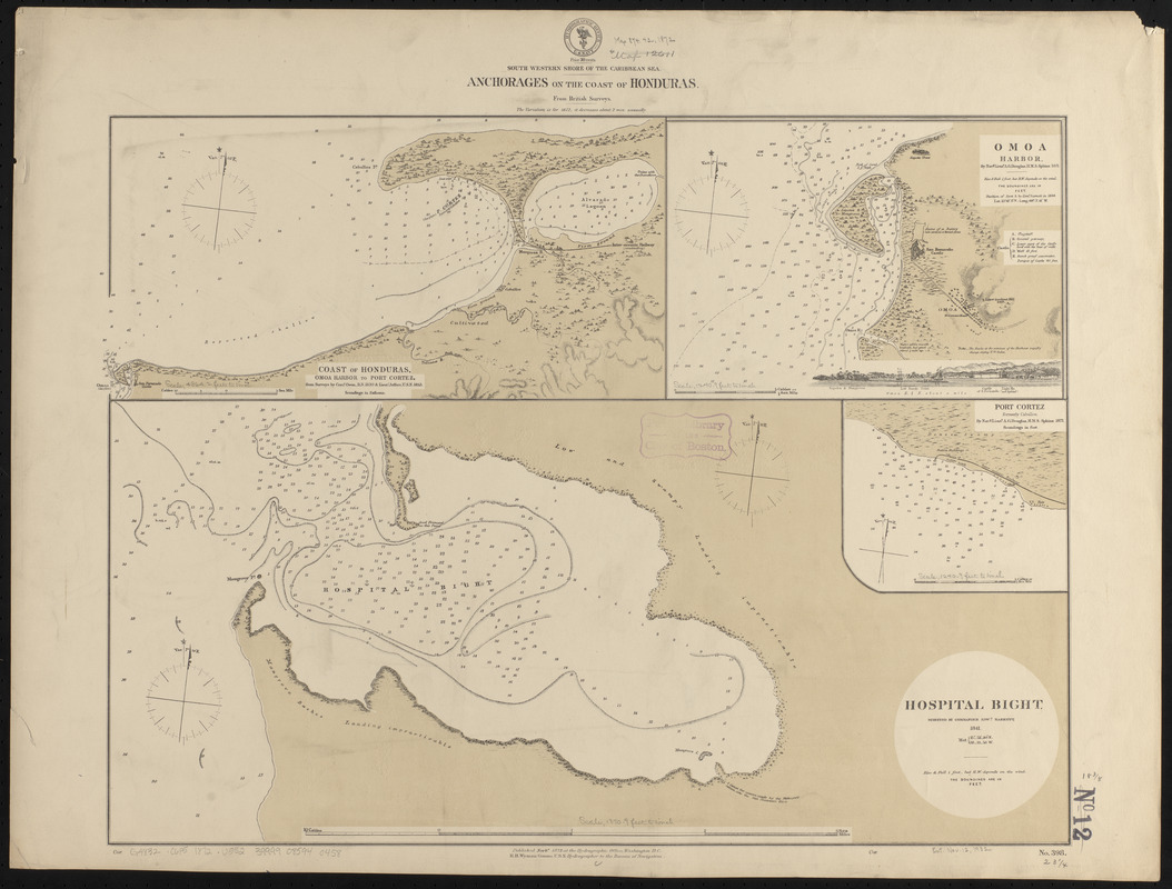
- 4 maps on 1 sheet ; 45 x 60 cm
- Terms of Use:
-
No known copyright restrictions.
No known restrictions on use.
- Publisher:
-
Washington, D.C. :
Hydrographic Office
- Scale:
-
Scale approximately 1:15,000
Scale approximately 1:15,000
Scale approximately 1:22,500
Scale approximately 1:29,500
- Language:
-
English
- Table of Contents:
-
Coast of Honduras. Omoa Harbor to Port Cortez
Omoa Harbor
Hospital Bight
Port Cortez.
- Notes:
-
Relief shown by hachures and spot heights. Depths shown by soundings and isolines.
Includes view of Omoa.
- Identifier:
-
06_01_015848
- Call #:
-
G9096.P5 svar .U55
- Barcode:
-
39999085940458


