Toggle navigation
LMEC Home
Exhibitions
Georeferencing
Tools for Teachers
Collections
My Favorites
Sign Up / Log In
Search
Search the map portal
Map Collection
Map Collection
Map Sets
Search
Search
Search for
Search In
All Fields
Creator
Title
Subject
Place
Search All Digital Collections
Advanced Search
8943 Results
My Search
Start Over
More Like
commonwealth:3f463917s
Remove constraint More Like: commonwealth:3f463917s
Filter your Search
Place
North and Central America
6,174
United States
5,076
Massachusetts
2,195
Europe
1,396
Suffolk (county)
1,207
Boston
1,180
Canada
450
Asia
438
more
Place
»
Topic
Boston (Mass.)--Maps
752
United States--Maps
282
Massachusetts--Maps
235
Real property--Massachusetts--Boston--Maps
195
City planning--Massachusetts--Boston--Maps
157
Landowners--Massachusetts--Boston--Maps
142
New England--Maps
106
North America--Maps--Early works to 1800
103
more
Topic
»
Date
Date range begin
–
Date range end
Current results range from
1482
to
2023
View distribution
Creator
United States. Hydrographic Office
595
Boston Redevelopment Authority
162
O.H. Bailey & Co
148
Des Barres, Joseph F. W. (Joseph Frederick Wallet), 1722-1824
124
United States. Post Office Dept
120
Ptolemy, 2nd cent
100
Walling, Henry Francis, 1825-1888
95
Geological Survey (U.S.)
92
more
Creator
»
Format
Maps/Atlases
8,882
Manuscripts
219
Prints
56
Books
36
Objects/Artifacts
10
Drawings/Illustrations
8
Posters
5
Ephemera
1
Georeferenced
Yes
894
No
8,049
Collection
Norman B. Leventhal Map & Education Center Collection
8,765
Boston and New England Maps
2,404
Urban Maps
2,144
Maritime Charts and Atlases
1,083
American Revolutionary War-Era Maps
659
Boston Redevelopment Authority Collection
194
Applied Geographics, Inc. Records
22
Mapping Boston Collection
22
more
Collection
»
Available to use
No known restrictions
8,707
Creative Commons license
73
Search Constraints
Sort by relevance
relevance
title
date (asc)
date (desc)
Number of results to display per page
20 per page
10
per page
20
per page
50
per page
100
per page
View results as:
grid view
map view
Search Results
8661.
W. & A.K. Johnston's maps to illustrate the Niger and Upper Nile questions
8662.
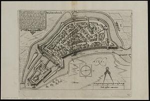
Wachtendonck
8663.
Wage map no. 1 - Polk Street to Twelfth, Halsted Street to Jefferson, Chicago ; Wage map no. 2 - Polk Street to Twelfth,...
8664.
Wage map no. 3 - Polk Street to Twelfth, Beach Street to Pacific Avenue, Chicago ; Wage map no. 4 - Polk Street to Twelfth,...
8665.
Wahre Bildtnüé der vesten Statt Montavban und wie dieselbe von Königl. Maÿ. in Franckreich belägert worden Anno 1621
8666.
Wakefield and Peace Dale, Rhode Island : 1888
8667.
Wakes Island ; Vatoa or Turtle Island and Vuata Vatoa ; Taloo Harbour, Island of Eimeo
8668.
Die Walachei
8669.
Waldoboro, Lincoln County, Maine, 1896
8670.
Wales
8671.
Walling and Gray's map of the United States and territories
8672.
Wallis's plan of the cities of London & Westminster
8673.
Wallis's tour through the United Kingdom of England, Scotland and Ireland, a new geographical game, comprehending all the...
8674.
Wallowa National Forest, Oregon
8675.
Walpole, Massachusetts : 1882
8676.
Waltham, 1911
8677.
Walworth County, Wis.
8678.
War chart of the Southern States showing the towns, rivers, rail-roads and common roads
8679.
War map no. 2 : northern Italy
8680.
War map of Central Europe from Paris to Vienna
‹ Prev
Next ›
1
2
…
430
431
432
433
434
435
436
437
438
…
447
448