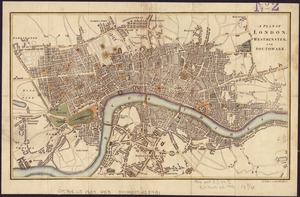
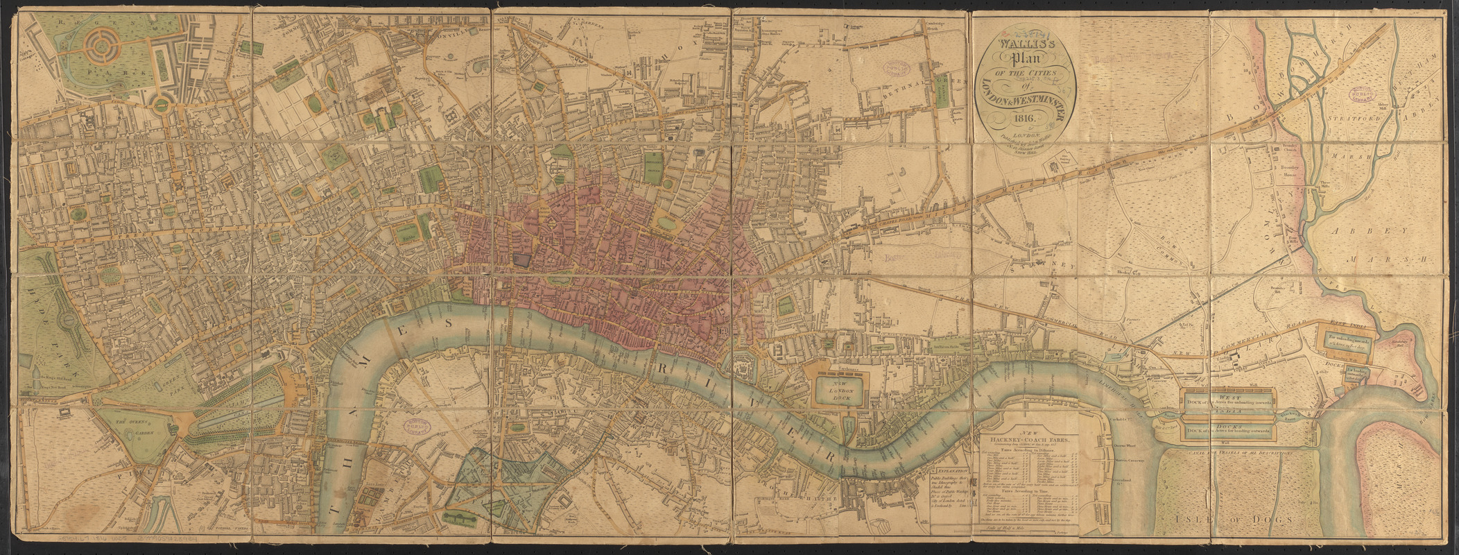
Wallis's plan of the cities of London & Westminster
Item Information
- Title:
- Wallis's plan of the cities of London & Westminster
- Title (alt.):
-
Plan of the cities of London & Westminster
- Creator:
- Wallis, J. (John), -1818
- Date:
-
1816
- Format:
-
Maps/Atlases
- Location:
-
Boston Public Library
Norman B. Leventhal Map & Education Center - Collection (local):
-
Norman B. Leventhal Map & Education Center Collection
- Subjects:
-
London (England)--Maps
Westminster (London, England)--Maps
- Places:
-
EnglandLondonCity of Westminster
- Extent:
- 1 map : col., dissected and mounted on linen ; 42 x 116 cm.
- Terms of Use:
-
No known copyright restrictions.
No known restrictions on use.
- Publisher:
-
London :
John Wallis
- Scale:
-
Scale [ca. 1:9,748]
- Language:
-
English
- Notes:
-
Map of London from Hyde Park in the west to East India Docks in the east, showing public buildings and City of London boundary.
Includes legend and explanation of new hackney coach fares commencing June 23rd, 1808.
- Identifier:
-
06_01_006971
- Call #:
-
G5754.L7 1816 .W35
- Barcode:
-
39999059028934