Toggle navigation
LMEC Home
Exhibitions
Georeferencing
Tools for Teachers
Collections
My Favorites
Sign Up / Log In
Search
Search the map portal
Map Collection
Map Collection
Map Sets
Search
Search
Search for
Search In
All Fields
Creator
Title
Subject
Place
Search All Digital Collections
Advanced Search
8889 Results
My Search
Start Over
More Like
commonwealth:3f463699n
Remove constraint More Like: commonwealth:3f463699n
Filter your Search
Place
North and Central America
6,120
United States
5,036
Massachusetts
2,128
Europe
1,396
Suffolk (county)
1,235
Boston
1,208
Canada
449
Asia
438
more
Place
»
Topic
Boston (Mass.)--Maps
752
United States--Maps
282
Real property--Massachusetts--Boston--Maps
223
Landowners--Massachusetts--Boston--Maps
169
Massachusetts--Maps
166
City planning--Massachusetts--Boston--Maps
159
New England--Maps
104
North America--Maps--Early works to 1800
103
more
Topic
»
Date
Date range begin
–
Date range end
Current results range from
1482
to
2023
View distribution
Creator
United States. Hydrographic Office
595
Boston Redevelopment Authority
163
O.H. Bailey & Co
148
Des Barres, Joseph F. W. (Joseph Frederick Wallet), 1722-1824
124
United States. Post Office Dept
120
Ptolemy, 2nd cent
100
Walling, Henry Francis, 1825-1888
94
Geological Survey (U.S.)
87
more
Creator
»
Format
Maps/Atlases
8,829
Manuscripts
215
Prints
56
Books
36
Objects/Artifacts
10
Drawings/Illustrations
8
Posters
5
Georeferenced
Yes
885
No
8,004
Collection
Norman B. Leventhal Map & Education Center Collection
8,723
Boston and New England Maps
2,359
Urban Maps
2,143
Maritime Charts and Atlases
1,083
American Revolutionary War-Era Maps
638
Boston Redevelopment Authority Collection
193
Massachusetts Real Estate Atlases
38
Mapping Boston Collection
20
more
Collection
»
Available to use
No known restrictions
8,666
Creative Commons license
70
Search Constraints
Sort by relevance
relevance
title
date (asc)
date (desc)
Number of results to display per page
20 per page
10
per page
20
per page
50
per page
100
per page
View results as:
grid view
map view
Search Results
561.
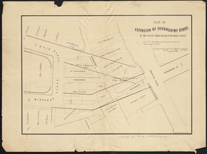
Plan of extension of Devonshire Street, by two routes through Otis and Winthrop Places
562.
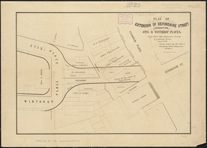
Plan of extension of Devonshire Street connecting Otis & Winthrop Places
563.
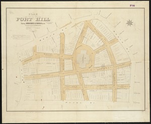
Plan of Fort Hill showing improvements as proposed by the Committee on laying out and widening streets
564.
Plan of Fort Hill showing street improvements as adopted by the city council : 1869
565.
Plan of Gray's Wharf, to be sold at public auction, on the premises, on Thursday April 28th 1870 at 12 o'clock noon
566.
Plan of land & wharves belonging to Mill Pond Wharf Co. near Bartons Point
567.
Plan of land on Bedford and Avon Streets belonging to the proprietors of the Second Church in Boston : to be sold by public...
568.
Plan of lands belonging to the Boston Water Power Co
569.
Plan of lands on the Back Bay belonging to the Boston Water Power Co., the Commonwealth and other parthies [i.e. parties],...
570.
[Plan of lots in Chinatown, between Broad and Front Streets, and Beach and Orange Streets, Boston]
571.
[Plan of lots in Chinatown (Boston), between Avery and Eliot Streets, and Tremont Street and Harrison Avenue]
572.
Plan of proposed Marginal Street from Broad Street at Rowe's Wharf to Commercial Street at Eastern Avenue : showing adjacent...
573.
Plan of Public library lot
574.
Plan of real estate on Cambridge Street near Bowdoin Square, belonging to the heirs of the late Deacon Moses : to be sold by...
575.
[Plan of real estate on Pearl Street, Boston]
576.
Plan of Rowe's Wharf
577.
Plan of store lots near Haymarket Square : belonging to the estate of Josiah Quincy Jr. : to be sold by public auction on...
578.
Plan of Suffolk Street District : showing estates & buildings as proposed to be taken by the City of Boston under the Act of...
579.
Plan of the burnt district : showing proposed improvements in streets. Nov. 12th 1872
580.
Plan of the city of Boston
‹ Prev
Next ›
1
2
…
25
26
27
28
29
30
31
32
33
…
444
445


![Plan of lands on the Back Bay belonging to the Boston Water Power Co., the Commonwealth and other parthies [i.e. parties], showing the system of streets, grades and sewers as laid out and recommended by the Back Bay Commissioners](https://bpldcassets.blob.core.windows.net/derivatives/images/commonwealth:1257bb305/image_thumbnail_300.jpg)
![[Plan of lots in Chinatown, between Broad and Front Streets, and Beach and Orange Streets, Boston]](https://bpldcassets.blob.core.windows.net/derivatives/images/commonwealth:9s161h46q/image_thumbnail_300.jpg)
![[Plan of lots in Chinatown (Boston), between Avery and Eliot Streets, and Tremont Street and Harrison Avenue]](https://bpldcassets.blob.core.windows.net/derivatives/images/commonwealth:cj82kz565/image_thumbnail_300.jpg)


![[Plan of real estate on Pearl Street, Boston]](https://bpldcassets.blob.core.windows.net/derivatives/images/commonwealth:9s161d705/image_thumbnail_300.jpg)


