Toggle navigation
LMEC Home
Exhibitions
Georeferencing
Tools for Teachers
Collections
My Favorites
Sign Up / Log In
Search
Search the map portal
Map Collection
Map Collection
Map Sets
Search
Search
Search for
Search In
All Fields
Creator
Title
Subject
Place
Search All Digital Collections
Advanced Search
198 Results
My Search
Start Over
More Like
commonwealth:3f4632294
Remove constraint More Like: commonwealth:3f4632294
Filter your Search
Place
North and Central America
164
United States
161
Boston Harbor
85
Boston
64
Suffolk (county)
64
New England
30
Massachusetts
24
World
19
more
Place
»
Topic
Boston Harbor (Mass.)--Maps
66
Boston (Mass.)--Maps
39
New England--Maps--Early works to 1800
23
World maps--Early works to 1800
19
Harbors--Massachusetts--Boston--Maps
17
Boston (Mass.)--History--Revolution, 1775-1783--Maps--Early works to 1800
16
Nautical charts--Massachusetts--Boston Harbor
14
Boston Harbor (Mass.)--Maps--Early works to 1800
13
more
Topic
»
Date
Date range begin
–
Date range end
Current results range from
1493
to
1985
View distribution
Creator
United States Coast Survey
9
Page, Thomas Hyde, Sir, 1746-1821
7
Bache, A. D. (Alexander Dallas), 1806-1867
6
Des Barres, Joseph F. W. (Joseph Frederick Wallet), 1722-1824
6
Southack, Cyprian, 1662-1745
5
Bellin, Jacques Nicolas, 1703-1772
4
Board of Harbor and Land Commissioners of Massachusetts
4
Massachusetts. Board of Harbor Commissioners
4
more
Creator
»
Format
Maps/Atlases
197
Posters
1
Prints
1
Georeferenced
Yes
34
No
164
Collection
Norman B. Leventhal Map Center Collection
185
Mapping Boston Collection
139
Boston and New England Maps
115
American Revolutionary War-Era Maps
45
Maritime Charts and Atlases
34
Urban Maps
27
William L. Clements Library Collection
10
Boston Redevelopment Authority Collection
2
more
Collection
»
Available to use
Creative Commons license
137
No known restrictions
50
Search Constraints
Sort by date (desc)
relevance
title
date (asc)
date (desc)
Number of results to display per page
20 per page
10
per page
20
per page
50
per page
100
per page
View results as:
grid view
map view
Search Results
1.
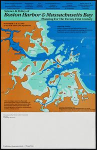
Science & policy of Boston Harbor symposium poster
2.
Port facilities at Boston, MA
3.
The Harbor Park system
4.
Boston and surroundings
5.
Map of Boston inner harbor
6.
Map of Boston proper, showing proposed railroad tunnels and business streets
7.
Boston Harbor & vicinity
8.
Map of the existing and proposed circumferential thoroughfares of the district
9.
Map of the existing and proposed radial thoroughfares of the district and their connections
10.
Boston Harbor, Massachusetts
11.
Map of Boston inner harbor to accompany report under chapter 93, resolves of 1907, December 1, 1907
12.
Boston I
13.
Boston II
14.
Boston Harbor
15.
Map showing the terminal facilities of Boston
16.
Plan of location of projected ship canal from Taunton River to Boston Harbor, through Weymouth Fore River ... Frank W. Hodgdon,...
17.
Map of Boston Harbor
18.
Boston Inner Harbor Massachusetts
19.
Map showing the routes of The Winthrop Steamboat Co
20.
Map to accompany report of State Board on Docks and Terminal Facilities : showing existing conditions and proposed changes at...
‹ Prev
Next ›
1
2
3
4
5
…
9
10