Toggle navigation
LMEC Home
Exhibitions
Georeferencing
Tools for Teachers
Collections
My Favorites
Sign Up / Log In
Search
Search the map portal
Map Collection
Map Collection
Map Sets
Search
Search
Search for
Search In
All Fields
Creator
Title
Subject
Place
Search All Digital Collections
Advanced Search
8555 Results
My Search
Start Over
More Like
commonwealth:3f4631238
Remove constraint More Like: commonwealth:3f4631238
Filter your Search
Place
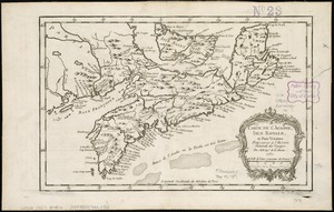
North and Central America
5,850
United States
4,773
Massachusetts
2,052
Europe
1,359
Suffolk (county)
1,034
Boston
1,007
Canada
453
Asia
422
more
Place
»
Topic
Boston (Mass.)--Maps
577
United States--Maps
273
Real property--Massachusetts--Boston--Maps
174
Massachusetts--Maps
160
Landowners--Massachusetts--Boston--Maps
132
North America--Maps--Early works to 1800
103
New England--Maps
99
Europe--Maps
78
more
Topic
»
Date
Date range begin
–
Date range end
Current results range from
1482
to
2023
View distribution
Creator
United States. Hydrographic Office
594
O.H. Bailey & Co
148
Des Barres, Joseph F. W. (Joseph Frederick Wallet), 1722-1824
123
United States. Post Office Dept
120
Ptolemy, 2nd cent
100
Walling, Henry Francis, 1825-1888
94
Jefferys, Thomas, -1771
87
Geological Survey (U.S.)
86
more
Creator
»
Format
Maps/Atlases
8,496
Manuscripts
215
Prints
56
Books
36
Objects/Artifacts
10
Drawings/Illustrations
8
Posters
4
Georeferenced
Yes
869
No
7,686
Collection
Norman B. Leventhal Map & Education Center Collection
8,550
Boston and New England Maps
2,204
Urban Maps
1,936
Maritime Charts and Atlases
1,081
American Revolutionary War-Era Maps
621
Boston Redevelopment Authority Collection
87
Richard H. Brown Revolutionary War Map Collection at Mount Vernon
3
Harvard Map Collection
1
more
Collection
»
Available to use
No known restrictions
8,408
Creative Commons license
51
Search Constraints
Sort by relevance
relevance
title
date (asc)
date (desc)
Number of results to display per page
20 per page
10
per page
20
per page
50
per page
100
per page
View results as:
grid view
map view
Search Results
21.
Port Campbell
22.
Port Hood, situated on the north-western extremity of the island of Cape Breton
23.
Port Mills : Port Mansfield ; Gambier Harbour
24.
Sandwich Bay ... low water
25.
Spry Harbour : Port Pallisser ; Port North ; Port Parker ; Beaver Harbour ; Fleming River
26.
[St. Peter's Bay, on the south shore of Cape Breton Island]
27.
[Torbay]
28.
White Haven
29.
White Islands Harbour : Port Stephen's ; Liscomb Harbour ; Houlton Harbour ; River St. Mary
30.
Chart of the Streights of Belle Isle
31.
Barrington Bay
32.
Carte de l'Acadie, Isle Royale, et Païs Voisins : pour servir à l'Histoire Générale des voyages
33.
A chart of Nova Scotia
34.
A draught of the harbour of Hallifax and the adjacent coast in Nova Scotia
35.
Map of Nova Scotia, or Acadia : with the islands of Cape Breton and St. John's, from actual surveys
36.
New Found Land, St. Laurence Bay, the fishing banks, Acadia, and part of New Scotland
37.
A new map of Nova Scotia, and Cape Britain : with the adjacent parts of New England and Canada, composed from a great number of...
38.
Plans des isles, rades, et ports de plusieurs lieux de l'Amérique : tirés de la Carte angloise de Mr. Popple publiée en 1733...
39.
Port Mills : Port Mansfield ; Gambier Harbour
40.
A new chart of the coast of New England, Nova Scotia, and the islands of St. John, Cape Breton, Sable, the banks of St. Peters,...
‹ Prev
Next ›
1
2
3
4
5
6
…
427
428


![[St. Peter's Bay, on the south shore of Cape Breton Island]](https://bpldcassets.blob.core.windows.net/derivatives/images/commonwealth:ws859h094/image_thumbnail_300.jpg)
![[Torbay]](https://bpldcassets.blob.core.windows.net/derivatives/images/commonwealth:ws859h01x/image_thumbnail_300.jpg)