Toggle navigation
LMEC Home
Exhibitions
Georeferencing
Tools for Teachers
Collections
My Favorites
Sign Up / Log In
Search
Search the map portal
Map Collection
Map Collection
Map Sets
Search
Search
Search for
Search In
All Fields
Creator
Title
Subject
Place
Search All Digital Collections
Advanced Search
8683 Results
My Search
Start Over
More Like
commonwealth:3f463003k
Remove constraint More Like: commonwealth:3f463003k
Filter your Search
Place
North and Central America
5,923
United States
4,839
Massachusetts
2,070
Europe
1,392
Suffolk (county)
1,041
Boston
1,014
Canada
455
Asia
436
more
Place
»
Topic
Boston (Mass.)--Maps
582
United States--Maps
279
Real property--Massachusetts--Boston--Maps
175
Massachusetts--Maps
163
Landowners--Massachusetts--Boston--Maps
133
New England--Maps
108
North America--Maps--Early works to 1800
102
New York (State)--Maps
85
more
Topic
»
Date
Date range begin
–
Date range end
Current results range from
1482
to
2023
View distribution
Creator
United States. Hydrographic Office
595
O.H. Bailey & Co
148
Des Barres, Joseph F. W. (Joseph Frederick Wallet), 1722-1824
123
United States. Post Office Dept
120
Ptolemy, 2nd cent
100
Walling, Henry Francis, 1825-1888
94
Geological Survey (U.S.)
86
Jefferys, Thomas, -1771
85
more
Creator
»
Format
Maps/Atlases
8,623
Manuscripts
217
Prints
56
Books
36
Objects/Artifacts
10
Drawings/Illustrations
8
Posters
5
Georeferenced
Yes
870
No
7,813
Collection
Norman B. Leventhal Map & Education Center Collection
8,644
Boston and New England Maps
2,221
Urban Maps
1,991
Maritime Charts and Atlases
1,083
American Revolutionary War-Era Maps
652
Boston Redevelopment Authority Collection
87
William L. Clements Library Collection
24
American Antiquarian Society Collection
9
more
Collection
»
Available to use
No known restrictions
8,503
Creative Commons license
48
Search Constraints
Sort by relevance
relevance
title
date (asc)
date (desc)
Number of results to display per page
20 per page
10
per page
20
per page
50
per page
100
per page
View results as:
grid view
map view
Search Results
5761.
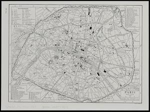
Paris
5762.
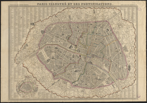
Paris illustré et ses fortifications
5763.
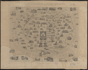
Paris monumental et ses environs
5764.
Parkersburg, West Va
5765.
Part of an estate in Lowell, the property of Sarah C. Livermore
5766.
Part of New England
5767.
Part of New York City
5768.
Part of New York in 1742 : showing the site of the present park, the collect and the little collect ponds, and a portion of the...
5769.
Part of the city of Honolulu, Oahu H.I.
5770.
Part of the counties of Charlotte and Albany, in the Province of New York : being the seat of war between the King's forces...
5771.
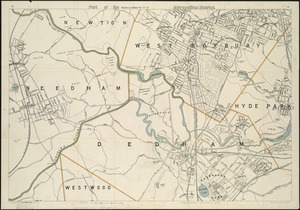
Part of the metropolitan district
5772.
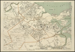
Part of the (Quincy) metropolitan district
5773.
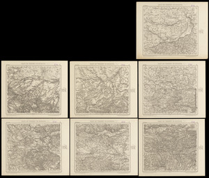
Part of Turkey in Europe
5774.
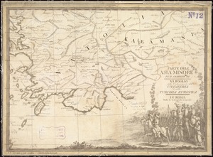
Parte dell'Asia Minore per servire di VI foglio della carta generale dell'Ungheria e della Turchia Europea
5775.
La Parte meridionale del gran ducato di Toscana : che comprende lo stato Senese e porzione del territorio Pisano col principato...
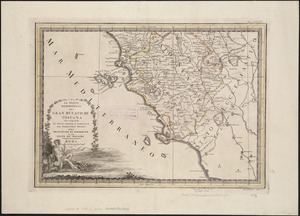
5776.
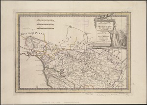
La parte settentrionale del Gran Ducato di Toscana : che comprehendo porzioni dello Stato Florentino e del Territorio Pisano...
5777.
Particular draughts and plans of some of the principal towns and harbours belonging to the English, French, and Spaniards, in...
5778.
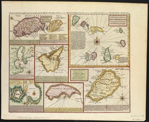
Particular draughts of some of the chief African Islands in the Mediterranean : as also in the Atlantic and Ethiopic Oceans
5779.
A particular map of the River Sanaga, from its mouth, to the desart, exhibiting its several branches, and the islands formed by...
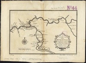
5780.
A particular map of the River Sanaga, from ye desart, to ye Isle of Morfil or Jvory, including the Lake of Pania Fuli
‹ Prev
Next ›
1
2
…
285
286
287
288
289
290
291
292
293
…
434
435