Toggle navigation
LMEC Home
Exhibitions
Georeferencing
Tools for Teachers
Collections
My Favorites
Sign Up / Log In
Search
Search the map portal
Map Collection
Map Collection
Map Sets
Search
Search
Search for
Search In
All Fields
Creator
Title
Subject
Place
Search All Digital Collections
Advanced Search
8693 Results
My Search
Start Over
More Like
commonwealth:3f462w49d
Remove constraint More Like: commonwealth:3f462w49d
Filter your Search
Place
North and Central America
5,924
United States
4,842
Massachusetts
2,078
Europe
1,396
Suffolk (county)
1,045
Boston
1,018
Canada
449
Asia
438
more
Place
»
Topic
Boston (Mass.)--Maps
586
United States--Maps
282
Real property--Massachusetts--Boston--Maps
175
Massachusetts--Maps
162
Landowners--Massachusetts--Boston--Maps
133
North America--Maps--Early works to 1800
103
New England--Maps
102
Europe--Maps
79
more
Topic
»
Date
Date range begin
–
Date range end
Current results range from
1482
to
2023
View distribution
Creator
United States. Hydrographic Office
595
O.H. Bailey & Co
148
Des Barres, Joseph F. W. (Joseph Frederick Wallet), 1722-1824
122
United States. Post Office Dept
120
Ptolemy, 2nd cent
100
Walling, Henry Francis, 1825-1888
94
Geological Survey (U.S.)
86
Jefferys, Thomas, -1771
85
more
Creator
»
Format
Maps/Atlases
8,633
Manuscripts
215
Prints
56
Books
36
Objects/Artifacts
10
Drawings/Illustrations
8
Posters
5
Georeferenced
Yes
869
No
7,824
Collection
Norman B. Leventhal Map & Education Center Collection
8,693
Boston and New England Maps
2,231
Urban Maps
2,023
Maritime Charts and Atlases
1,083
American Revolutionary War-Era Maps
614
Boston Redevelopment Authority Collection
87
Available to use
No known restrictions
8,551
Creative Commons license
47
Search Constraints
Sort by relevance
relevance
title
date (asc)
date (desc)
Number of results to display per page
20 per page
10
per page
20
per page
50
per page
100
per page
View results as:
grid view
map view
Search Results
1.
Coast of Maine from Rockland Harbor to Pemaquid Point
2.
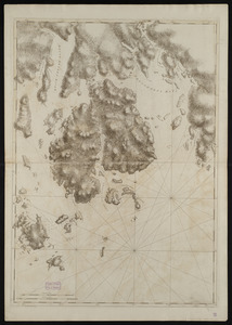
[Coast of Maine from Frenchman Bay to Mosquito Harbor]
3.
Coast of Maine from Frenchman Bay to Mosquito Harbor
4.
Coast of Maine from Moose Cove to Gouldsboro Bay
5.
Coast of Maine from Moose Cove to Gouldsboro Bay
6.
Coast of Maine from Mosquito Head to Spurwink River
7.
Coast of Maine from Mosquito Head to Spurwink River
8.
Coast of Maine from Salter Island to Portland Head
9.
Coast of Maine from Salter Island to Portland Head
10.
Coast of Maine showing Blue Hill Bay, Penobscot Bay, Belfast Bay, Islesboro Island, Deer Island, and other islands
11.
Coast of Maine showing Blue Hill Bay, Penobscot Bay, Belfast Bay, Islesboro Island, Deer Island, and other islands
12.
Coast of Maine showing entrances of Blue Hill Bay, Isle of Haut Bay, and Penobscot Bay, with Owls Head, Vinalhaven Island, Isle...
13.
Coast of Maine showing entrances of Blue Hill Bay, Isle of Haut Bay, and Penobscot Bay, with Owls Head, Vinalhaven Island, Isle...
14.
Coast of New England from Cape Elizabeth, Me. to Newburyport, Mass.
15.
Coast of New England from Cape Elizabeth, Me. to Newburyport, Mass.
16.
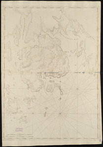
[Coast of New England from York Harbor to North Beach]
17.
Mount Desert Island and neighboring coast of Maine
18.
Mount Desert Island and neighboring coast of Maine
19.
The 100th anniversary map of Abraham Lincoln's visit to Massachusetts, September 11-23, 1848
20.
1630 shoreline
‹ Prev
Next ›
1
2
3
4
5
…
434
435

![[Coast of Maine from Frenchman Bay to Mosquito Harbor]](https://bpldcassets.blob.core.windows.net/derivatives/images/commonwealth:cj82m295n/image_thumbnail_300.jpg)


![[Coast of New England from York Harbor to North Beach]](https://bpldcassets.blob.core.windows.net/derivatives/images/commonwealth:7h149z874/image_thumbnail_300.jpg)