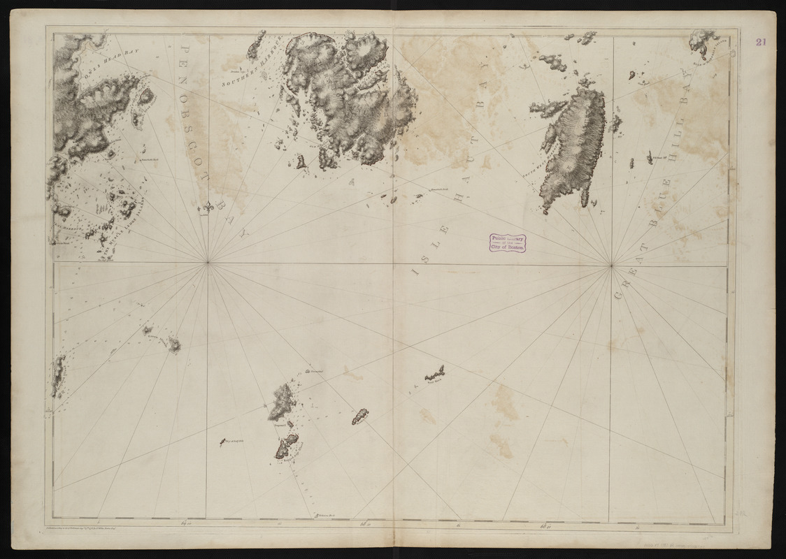
Coast of Maine showing entrances of Blue Hill Bay, Isle of Haut Bay, and Penobscot Bay, with Owls Head, Vinalhaven Island, Isle au Haut, and other islands
This map is also available in American Revolutionary Geographies Online (ARGO), a collections portal especially built for material relating to the American Revolutionary War Era. Visit ARGO to learn more about this item and explore the historical geography of North America in the late eighteenth century.
Item Information
- Title:
- Coast of Maine showing entrances of Blue Hill Bay, Isle of Haut Bay, and Penobscot Bay, with Owls Head, Vinalhaven Island, Isle au Haut, and other islands
- Creator:
- Des Barres, Joseph F. W. (Joseph Frederick Wallet), 1722-1824
- Date:
-
1776
- Format:
-
Maps/Atlases
- Location:
-
Boston Public Library
Norman B. Leventhal Map & Education Center - Collection (local):
-
Norman B. Leventhal Map & Education Center Collection
- Subjects:
-
Coasts--Maine--Maps--Early works to 1800
Nautical charts--Maine--Early works to 1800
Atlantic Coast (Me.)--Maps--Early works to 1800
- Places:
-
Maine
- Extent:
- 1 chart ; 76 x 107 cm.
- Terms of Use:
-
No known copyright restrictions.
No known restrictions on use.
- Publisher:
-
[London] :
J.F.W. Des Barres
- Edition:
- 2nd state.
- Scale:
-
Scale [ca. 1:48,500]
- Language:
-
English
- Notes:
-
Relief shown by hachures. Depths shown by soundings.
- Identifier:
-
06_01_004502
- Call #:
-
G1106.P5 D47 1781
- Barcode:
-
30000003818379
![[Coast of Maine from Frenchman Bay to Mosquito Harbor]](https://bpldcassets.blob.core.windows.net/derivatives/images/commonwealth:cj82m295n/image_thumbnail_300.jpg)


