Toggle navigation
LMEC Home
Exhibitions
Georeferencing
Tools for Teachers
Collections
My Favorites
Sign Up / Log In
Search
Search the map portal
Map Collection
Map Collection
Map Sets
Search
Search
Search for
Search In
All Fields
Creator
Title
Subject
Place
Search All Digital Collections
Advanced Search
109 Results
My Search
Start Over
More Like
commonwealth:3f462s808
Remove constraint More Like: commonwealth:3f462s808
Filter your Search
Place
North and Central America
102
United States
99
New England
88
Middle Atlantic
20
Canada
13
Massachusetts
12
Northeastern United States
10
New York
9
more
Place
»
Topic
New England--Maps--Early works to 1800
91
Middle Atlantic States--Maps--Early works to 1800
20
Northeastern States--Maps--Early works to 1800
10
New York (State)--Maps--Early works to 1800
8
Maritime Provinces--Maps--Early works to 1800
6
Massachusetts--Maps--Early works to 1800
6
Boston (Mass.)--Maps--Early works to 1800
5
Boston Harbor (Mass.)--Maps--Early works to 1800
5
more
Topic
»
Date
Date range begin
–
Date range end
Current results range from
1483
to
1999
View distribution
Creator
Jefferys, Thomas, d. 1771
8
Bachelder, John B. (John Badger), 1825-1894
4
Bellin, Jacques Nicolas, 1703-1772
4
Green, John, d. 1757
4
Jefferys, Thomas, -1771
4
Bien, Julius, 1826-1909
3
Bowles, Carington, 1724-1793
3
Brady, Mathew B., approximately 1823-1896
3
more
Creator
»
Format
Maps/Atlases
104
Manuscripts
4
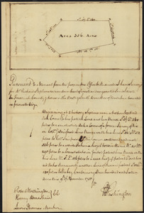
Photographs
3
Books
1
Documents
1
Georeferenced
Yes
8
No
101
Collection
Norman B. Leventhal Map Center Collection
79
American Revolutionary War-Era Maps
49
Boston and New England Maps
31
Mapping Boston Collection
23
Sidney R. Knafel Map Collection at Phillips Academy
15
Maritime Charts and Atlases
10
Richard H. Brown Revolutionary War Map Collection at Mount Vernon
6
New York Public Library Collection
3
more
Collection
»
Available to use
No known restrictions
56
Creative Commons license
35
Search Constraints
Sort by relevance
relevance
title
date (asc)
date (desc)
Number of results to display per page
10 per page
10
per page
20
per page
50
per page
100
per page
View results as:
grid view
map view
Search Results
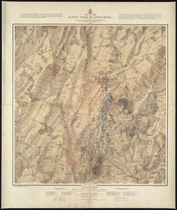
101.
Map of the battle field of Gettysburg, July 1st, 2nd, 3rd, 1863 : Second day's battle
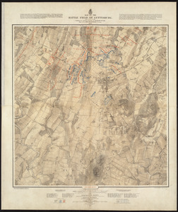
102.
Map of the battle field of Gettysburg, July 1st, 2nd, 3rd, 1863 : First day's battle
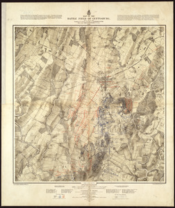
103.
Map of the battle field of Gettysburg, July 1st, 2nd, 3rd, 1863 : Third day's battle
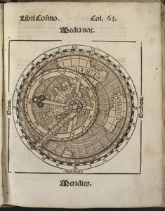
104.
Small circular world map
105.
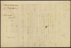
Survey of land for Richard Stephenson in Frederick County; attested by Robert Worthington, Henry Bradshaw and Lewis Thomas : verso
106.
Survey of land for Richard Stephenson in Frederick County; attested by Robert Worthington, Henry Bradshaw and Lewis Thomas : recto
107.
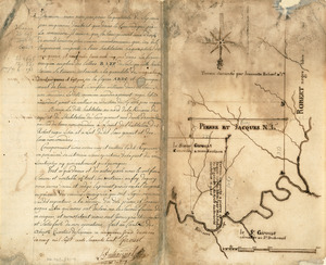
Survey plat of land grants on Caps River, Saint Domingue
108.
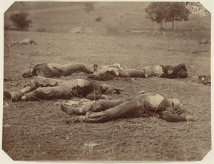
Union dead at Gettysburg
109.
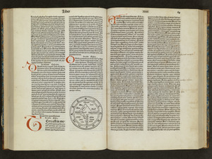
Unsigned and untitled T-O world map
‹ Prev
Next ›
1
2
…
7
8
9
10
11