Toggle navigation
LMEC Home
Exhibitions
Georeferencing
Tools for Teachers
Collections
My Favorites
Sign Up / Log In
Search
Search the map portal
Map Collection
Map Collection
Map Sets
Search
Search
Search for
Search In
All Fields
Creator
Title
Subject
Place
Search All Digital Collections
Advanced Search
375 Results
My Search
Start Over
More Like
commonwealth:3f462s50j
Remove constraint More Like: commonwealth:3f462s50j
Filter your Search
Place
North and Central America
299
North America
231
United States
141
Massachusetts
73
Boston
45
Suffolk (county)
44
New England
34
Boston Harbor
29
more
Place
»
Topic
North America--Maps--Early works to 1800
240
New England--Maps--Early works to 1800
27
Boston (Mass.)--Maps
20
World maps--Early works to 1800
19
Great Britain--Colonies--America--Maps--Early works to 1800
18
Boston (Mass.)--History--Revolution, 1775-1783--Maps--Early works to 1800
16
United States--Maps--Early works to 1800
14
Boston Harbor (Mass.)--Maps--Early works to 1800
13
more
Topic
»
Date
Date range begin
–
Date range end
Current results range from
1493
to
1927
View distribution
Creator
Mitchell, John, 1711-1768
18
Sayer, Robert, 1725-1794
15
Gibson, J. (John), active 1750-1792
14
Jefferys, Thomas, -1771
13
Bowen, Emanuel, 1693 or 1694-1767
11
Moll, Herman, d. 1732
11
Anville, Jean Baptiste Bourguignon d', 1697-1782
10
Le Rouge, Georges-Louis
8
more
Creator
»
Format
Maps/Atlases
374
Manuscripts
2
Prints
1
Georeferenced
Yes
30
No
345
Collection
Norman B. Leventhal Map & Education Center Collection
247
American Revolutionary War-Era Maps
212
Mapping Boston Collection
142
Boston and New England Maps
76
MacLean Collection Map Library
59
New York Public Library Collection
32
Maritime Charts and Atlases
28
Urban Maps
24
more
Collection
»
Available to use
Creative Commons license
192
No known restrictions
113
Search Constraints
Sort by relevance
relevance
title
date (asc)
date (desc)
Number of results to display per page
20 per page
10
per page
20
per page
50
per page
100
per page
View results as:
grid view
map view
Search Results
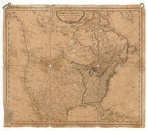
201.
North America
202.
North America : performed under the patronage of Louis Duke of Orleans, First Prince of the Blood
203.
North America : from the French of Mr. d'Anville, improved with the back settlements of Virginia and course of Ohio,...
204.
North America : corrected from the observation communicated to the Royal Society at London and the Royal Academy at Paris
205.
North America
206.
North America
207.
North America
208.
North America, agreeable to the most approved maps and charts
209.
North America, as divided amongst the European powers
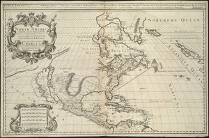
210.
North America divided into its III principall parts : 1st English part viz. English Empire containing ye Articklands near...
211.
North America, divided into its principall parts where are distinguished the severall states which belong to the English,...
212.
North America, drawn from the best authorities
213.
North America drawn from the latest and best authorities
214.
North America from the French of Mr. D'Anville, improved with the back settlements of Virginia and course of Ohio, illustrated...
215.
North America from the French of Mr. D'Anville, improved with the back settlements of Virginia and course of Ohio, illustrated...
216.
North America with the new discoveries
217.
The north part of America : conteyning Newfoundland, new England, Virginia, Florida, new Spaine, and Noua Francia wth ye rich...
218.
The north part of America : conteyning Newfoundland, new England, Virginia, Florida, new Spaine, and Noua Francia wth ye rich...
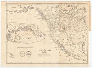
219.
The north-west-coast of North America and adjacent territories
220.
Noua et accurata totius Americae tabula
‹ Prev
Next ›
1
2
…
7
8
9
10
11
12
13
14
15
…
18
19