Toggle navigation
LMEC Home
Exhibitions
Georeferencing
Tools for Teachers
Collections
My Favorites
Sign Up / Log In
Search
Search the map portal
Map Collection
Map Collection
Map Sets
Search
Search
Search for
Search In
All Fields
Creator
Title
Subject
Place
Search All Digital Collections
Advanced Search
124 Results
My Search
Start Over
More Like
commonwealth:2v23zt06v
Remove constraint More Like: commonwealth:2v23zt06v
Filter your Search
Place
North and Central America
104
Canada
97
Quebec
68
Saint Lawrence River
66
Québec
31
New France
24
United States
16
Longue-Pointe-de-Mingan
12
more
Place
»
Topic
Saint Lawrence River--Maps
67
United States--History--French and Indian War, 1754-1763--Maps
32
Québec (Québec)--Maps
27
New France--Maps
24
Seven Years' War, 1756-1763--Campaigns--Canada--Maps
20
Longue-Pointe (Québec)--Maps
12
Mingan Islands (Québec)--Maps
12
Saguenay River (Québec)--Maps
12
more
Topic
»
Date
Date range begin
–
Date range end
Current results range from
1744
to
1891
View distribution
Creator
Holland, Samuel, 1728-1801
16
Jefferys, Thomas, -1771
15
Cook, James, 1728-1779
14
Robert Sayer and John Bennett (Firm)
13
Desjardins, pilot of Québec
12
Saunders, Charles, Sir, 1713?-1775
12
Bellin, Jacques Nicolas, 1703-1772
10
Montrésor, John, 1736-1799
7
more
Creator
»
Format
Maps/Atlases
124
Manuscripts
1
Georeferenced
No
124
Collection
American Revolutionary War-Era Maps
120
William L. Clements Library Collection
61
Library and Archives Canada Collection
52
Norman B. Leventhal Map & Education Center Collection
4
New York Public Library Collection
3
American Antiquarian Society Collection
2
MacLean Collection Map Library
2
Available to use
No known restrictions
4
Creative Commons license
3
Search Constraints
Sort by relevance
relevance
title
date (asc)
date (desc)
Number of results to display per page
20 per page
10
per page
20
per page
50
per page
100
per page
View results as:
grid view
map view
Search Results
61.
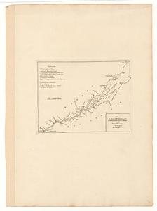
Iroquois or St. Lawrence
62.
Manicouagan Shoals; Havre St. Nicholas; Bay of the Seven Islands
63.
A map of the several dispositions of the English fleet & army on the river S.t Laurence, to the taking of Quebec
64.
A new map of the province of Quebec, : according to the Royal proclamation, of the 7th of October 1763
65.
A new map of the province of Quebec, : according to the Royal proclamation, of the 7th of October 1763
66.
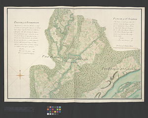
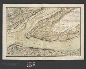
Parish of Batiscant. Parish of St. Pierre Becquet. Parish of Champlain. Parish of Gentilly
67.
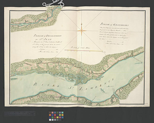
Parish of Dechaillon or St. Jean. Parish of Grondines
68.
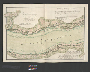
Parish of Dechambeaux. Parish of Cape Sante. Parish of Lotbinière. Parish of St. Croix
69.
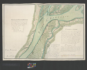
Parish of La Norray & Dautray. Parish of Sorrel
70.
Parish of L'Assomption. Parish of St. Sulpice
71.
Parish of Lavalterie. Parish of Contrecoeur
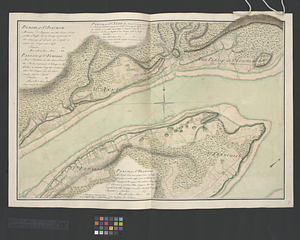
72.
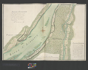
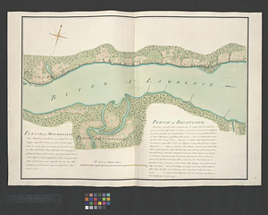
Parish of Magdelaine. Parish of Becancour
73.
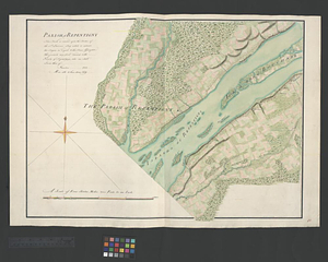
Parish of Repentigny
74.
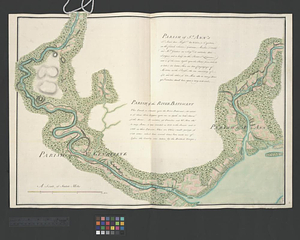
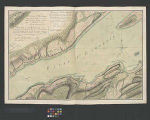
Parish of St. Ann's. Parish of the River Batiscant
75.
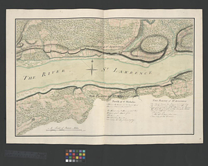
Parish of St. Joachim. Parish of St. Famille. Parish of St. Anne. Parish of St. François
76.
Parish of St. Lawrence. Parish of Beaumont. Parish of St. Peter
77.
Parish of St. Michelle. Parish of St. John Baptist. Parish of St. Vertier
78.
Parish of St. Nicholas. The Parish of St. Augustin
79.
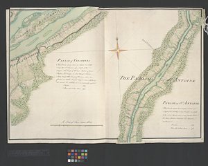
Parish of the Ecureuils. Parish of Point aux Trembles. Parish of St. Antoine. Parish of St. Croix
80.
Parish of Vercheres. Parish of St. Antoine
‹ Prev
Next ›
1
2
3
4
5
6
7