Toggle navigation
LMEC Home
Exhibitions
Georeferencing
Tools for Teachers
Collections
My Favorites
Sign Up / Log In
Search
Search the map portal
Map Collection
Map Collection
Map Sets
Search
Search
Search for
Search In
All Fields
Creator
Title
Subject
Place
Search All Digital Collections
Advanced Search
8996 Results
My Search
Start Over
More Like
commonwealth:1257c359v
Remove constraint More Like: commonwealth:1257c359v
Filter your Search
Place
North and Central America
6,227
United States
5,143
Massachusetts
2,146
Europe
1,396
Suffolk (county)
1,342
Boston
1,315
Canada
449
Asia
438
more
Place
»
Topic
Boston (Mass.)--Maps
753
United States--Maps
282
Real property--Massachusetts--Boston--Maps
254
City planning--Massachusetts--Boston--Maps
253
Landowners--Massachusetts--Boston--Maps
170
Massachusetts--Maps
166
Urban renewal--Massachusetts--Boston--Maps
150
New England--Maps
104
more
Topic
»
Date
Date range begin
–
Date range end
Current results range from
1482
to
2023
View distribution
Creator
United States. Hydrographic Office
595
Boston Redevelopment Authority
256
O.H. Bailey & Co
148
Des Barres, Joseph F. W. (Joseph Frederick Wallet), 1722-1824
124
United States. Post Office Dept
120
Ptolemy, 2nd cent
100
Walling, Henry Francis, 1825-1888
94
Geological Survey (U.S.)
87
more
Creator
»
Format
Maps/Atlases
8,936
Manuscripts
215
Prints
56
Books
36
Objects/Artifacts
10
Drawings/Illustrations
8
Posters
5
Georeferenced
Yes
886
No
8,110
Collection
Norman B. Leventhal Map & Education Center Collection
8,726
Boston and New England Maps
2,466
Urban Maps
2,249
Maritime Charts and Atlases
1,083
American Revolutionary War-Era Maps
638
Boston Redevelopment Authority Collection
297
Massachusetts Real Estate Atlases
38
Mapping Boston Collection
20
more
Collection
»
Available to use
No known restrictions
8,773
Creative Commons license
70
Search Constraints
Sort by relevance
relevance
title
date (asc)
date (desc)
Number of results to display per page
20 per page
10
per page
20
per page
50
per page
100
per page
View results as:
grid view
map view
Search Results
81.
Parker Hill-Fenway project no. Mass. R-48 : police signal system, fire alarm system and M.T.A. facilities
82.
Parker Hill-Fenway project no. Mass. R-48 : sewer and storm drain system
83.
Parker Hill-Fenway project no. Mass. R-48 : water distribution system
84.
Parker Hill-Fenway urban renewal area r-48 : building conditions
85.
Parker Hill-Fenway urban renewal area r-48 : existing population density
86.
Parker Hill-Fenway urban renewal area r-48 : existing building coverage
87.
Parker Hill-Fenway urban renewal area r-48 : existing and proposed community facilities
88.
Parker Hill-Fenway urban renewal area r-48 : proposed circulation
89.
Parker Hill-Fenway urban renewal area r-48 : existing institutions
90.
Parker Hill-Fenway urban renewal area r-48 : existing circulation
91.
Parker Hill-Fenway urban renewal area r-48 : proposed land use
92.
Parker Hill-Fenway urban renewal area r-48 : existing land use
93.
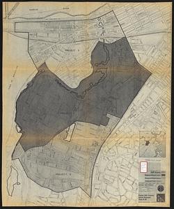
Parker Hill-Fenway urban renewal area r-48 : development areas
94.
Parker Hill-Fenway urban renewal area r-48 : proposed title I projects
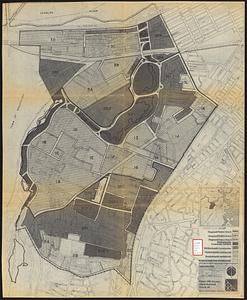
95.
Atlas of the city of Boston : Boston proper and Back Bay
96.
Atlas of the city of Boston : Boston proper and Back Bay
97.
Atlas of the city of Boston : Boston proper
98.
Atlas of the city of Boston : Boston proper and Back Bay
99.
Atlas of the city of Boston : Boston proper and Back Bay
100.
Atlas of the city of Boston : Boston proper and Back Bay
‹ Prev
Next ›
1
2
3
4
5
6
7
8
9
…
449
450