Toggle navigation
LMEC Home
Exhibitions
Georeferencing
Tools for Teachers
Collections
My Favorites
Sign Up / Log In
Search
Search the map portal
Map Collection
Map Collection
Map Sets
Search
Search
Search for
Search In
All Fields
Creator
Title
Subject
Place
Search All Digital Collections
Advanced Search
8933 Results
My Search
Start Over
More Like
commonwealth:1257c153s
Remove constraint More Like: commonwealth:1257c153s
Filter your Search
Place
North and Central America
6,164
United States
5,080
Massachusetts
2,138
Europe
1,396
Suffolk (county)
1,279
Boston
1,252
Canada
449
Asia
438
more
Place
»
Topic
Boston (Mass.)--Maps
753
United States--Maps
282
Real property--Massachusetts--Boston--Maps
254
City planning--Massachusetts--Boston--Maps
197
Landowners--Massachusetts--Boston--Maps
170
Massachusetts--Maps
166
Urban renewal--Massachusetts--Boston--Maps
105
New England--Maps
104
more
Topic
»
Date
Date range begin
–
Date range end
Current results range from
1482
to
2023
View distribution
Creator
United States. Hydrographic Office
595
Boston Redevelopment Authority
200
O.H. Bailey & Co
148
Des Barres, Joseph F. W. (Joseph Frederick Wallet), 1722-1824
124
United States. Post Office Dept
120
Ptolemy, 2nd cent
100
Walling, Henry Francis, 1825-1888
94
Geological Survey (U.S.)
87
more
Creator
»
Format
Maps/Atlases
8,873
Manuscripts
215
Prints
56
Books
36
Objects/Artifacts
10
Drawings/Illustrations
8
Posters
5
Georeferenced
Yes
886
No
8,047
Collection
Norman B. Leventhal Map & Education Center Collection
8,725
Boston and New England Maps
2,403
Urban Maps
2,187
Maritime Charts and Atlases
1,083
American Revolutionary War-Era Maps
638
Boston Redevelopment Authority Collection
235
Massachusetts Real Estate Atlases
38
Mapping Boston Collection
20
more
Collection
»
Available to use
No known restrictions
8,710
Creative Commons license
70
Search Constraints
Sort by relevance
relevance
title
date (asc)
date (desc)
Number of results to display per page
20 per page
10
per page
20
per page
50
per page
100
per page
View results as:
grid view
map view
Search Results
8641.
Völker und sprachen-karte von Deutschland und den nachbarländern im j. 1867
8642.
Volunteer militia and eastern army guide : One hundred and fifty miles around Richmond
8643.
Vom Rhein bis Paris
8644.
Vorstellung einiger Gegenden und Plaetze in Nord-America unter Franzoesisch und Englische Jurisdiction gehoerig
8645.
Vtriusque Castellae nova descriptio
8646.
La vue a vol d'oiseau de l'Abbaye de Saint-Martin de Laon (de l'Ordre de Prémontré)
8647.
Vue de Quebec, capitale du Canada
8648.
Vue du Port-au-Prince et ses environs
8649.
W. & A.K. Johnston's map to illustrate the Chinese question
8650.
W. & A.K. Johnston's maps to illustrate the Niger and Upper Nile questions
8651.
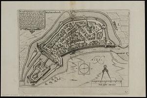
Wachtendonck
8652.
Wage map no. 1 - Polk Street to Twelfth, Halsted Street to Jefferson, Chicago ; Wage map no. 2 - Polk Street to Twelfth,...
8653.
Wage map no. 3 - Polk Street to Twelfth, Beach Street to Pacific Avenue, Chicago ; Wage map no. 4 - Polk Street to Twelfth,...
8654.
Wahre Bildtnüé der vesten Statt Montavban und wie dieselbe von Königl. Maÿ. in Franckreich belägert worden Anno 1621
8655.
Wakefield and Peace Dale, Rhode Island : 1888
8656.
Wakes Island ; Vatoa or Turtle Island and Vuata Vatoa ; Taloo Harbour, Island of Eimeo
8657.
Die Walachei
8658.
Waldoboro, Lincoln County, Maine, 1896
8659.
Wales
8660.
Walling and Gray's map of the United States and territories
‹ Prev
Next ›
1
2
…
429
430
431
432
433
434
435
436
437
…
446
447