Toggle navigation
LMEC Home
Exhibitions
Georeferencing
Tools for Teachers
Collections
My Favorites
Sign Up / Log In
Search
Search the map portal
Map Collection
Map Collection
Map Sets
Search
Search
Search for
Search In
All Fields
Creator
Title
Subject
Place
Search All Digital Collections
Advanced Search
8950 Results
My Search
Start Over
More Like
commonwealth:1257bt93b
Remove constraint More Like: commonwealth:1257bt93b
Filter your Search
Place
North and Central America
6,181
United States
5,097
Massachusetts
2,167
Europe
1,396
Suffolk (county)
1,296
Boston
1,269
Canada
449
Asia
438
more
Place
»
Topic
Boston (Mass.)--Maps
753
United States--Maps
282
Real property--Massachusetts--Boston--Maps
254
City planning--Massachusetts--Boston--Maps
212
Landowners--Massachusetts--Boston--Maps
170
Massachusetts--Maps
166
Urban renewal--Massachusetts--Boston--Maps
118
New England--Maps
104
more
Topic
»
Date
Date range begin
–
Date range end
Current results range from
1482
to
2023
View distribution
Creator
United States. Hydrographic Office
595
Boston Redevelopment Authority
216
O.H. Bailey & Co
148
Des Barres, Joseph F. W. (Joseph Frederick Wallet), 1722-1824
124
United States. Post Office Dept
120
Ptolemy, 2nd cent
100
Walling, Henry Francis, 1825-1888
94
Geological Survey (U.S.)
87
more
Creator
»
Format
Maps/Atlases
8,889
Manuscripts
215
Prints
56
Books
36
Objects/Artifacts
10
Drawings/Illustrations
9
Posters
5
Georeferenced
Yes
885
No
8,065
Collection
Norman B. Leventhal Map & Education Center Collection
8,726
Boston and New England Maps
2,417
Urban Maps
2,200
Maritime Charts and Atlases
1,083
American Revolutionary War-Era Maps
642
Boston Redevelopment Authority Collection
248
Massachusetts Real Estate Atlases
38
Mapping Boston Collection
21
more
Collection
»
Available to use
No known restrictions
8,723
Creative Commons license
71
Search Constraints
Sort by relevance
relevance
title
date (asc)
date (desc)
Number of results to display per page
20 per page
10
per page
20
per page
50
per page
100
per page
View results as:
grid view
map view
Search Results
4641.
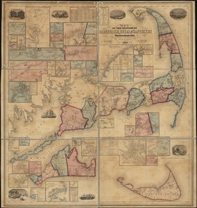
Map of the counties of Barnstable, Dukes and Nantucket, Massachusetts : based upon the trigonometrical survey of the state
4642.
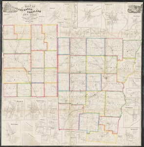
Map of the counties of Chenango and Cortland, New York : from actual surveys
4643.
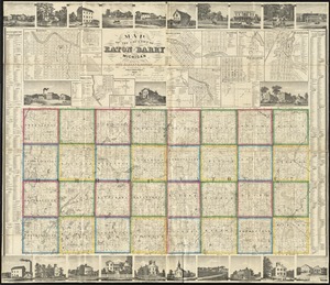
Map of the counties of Eaton and Barry, Michigan
4644.
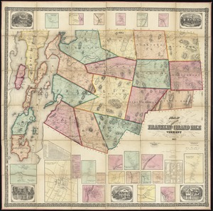
Map of the counties of Franklin and Grand Isle, Vermont : from actual surveys
4645.
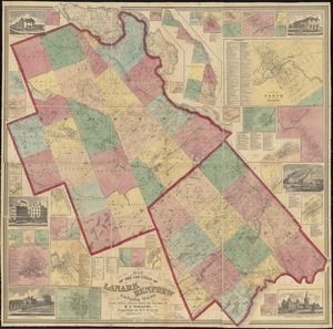
Map of the counties of Lanark and Renfrew, Canada West : from actual surveys under the direction of H.F. Walling
4646.
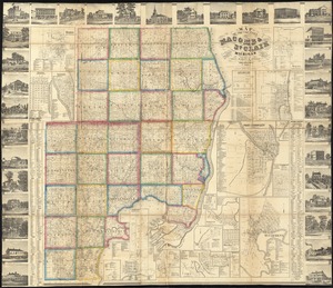
Map of the counties of Macomb & St. Clair, Michigan
4647.
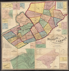
Map of the counties of Monroe and Carbon, Pennsylvania
4648.
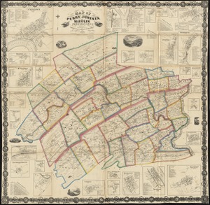
Map of the counties of Perry, Juniata and Mifflin, Pennsylvania
4649.
Map of the counties of Shefford, Iberville, Brome, Missisquoi, and Rouville, Canada East
4650.
Map of the counties of Stormont, Dundas, Glengarry, Prescott & Russell, Canada West : from actual surveys under the direction...
4651.
Map of the counties of Washtenaw and Lenawee, Michigan
4652.
Map of the countries near to the land of Oz
4653.
A map of the countries situate about the North Pole as far as the 50th. degree of north latitude
4654.
A map of the countries thirty degrees round the north pole
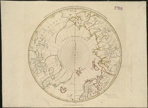
4655.
Map of the country about Boston
4656.
A map of the country adjacent to the north boundary line of the colony of Rhode Island as the same was run by commissioners...
4657.
Map of the country between Monterey, Tenn: & Corinth, Miss: showing the lines of entrenchments made & the routes followed by...
4658.
Map of the country between Washington & Pittsburg refering to the contemplated Chesapeake & Ohio Canal and its general route...
4659.
A map of the country between Will's Creek & Monongahela River shewing the rout and encampments of the English army in 1755
4660.
Map of the country copied from Hale's map of N. E. with railroad route from Boston to Lake Champlain : through Keene, N. H
‹ Prev
Next ›
1
2
…
229
230
231
232
233
234
235
236
237
…
447
448