Toggle navigation
LMEC Home
Exhibitions
Georeferencing
Tools for Teachers
Collections
My Favorites
Sign Up / Log In
Search
Search the map portal
Map Collection
Map Collection
Map Sets
Search
Search
Search for
Search In
All Fields
Creator
Title
Subject
Place
Search All Digital Collections
Advanced Search
8776 Results
My Search
Start Over
More Like
commonwealth:1257bb615
Remove constraint More Like: commonwealth:1257bb615
Filter your Search
Place
North and Central America
6,007
United States
4,924
Massachusetts
2,089
Europe
1,396
Suffolk (county)
1,126
Boston
1,099
Canada
449
Asia
438
more
Place
»
Topic
Boston (Mass.)--Maps
607
United States--Maps
282
Real property--Massachusetts--Boston--Maps
253
Landowners--Massachusetts--Boston--Maps
170
Massachusetts--Maps
163
City planning--Massachusetts--Boston--Maps
110
North America--Maps--Early works to 1800
103
New England--Maps
102
more
Topic
»
Date
Date range begin
–
Date range end
Current results range from
1482
to
2023
View distribution
Creator
United States. Hydrographic Office
595
O.H. Bailey & Co
148
Des Barres, Joseph F. W. (Joseph Frederick Wallet), 1722-1824
123
United States. Post Office Dept
120
Boston Redevelopment Authority
111
Ptolemy, 2nd cent
100
Walling, Henry Francis, 1825-1888
94
Geological Survey (U.S.)
87
more
Creator
»
Format
Maps/Atlases
8,716
Manuscripts
215
Prints
56
Books
36
Objects/Artifacts
10
Drawings/Illustrations
8
Posters
5
Georeferenced
Yes
869
No
7,907
Collection
Norman B. Leventhal Map & Education Center Collection
8,695
Boston and New England Maps
2,278
Urban Maps
2,068
Maritime Charts and Atlases
1,083
American Revolutionary War-Era Maps
616
Boston Redevelopment Authority Collection
132
Massachusetts Real Estate Atlases
36
Applied Geographics, Inc. Records
1
Available to use
No known restrictions
8,598
Creative Commons license
47
Search Constraints
Sort by relevance
relevance
title
date (asc)
date (desc)
Number of results to display per page
20 per page
10
per page
20
per page
50
per page
100
per page
View results as:
grid view
map view
Search Results
3801.
Map of Keene including the original boundaries of upper Ashuelot
3802.
Map of Kentucky and Tennessee
3803.
Map of Korea
3804.
Map of Korea and Manchuria
3805.
Map of Lake Sunapee and vicinity reached by Boston and Maine Railroad
3806.
A map of Lancaster
3807.
Map of Lapeer Co., Michigan
3808.
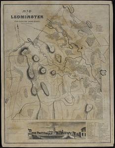
Map of Leominster containing 16602 acres
3809.
Map of Liberia
3810.
A map of Long Island
3811.
A map of Louisiana and of the River Mississipi
3812.
Map of Louisiana, Mississippi and Alabama : constructed from the latest authorities
3813.
Map of Lunenburg
3814.
Map of Lynn and Saugus : settled in 1629
3815.
A map of Mackenzie's track from Fort Chipewyan to the Pacific Ocean in 1793
3816.
Map of Madison and the Four Lake Country, Dane Co. Wis
3817.
Map of Madison County, Virginia : prepared under the direction of P.S. Michie
3818.
Map of Madison, Wisconsin : A.A.A.S. XLII meeting, August 17-24, 1893
3819.
Map of Maine for the Maine register
3820.
Map of Maine, New Hampshire, and Vermont : compiled from the latest authorities
‹ Prev
Next ›
1
2
…
187
188
189
190
191
192
193
194
195
…
438
439