Toggle navigation
LMEC Home
Exhibitions
Georeferencing
Tools for Teachers
Collections
My Favorites
Sign Up / Log In
Search
Search the map portal
Map Collection
Map Collection
Map Sets
Search
Search
Search for
Search In
All Fields
Creator
Title
Subject
Place
Search All Digital Collections
Advanced Search
8677 Results
My Search
Start Over
More Like
commonwealth:1257bb216
Remove constraint More Like: commonwealth:1257bb216
Filter your Search
Place
North and Central America
5,916
United States
4,835
Massachusetts
2,093
Europe
1,392
Suffolk (county)
1,055
Boston
1,028
Canada
449
Asia
437
more
Place
»
Topic
Boston (Mass.)--Maps
593
United States--Maps
279
Real property--Massachusetts--Boston--Maps
175
Massachusetts--Maps
161
Landowners--Massachusetts--Boston--Maps
133
North America--Maps--Early works to 1800
103
New England--Maps
101
Europe--Maps
79
more
Topic
»
Date
Date range begin
–
Date range end
Current results range from
1482
to
2023
View distribution
Creator
United States. Hydrographic Office
595
O.H. Bailey & Co
148
Des Barres, Joseph F. W. (Joseph Frederick Wallet), 1722-1824
124
United States. Post Office Dept
120
Ptolemy, 2nd cent
100
Walling, Henry Francis, 1825-1888
94
Geological Survey (U.S.)
86
Jefferys, Thomas, -1771
85
more
Creator
»
Format
Maps/Atlases
8,617
Manuscripts
215
Prints
56
Books
36
Objects/Artifacts
10
Drawings/Illustrations
8
Posters
6
Georeferenced
Yes
873
No
7,804
Collection
Norman B. Leventhal Map & Education Center Collection
8,662
Boston and New England Maps
2,239
Urban Maps
1,998
Maritime Charts and Atlases
1,090
American Revolutionary War-Era Maps
627
Boston Redevelopment Authority Collection
90
Mapping Boston Collection
15
William L. Clements Library Collection
10
more
Collection
»
Available to use
No known restrictions
8,508
Creative Commons license
63
Search Constraints
Sort by relevance
relevance
title
date (asc)
date (desc)
Number of results to display per page
20 per page
10
per page
20
per page
50
per page
100
per page
View results as:
grid view
map view
Search Results
21.
Plan of the harbour of Boston, from surveys made under the direction of commissioners appointed by a resolve of the...
22.
Plan showing encroachments upon the inner basins of Boston Harbor : accompanying annual report of Harbor and Land...
23.
Carte de la Baye de Baston : située dans la Nouvelle Angleterre
24.
Boston Harbor, Massachusetts
25.
Boston Harbor, Massachusetts
26.
Boston Harbour : from the survey of A.S. Wadsworth, Esq., U.S.N. and the chart of Des Barres
27.
A chart of the Harbour of Boston, with the soundings, sailing-marks and other directions
28.
Plan of the Inner Harbor of Boston
29.
Port facilities at Boston, MA
30.
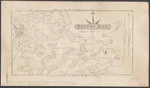
Boston Bay
31.
Massachusetts Bay with the coast from Cape Ann to Cape Cod
32.
Plan for the occupation of flats owned by the Commonwealth in Boston Harbor
33.
Plan of Mystic River showing the Harbor Commissioners lines : Dec. 1854
34.
Plan of Neponset River and part of Dorchester Bay showing the harbor lines proposed by the Commissioners 1854
35.
Plan of the proposed docks at South Boston
36.
Boston Harbor Mass : Charles River from Brookline Street bridge to Market Street bridge
37.
Boston Harbor, Mass : map of Charles River from Brookline Street bridge to its mouth
38.
Boston Harbor, Massachusetts
39.
Boston Inner Harbor Massachusetts
40.
Changes in the bed of Boston Harbor from a comparison of the surveys of 1835-61
‹ Prev
Next ›
1
2
3
4
5
6
…
433
434