Toggle navigation
LMEC Home
Exhibitions
Georeferencing
Tools for Teachers
Collections
My Favorites
Sign Up / Log In
Search
Search the map portal
Map Collection
Map Collection
Map Sets
Search
Search
Search for
Search In
All Fields
Creator
Title
Subject
Place
Search All Digital Collections
Advanced Search
8697 Results
My Search
Start Over
More Like
commonwealth:1257b941g
Remove constraint More Like: commonwealth:1257b941g
Filter your Search
Place
North and Central America
5,926
United States
4,844
Massachusetts
2,079
Europe
1,396
Suffolk (county)
1,046
Boston
1,019
Canada
449
Asia
438
more
Place
»
Topic
Boston (Mass.)--Maps
586
United States--Maps
282
Real property--Massachusetts--Boston--Maps
175
Massachusetts--Maps
162
Landowners--Massachusetts--Boston--Maps
133
North America--Maps--Early works to 1800
103
New England--Maps
102
Europe--Maps
79
more
Topic
»
Date
Date range begin
–
Date range end
Current results range from
1482
to
2023
View distribution
Creator
United States. Hydrographic Office
595
O.H. Bailey & Co
148
Des Barres, Joseph F. W. (Joseph Frederick Wallet), 1722-1824
123
United States. Post Office Dept
120
Ptolemy, 2nd cent
100
Walling, Henry Francis, 1825-1888
94
Geological Survey (U.S.)
86
Jefferys, Thomas, -1771
86
more
Creator
»
Format
Maps/Atlases
8,637
Manuscripts
215
Prints
56
Books
36
Objects/Artifacts
10
Drawings/Illustrations
8
Posters
5
Georeferenced
Yes
869
No
7,828
Collection
Norman B. Leventhal Map & Education Center Collection
8,694
Boston and New England Maps
2,233
Urban Maps
2,023
Maritime Charts and Atlases
1,082
American Revolutionary War-Era Maps
617
Boston Redevelopment Authority Collection
87
Sidney R. Knafel Map Collection at Phillips Academy
2
Richard H. Brown Revolutionary War Map Collection at Mount Vernon
1
Available to use
No known restrictions
8,552
Creative Commons license
48
Search Constraints
Sort by relevance
relevance
title
date (asc)
date (desc)
Number of results to display per page
20 per page
10
per page
20
per page
50
per page
100
per page
View results as:
grid view
map view
Search Results
61.
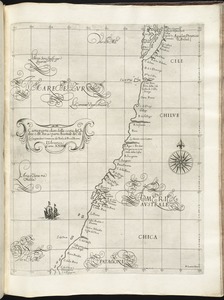
Carta particolare della costa del' Peru parte australe con parte di Cili
62.
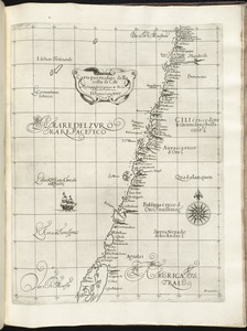
Carta particolare della costa di America Australe che comincia al C. di Matas sin al C. di Galegos
63.
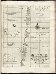
Carta particolare della costa di Chilue è di Chica è parte australe di Cili
64.
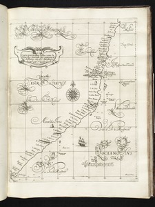
Carta particolare della costa di Cili
65.
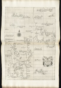
Carta particolare della costa di Florida è di Virginia
66.
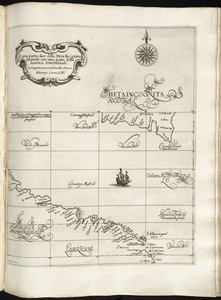
Carta particolare della Meta Incognita Australe con una parte della America Settentrionale
67.
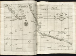
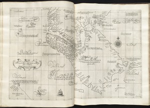
Carta particolare della nuoua Belgia è parte della nuoua Anglia
68.
Carta particolare della parte ocidentale della nuova Spagnia, è del la California
69.
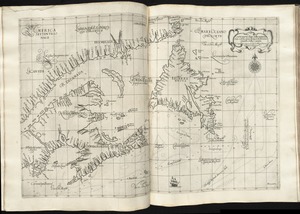
Carta particolare della terra nuoua con la Gran Baia et il Fiume Grande della Canida
70.
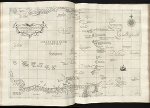
Carta particolare dell'India Ocidentale, con la terra ferma dal' capo di Paria sin al' capo S. Romano
71.
Carta particolare dell'Isola Ispaniola è S. Gioni. nel'India ocidentle. con l'Isola Intorno
72.
Carta particolare dello istreto e mare iscoperto de Hen. Hudson Ingilese nel. 1611
73.
Carta particolare dello Stretto di Magellano è di Maire
74.
Portolan atlas
75.
Al sermo. Ferdinando. II. Grandvca di Toscana svo signore Don Roberto Dudleo, Duca di Northumbria
76.
Maris Pacifici (quod vulgo Mar del Zur) cum regionibus circumiacentibus, insulisque in eodem passim sparsis, novissima descriptio
77.
Chart of South America, comprehending the West Indies, with the adjacent islands, in the Southern Ocean, and South Sea
78.
Carta marina nova tabula
79.
The 100th anniversary map of Abraham Lincoln's visit to Massachusetts, September 11-23, 1848
80.
1630 shoreline
‹ Prev
Next ›
1
2
3
4
5
6
7
8
…
434
435