Toggle navigation
LMEC Home
Exhibitions
Georeferencing
Tools for Teachers
Collections
My Favorites
Sign Up / Log In
Search
Search the map portal
Map Collection
Map Collection
Map Sets
Search
Search
Search for
Search In
All Fields
Creator
Title
Subject
Place
Search All Digital Collections
Advanced Search
596 Results
My Search
Start Over
More Like
commonwealth:0v83fk69n
Remove constraint More Like: commonwealth:0v83fk69n
Filter your Search
Place
North and Central America
547
United States
419
New England
130
New York
105
Canada
76
North America
68
New Jersey
43
Pennsylvania
35
more
Place
»
Topic
New England--Maps
127
New York (State)--Maps
85
North America--Maps--Early works to 1800
59
Railroads--New England--Maps
50
United States--Maps--Early works to 1800
43
New Jersey--Maps
40
Canada--Maps--Early works to 1800
38
Massachusetts--Maps
21
more
Topic
»
Date
Date range begin
–
Date range end
Current results range from
1623
to
2015
View distribution
Creator
Jefferys, Thomas, -1771
18
Bellin, Jacques Nicolas, 1703-1772
16
Robert Sayer and John Bennett (Firm)
15
Carey, Mathew, 1760-1839
14
Gibson, J. (John), active 1750-1792
14
Carleton, Osgood, 1742-1816
13
Faden, William, 1749-1836
13
Bowles, Carington, 1724-1793
10
more
Creator
»
Format
Maps/Atlases
594
Manuscripts
7
Paintings
3
Ephemera
1
Objects/Artifacts
1
Prints
1
Georeferenced
Yes
37
No
559
Collection
American Revolutionary War-Era Maps
389
MacLean Collection Map Library
379
Norman B. Leventhal Map & Education Center Collection
155
Boston and New England Maps
80
William L. Clements Library Collection
38
American Antiquarian Society Collection
15
David Judkins Weaver Papers
4
Sidney R. Knafel Map Collection at Phillips Academy
4
more
Collection
»
Available to use
No known restrictions
156
Creative Commons license
4
Search Constraints
Sort by relevance
relevance
title
date (asc)
date (desc)
Number of results to display per page
20 per page
10
per page
20
per page
50
per page
100
per page
View results as:
grid view
map view
Search Results
21.
New England and New York in 1697
22.
Post route map of the states of New Hampshire, Vermont, Massachusetts, Rhode Island, Connecticut, and parts of New York and Maine
23.
Rail road map of New England & eastern New York
24.
Rail road map of New England & eastern New York
25.
Rand McNally official 1920 auto trails map : District number 6 : New England, eastern New York
26.
Sherman & Smith's rail road, steam boat & stage route map of New England, New-York, and Canada
27.
This plan of Kennebeck & Sagadahock Rivers & country adjacent
28.
Williams' telegraph and rail road map of the New England states, eastern protion of New York state and Canada : compiled from...
29.
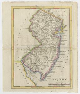
New Jersey
30.
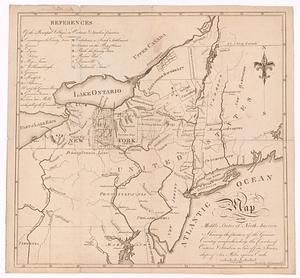
A map of the middle states of North America, shewing the position of the Geneseo country comprehending the counties of Ontario...
31.
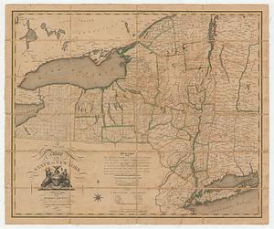
A map of the state of New York
32.
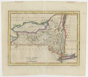
New York
33.
A map of the most inhabited part of New England containing the provinces of Massachusets Bay and New Hampshire with the...
34.
Bridge from Staten Island to the Jersies, by Cn. Laird's description
35.
A chorographical map of the country round Philadelphia = Carte particuliere des environs de Philadelphia
36.
A compleat plan of part of the province of Pennsylvania East and West Jersey shewing the transactions of the royal army under...
37.
From Freehold toward Trenton
38.
An historical map of Pennsylvania : showing the Indian names of streams and villages, and paths of travel : the sites of old...
39.
Manuscript maps of U.S. states, possibly drawn by a schoolchild
40.
Map of American camp in New Jersey and surrounding countryside
‹ Prev
Next ›
1
2
3
4
5
6
…
29
30