Toggle navigation
LMEC Home
Exhibitions
Georeferencing
Tools for Teachers
Collections
My Favorites
Sign Up / Log In
Search
Search the map portal
Map Collection
Map Collection
Map Sets
Search
Search
Search for
Search In
All Fields
Creator
Title
Subject
Place
Search All Digital Collections
Advanced Search
8865 Results
My Search
Start Over
More Like
commonwealth:0r96fq12n
Remove constraint More Like: commonwealth:0r96fq12n
Filter your Search
Place
North and Central America
6,042
United States
4,910
Massachusetts
2,079
Europe
1,398
Suffolk (county)
1,049
Boston
1,022
Canada
462
Asia
439
more
Place
»
Topic
Boston (Mass.)--Maps
586
United States--Maps
282
Real property--Massachusetts--Boston--Maps
175
Massachusetts--Maps
162
Manuscript maps--Early works to 1800
138
Landowners--Massachusetts--Boston--Maps
133
North America--Maps--Early works to 1800
105
New England--Maps
102
more
Topic
»
Date
Date range begin
–
Date range end
Current results range from
1482
to
2023
View distribution
Creator
United States. Hydrographic Office
595
O.H. Bailey & Co
148
Des Barres, Joseph F. W. (Joseph Frederick Wallet), 1722-1824
123
United States. Post Office Dept
120
Ptolemy, 2nd cent
100
Walling, Henry Francis, 1825-1888
94
Geological Survey (U.S.)
86
Jefferys, Thomas, -1771
85
more
Creator
»
Format
Maps/Atlases
8,805
Manuscripts
350
Prints
56
Books
36
Objects/Artifacts
10
Drawings/Illustrations
8
Posters
5
Georeferenced
Yes
871
No
7,994
Collection
Norman B. Leventhal Map & Education Center Collection
8,714
Boston and New England Maps
2,235
Urban Maps
2,030
Maritime Charts and Atlases
1,100
American Revolutionary War-Era Maps
748
Library of Congress Collection
97
Boston Redevelopment Authority Collection
87
Newberry Library Collection
39
more
Collection
»
Available to use
No known restrictions
8,554
Creative Commons license
163
Search Constraints
Sort by relevance
relevance
title
date (asc)
date (desc)
Number of results to display per page
20 per page
10
per page
20
per page
50
per page
100
per page
View results as:
grid view
map view
Search Results
941.
Bird's-eye view of New York City
942.
A bird's-eye view of Providence : showing the new railroad station and State House
943.
Bird's-eye view of the city of Philadelphia : its streets, avenues, and public buildings--and of the Centennial buildings in...
944.
Bird's-eye view of the Conemaugh Valley, from Nineveh to the Lake : Johnstown, Pa., from personal sketches and surveys of the...
945.
Bird's-eye view of the Panama Canal
946.
Bird's-eye view of the White Mountains, New Hampshire
947.
Birmingham, Conn : 1876
948.
Birthplace of Washington
949.
Biscaia, Alava, et Guipuscoa Cantabriae veteris partes
950.
Blackinton, Mass
951.
Black's general map of the seat of war
952.
Black's special war map
953.
Blackwood's map of the seat of war
954.
Blairstown, New Jersey
955.
Block diagram showing terrain of the Balkan Peninsula
956.
Block diagram showing terrain of the Trentino region
957.
Block diagram showing terrain of the Trieste-Isonzo region
958.
Block Island, Rhode Island
959.
Block map, vicinity of Faneuil Hall, Boston : embracing Custom House, Post Office Square, Fort Hill Square, and Chamber of...
960.
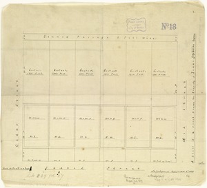
A block of 6 brick houses the property of Isaac Stebbins Esquire
‹ Prev
Next ›
1
2
…
44
45
46
47
48
49
50
51
52
…
443
444