Toggle navigation
LMEC Home
Exhibitions
Georeferencing
Tools for Teachers
Collections
My Favorites
Sign Up / Log In
Search
Search the map portal
Map Collection
Map Collection
Map Sets
Search
Search
Search for
Search In
All Fields
Creator
Title
Subject
Place
Search All Digital Collections
Advanced Search
8664 Results
My Search
Start Over
More Like
commonwealth:0r96fm94h
Remove constraint More Like: commonwealth:0r96fm94h
Filter your Search
Place
North and Central America
5,903
United States
4,822
Massachusetts
2,068
Europe
1,392
Suffolk (county)
1,041
Boston
1,014
Canada
449
Asia
437
more
Place
»
Topic
Boston (Mass.)--Maps
582
United States--Maps
279
Real property--Massachusetts--Boston--Maps
175
Massachusetts--Maps
161
Landowners--Massachusetts--Boston--Maps
133
North America--Maps--Early works to 1800
103
New England--Maps
101
Europe--Maps
79
more
Topic
»
Date
Date range begin
–
Date range end
Current results range from
1482
to
2023
View distribution
Creator
United States. Hydrographic Office
595
O.H. Bailey & Co
148
Des Barres, Joseph F. W. (Joseph Frederick Wallet), 1722-1824
123
United States. Post Office Dept
120
Ptolemy, 2nd cent
100
Walling, Henry Francis, 1825-1888
94
Geological Survey (U.S.)
86
Jefferys, Thomas, -1771
85
more
Creator
»
Format
Maps/Atlases
8,604
Manuscripts
215
Prints
56
Books
36
Objects/Artifacts
10
Drawings/Illustrations
8
Posters
5
Georeferenced
Yes
869
No
7,795
Collection
Norman B. Leventhal Map & Education Center Collection
8,646
Boston and New England Maps
2,221
Urban Maps
1,993
Maritime Charts and Atlases
1,083
American Revolutionary War-Era Maps
632
Boston Redevelopment Authority Collection
87
William L. Clements Library Collection
16
New York Public Library Collection
1
more
Collection
»
Available to use
No known restrictions
8,505
Creative Commons license
48
Search Constraints
Sort by relevance
relevance
title
date (asc)
date (desc)
Number of results to display per page
20 per page
10
per page
20
per page
50
per page
100
per page
View results as:
grid view
map view
Search Results
1.
Map of New York City showing concrete socialism in red, and private enterprises in white, 1895
2.
Map of northern part of New York City
3.
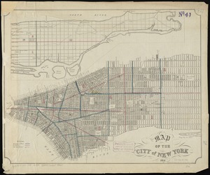
Map of the city & county of New York
4.
Hammond's complete map of the Bronx
5.
Center of New York, first city of the world
6.
Citizens & travelers guide map in, to and from the city of New York and adjacent places
7.
The city of New York as laid out by the Commissioners with the surrounding country
8.
City of New-York
9.
Downtown district of Manhattan
10.
Ground plan of the markets of the City of New-York
11.
Insurance maps of the city of New York
12.
Johnson's map of New York and the adjacent cities
13.
Manhattan : first city of America
14.
Map of greater New York : Map of the borough of Manhattan
15.
Map of New York and vicinity
16.
A map of New York which is published by the Washington Square Bookshop
17.
Map of New-York
18.
Map of the cities of New York, Brooklyn & Jersey City
19.
Map of the city & county of New York ; Upper part of the city and county of New York on a reduced scale
20.
Map of the city of New York
‹ Prev
Next ›
1
2
3
4
5
…
433
434