Toggle navigation
LMEC Home
Exhibitions
Georeferencing
Tools for Teachers
Collections
My Favorites
Sign Up / Log In
Search
Search the map portal
Map Collection
Map Collection
Map Sets
Search
Search
Search for
Search In
All Fields
Creator
Title
Subject
Place
Search All Digital Collections
Advanced Search
8968 Results
My Search
Start Over
More Like
commonwealth:02873q119
Remove constraint More Like: commonwealth:02873q119
Filter your Search
Place
North and Central America
6,199
United States
5,115
Massachusetts
2,151
Europe
1,396
Suffolk (county)
1,314
Boston
1,287
Canada
449
Asia
438
more
Place
»
Topic
Boston (Mass.)--Maps
752
United States--Maps
282
Real property--Massachusetts--Boston--Maps
253
City planning--Massachusetts--Boston--Maps
235
Landowners--Massachusetts--Boston--Maps
170
Massachusetts--Maps
166
Urban renewal--Massachusetts--Boston--Maps
135
Buildings--Massachusetts--Boston--Maps
125
more
Topic
»
Date
Date range begin
–
Date range end
Current results range from
1482
to
2023
View distribution
Creator
United States. Hydrographic Office
595
Boston Redevelopment Authority
236
O.H. Bailey & Co
148
Des Barres, Joseph F. W. (Joseph Frederick Wallet), 1722-1824
124
United States. Post Office Dept
120
Ptolemy, 2nd cent
100
Walling, Henry Francis, 1825-1888
94
Geological Survey (U.S.)
87
more
Creator
»
Format
Maps/Atlases
8,908
Manuscripts
215
Prints
56
Books
36
Objects/Artifacts
10
Drawings/Illustrations
8
Posters
5
Georeferenced
Yes
885
No
8,083
Collection
Norman B. Leventhal Map & Education Center Collection
8,724
Boston and New England Maps
2,438
Urban Maps
2,222
Maritime Charts and Atlases
1,083
American Revolutionary War-Era Maps
638
Boston Redevelopment Authority Collection
271
Massachusetts Real Estate Atlases
38
Mapping Boston Collection
20
more
Collection
»
Available to use
No known restrictions
8,745
Creative Commons license
70
Search Constraints
Sort by relevance
relevance
title
date (asc)
date (desc)
Number of results to display per page
20 per page
10
per page
20
per page
50
per page
100
per page
View results as:
grid view
map view
Search Results
8541.
Victory map
8542.
Victory map 1919
8543.
The victory war map
8544.
Viennense territorium ob res bellicas inter Christianos et Turcas nuperrime editum
8545.
Vieux Paris et ses monuments (XVIIe siècle) : avec le tracé de ses limites sous Philippe-Auguste, Charles VI, Louis XII et...
8546.
A view from the south eastward of Halifax Harbor : Appearance of the shore, (at three miles off,) four or five leagues to the...
8547.
View of Amherst, Mass
8548.
View of Andover, Massachusetts : 1882
8549.
View of Ansonia, Conn : 1875
8550.
View of Ashland, Mass : 1878
8551.
View of Athol, Mass : 1878
8552.
View of Attleborough, Mass : East Village, 1878
8553.
View of Bethel, Conn
8554.
View of Beverly, Mass
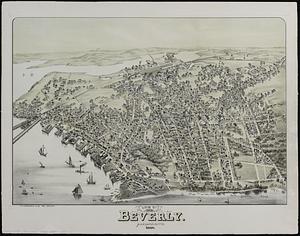
8555.
View of Beverly, Massachusetts, 1886
8556.
A view of Boston
8557.
View of Boston freight terminals, the New York, New Haven & Hartford Railroad
8558.
View of Boston, July 4th 1870
8559.
A view of Boston taken on the road to Dorchester
8560.
View of Bristol, Conn
‹ Prev
Next ›
1
2
…
424
425
426
427
428
429
430
431
432
…
448
449