Toggle navigation
LMEC Home
Exhibitions
Georeferencing
Tools for Teachers
Collections
My Favorites
Sign Up / Log In
Search
Search the map portal
Map Collection
Map Collection
Map Sets
Search
Search
Search for
Search In
All Fields
Creator
Title
Subject
Place
Search All Digital Collections
Advanced Search
8968 Results
My Search
Start Over
More Like
commonwealth:02873q119
Remove constraint More Like: commonwealth:02873q119
Filter your Search
Place
North and Central America
6,199
United States
5,115
Massachusetts
2,151
Europe
1,396
Suffolk (county)
1,314
Boston
1,287
Canada
449
Asia
438
more
Place
»
Topic
Boston (Mass.)--Maps
752
United States--Maps
282
Real property--Massachusetts--Boston--Maps
253
City planning--Massachusetts--Boston--Maps
235
Landowners--Massachusetts--Boston--Maps
170
Massachusetts--Maps
166
Urban renewal--Massachusetts--Boston--Maps
135
Buildings--Massachusetts--Boston--Maps
125
more
Topic
»
Date
Date range begin
–
Date range end
Current results range from
1482
to
2023
View distribution
Creator
United States. Hydrographic Office
595
Boston Redevelopment Authority
236
O.H. Bailey & Co
148
Des Barres, Joseph F. W. (Joseph Frederick Wallet), 1722-1824
124
United States. Post Office Dept
120
Ptolemy, 2nd cent
100
Walling, Henry Francis, 1825-1888
94
Geological Survey (U.S.)
87
more
Creator
»
Format
Maps/Atlases
8,908
Manuscripts
215
Prints
56
Books
36
Objects/Artifacts
10
Drawings/Illustrations
8
Posters
5
Georeferenced
Yes
885
No
8,083
Collection
Norman B. Leventhal Map & Education Center Collection
8,724
Boston and New England Maps
2,438
Urban Maps
2,222
Maritime Charts and Atlases
1,083
American Revolutionary War-Era Maps
638
Boston Redevelopment Authority Collection
271
Massachusetts Real Estate Atlases
38
Mapping Boston Collection
20
more
Collection
»
Available to use
No known restrictions
8,745
Creative Commons license
70
Search Constraints
Sort by relevance
relevance
title
date (asc)
date (desc)
Number of results to display per page
20 per page
10
per page
20
per page
50
per page
100
per page
View results as:
grid view
map view
Search Results
7821.
South Pacific--Society Islands, n.w. coast of Tahiti, Papiete Harbor : from a French survey in 1869 ; corrected 1889
7822.
The south part of Africa, and the island of Madagascar : here the Portugueze have many settlements and all the trade
7823.
The south part of Great Britain, called England and Wales
7824.
The south part of New-England, as it is planted this yeare, 1635
7825.
South Perry, [Ohio]
7826.
The South Shore and Norfolk County, Mass
7827.
South west end of Lake Erie
7828.
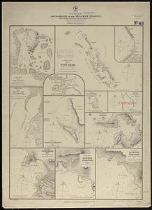
South west Pacific, anchorages in the Solomon Islands : from various authorities with corrections to 1874 ; republication of...
7829.
South western districts
7830.
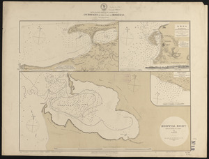
South western shore of the Caribbean Sea, anchorages on the coast of Honduras : from British surveys
7831.
South Weymouth, Norfolk County, Mass. 1885 : from the fair grounds
7832.
South-east New Guinea
7833.
Southeast States road map
7834.
Southern Alberta : map showing disposition of lands
7835.
Southern Asia
7836.
Southern British Columbia : map showing disposition of lands
7837.
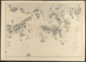
Southern coast of China, harbor of Hongkong and approaches : compiled from the latest information, 1886
7838.
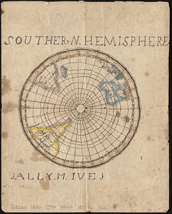
Southern hemisphere
7839.
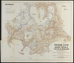
Southern Luzon : showing portion of theatre of operations ; 8th Army Corps, Major General Elwell S. Otis commanding
7840.
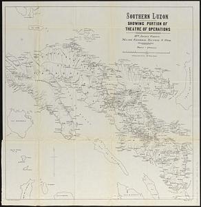
Southern Luzon, showing portion of theatre of operations : 8th Army Corps, Major General Elwell S. Otis commanding
‹ Prev
Next ›
1
2
…
388
389
390
391
392
393
394
395
396
…
448
449


![South Perry, [Ohio]](https://bpldcassets.blob.core.windows.net/derivatives/images/commonwealth:w9505r98t/image_thumbnail_300.jpg)