Toggle navigation
LMEC Home
Exhibitions
Georeferencing
Tools for Teachers
Collections
My Favorites
Sign Up / Log In
Search
Search the map portal
Map Collection
Map Collection
Map Sets
Search
Search
Search for
Search In
All Fields
Creator
Title
Subject
Place
Search All Digital Collections
Advanced Search
8774 Results
My Search
Start Over
More Like
commonwealth:00000x71j
Remove constraint More Like: commonwealth:00000x71j
Filter your Search
Place
North and Central America
6,005
United States
4,923
Massachusetts
2,089
Europe
1,396
Suffolk (county)
1,125
Boston
1,098
Canada
449
Asia
438
more
Place
»
Topic
Boston (Mass.)--Maps
606
United States--Maps
282
Real property--Massachusetts--Boston--Maps
253
Landowners--Massachusetts--Boston--Maps
170
Massachusetts--Maps
162
City planning--Massachusetts--Boston--Maps
108
North America--Maps--Early works to 1800
103
New England--Maps
102
more
Topic
»
Date
Date range begin
–
Date range end
Current results range from
1482
to
2023
View distribution
Creator
United States. Hydrographic Office
595
O.H. Bailey & Co
148
Des Barres, Joseph F. W. (Joseph Frederick Wallet), 1722-1824
123
United States. Post Office Dept
120
Boston Redevelopment Authority
111
Ptolemy, 2nd cent
100
Walling, Henry Francis, 1825-1888
94
Geological Survey (U.S.)
86
more
Creator
»
Format
Maps/Atlases
8,714
Manuscripts
215
Prints
56
Books
36
Objects/Artifacts
10
Drawings/Illustrations
8
Posters
5
Georeferenced
Yes
869
No
7,905
Collection
Norman B. Leventhal Map & Education Center Collection
8,696
Boston and New England Maps
2,277
Urban Maps
2,066
Maritime Charts and Atlases
1,083
American Revolutionary War-Era Maps
616
Boston Redevelopment Authority Collection
130
Massachusetts Real Estate Atlases
35
Applied Geographics, Inc. Records
1
more
Collection
»
Available to use
No known restrictions
8,597
Creative Commons license
47
Search Constraints
Sort by relevance
relevance
title
date (asc)
date (desc)
Number of results to display per page
20 per page
10
per page
20
per page
50
per page
100
per page
View results as:
grid view
map view
Search Results
6181.
A plan for the Central Artery
6182.
Plan for the construction of improvements at the Boston Common
6183.
Plan for the diversion and enclosure of Stony Brook : to accompany report of W.H. Bradley, November 1864
6184.
Plan for the improvement of the Central Park, adopted by the Commissioners, June 3rd, 1856
6185.
Plan for the occupation of flats owned by the Commonwealth in Boston Harbor
6186.
Plan for the occupation of flats owned by the Commonwealth in Boston Harbor
6187.
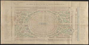
Plan général du palais et du parc de l'Exposition universelle de 1867
6188.
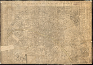
Plan géométral de Paris et de ses fauxbourgs
6189.
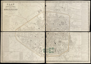
Plan géométrique de la ville de Bruxelles
6190.
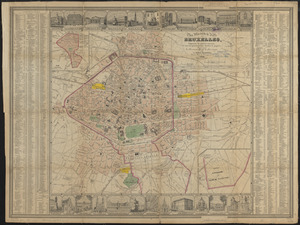
Plan illustré de la Ville de Bruxelles, comprenant les quartiers nouveaux & tous les agrandissements décrétés & projetés
6191.
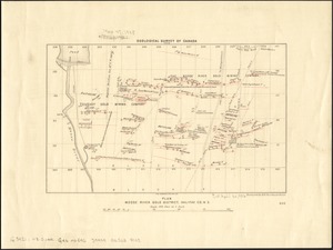
Plan Moose River gold district, Halifax Co., N.S
6192.
Plan of a part of Beverly in the Colony of the Massachusetts Bay
6193.
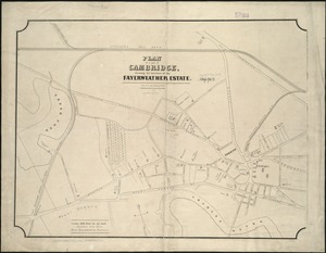
Plan of a part of Cambridge showing the location of the Fayerweather Estate
6194.
Plan of a part of New Brighton, Staten Island, showing the 500 blocks comprised in a proposed sale of lots
6195.
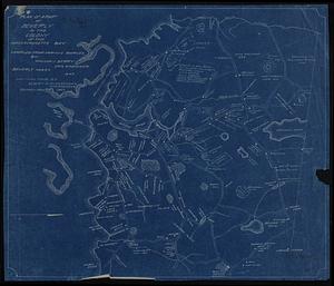
A plan of a survey of Noddles Island
6196.
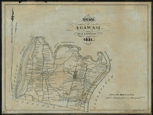
A plan of Agawam
6197.
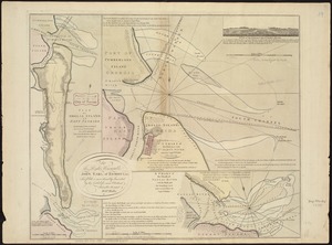
Plan of Amelia Island in East Florida : A chart of the entrance into St. Mary's River taken by Captn. W. Fuller in November,...
6198.
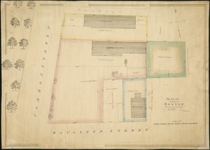
Plan of an estate in Boston belonging to Jos. Head Esqr
6199.
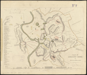
Plan of ancient Rome
6200.
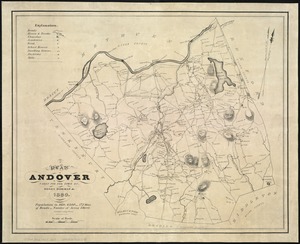
A plan of Andover taken for the town
‹ Prev
Next ›
1
2
…
306
307
308
309
310
311
312
313
314
…
438
439