Toggle navigation
LMEC Home
Exhibitions
Georeferencing
Tools for Teachers
Collections
My Favorites
Sign Up / Log In
Search
Search the map portal
Map Collection
Map Collection
Map Sets
Search
Search
Search for
Search In
All Fields
Creator
Title
Subject
Place
Search All Digital Collections
Advanced Search
8774 Results
My Search
Start Over
More Like
commonwealth:00000x71j
Remove constraint More Like: commonwealth:00000x71j
Filter your Search
Place
North and Central America
6,005
United States
4,923
Massachusetts
2,089
Europe
1,396
Suffolk (county)
1,125
Boston
1,098
Canada
449
Asia
438
more
Place
»
Topic
Boston (Mass.)--Maps
606
United States--Maps
282
Real property--Massachusetts--Boston--Maps
253
Landowners--Massachusetts--Boston--Maps
170
Massachusetts--Maps
162
City planning--Massachusetts--Boston--Maps
108
North America--Maps--Early works to 1800
103
New England--Maps
102
more
Topic
»
Date
Date range begin
–
Date range end
Current results range from
1482
to
2023
View distribution
Creator
United States. Hydrographic Office
595
O.H. Bailey & Co
148
Des Barres, Joseph F. W. (Joseph Frederick Wallet), 1722-1824
123
United States. Post Office Dept
120
Boston Redevelopment Authority
111
Ptolemy, 2nd cent
100
Walling, Henry Francis, 1825-1888
94
Geological Survey (U.S.)
86
more
Creator
»
Format
Maps/Atlases
8,714
Manuscripts
215
Prints
56
Books
36
Objects/Artifacts
10
Drawings/Illustrations
8
Posters
5
Georeferenced
Yes
869
No
7,905
Collection
Norman B. Leventhal Map & Education Center Collection
8,696
Boston and New England Maps
2,277
Urban Maps
2,066
Maritime Charts and Atlases
1,083
American Revolutionary War-Era Maps
616
Boston Redevelopment Authority Collection
130
Massachusetts Real Estate Atlases
35
Applied Geographics, Inc. Records
1
more
Collection
»
Available to use
No known restrictions
8,597
Creative Commons license
47
Search Constraints
Sort by relevance
relevance
title
date (asc)
date (desc)
Number of results to display per page
20 per page
10
per page
20
per page
50
per page
100
per page
View results as:
grid view
map view
Search Results
5781.
Official highway map of the state of Vermont
5782.
Official map of American and Canadian airways and aerial mail routes
5783.
Official map of Boston
5784.
Official map of New Mexico
5785.
The official map of New York : compiled from United States government surveys, official state surveys, and other sources
5786.
Official map of North Dakota
5787.
Official map of the Philadelphia Rapid Transit Co
5788.
Official map of the state of Virginia : from actual surveys by order of the executive, 1828 & 1859
5789.
Official map of the territory of Dakota, showing the two general divisions of Dakota, South and North, the land districts,...
5790.
The official map of the world : showing the four quarters of the globe on the quarter-spherical or orange peel projection
5791.
Official plan of the siege of Yorktown, Va. conducted by the Army of the Potomac under command of Maj. Gen. George B....
5792.
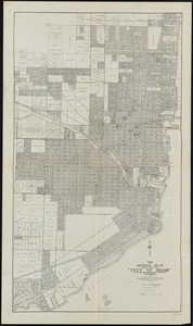
The official plat "City of Miami," Florida
5793.
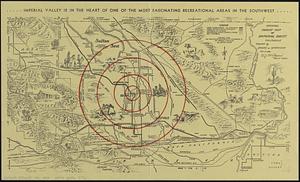
Official tourist map of Imperial County, California
5794.
Off-street parking inventory for the Boston regional core
5795.
Off-street parking inventory within Boston proper
5796.
Ohio and N.W. Territory
5797.
Ohio boundary no. 1 South Bend of Lake Michigan : map, exhibiting the position occupied in the determination of the latitude of...
5798.
Ohio boundary no. 1 South Bend of Lake Michigan : map, exhibiting the position occupied in the determination of the latitude of...
5799.
Ohio boundary no. 2 : map exhibiting the positions occupied on the Maumee Bay and river: viz: Turtle Island, the North Cape,...
5800.
Oil and gas fields of Pennsylvania
‹ Prev
Next ›
1
2
…
286
287
288
289
290
291
292
293
294
…
438
439