Toggle navigation
LMEC Home
Exhibitions
Georeferencing
Tools for Teachers
Collections
My Favorites
Sign Up / Log In
Search
Search the map portal
Map Collection
Map Collection
Map Sets
Search
Search
Search for
Search In
All Fields
Creator
Title
Subject
Place
Search All Digital Collections
Advanced Search
31 Results
My Search
Start Over
More Like
commonwealth:z603vt68q
Remove constraint More Like: commonwealth:z603vt68q
Place
Suffolk (county)
Remove constraint Place: Suffolk (county)
Filter your Search
Place
North and Central America
31
Suffolk (county)
[remove]
31
United States
31
Boston
29
Bunker Hill
4
Boston Harbor
3
Castle Island
1
Dorchester
1
more
Place
»
Topic
Boston (Mass.)--History--Revolution, 1775-1783--Maps--Early works to 1800
16
Boston (Mass.)--Pictorial works--Early works to 1800
8
Boston (Mass.)--History--Siege, 1775-1776--Maps--Early works to 1800
6
Fortification--Massachusetts--Boston--Maps--Early works to 1800
6
Boston (Mass.)--History--Revolution, 1775-1783--Aerial views--Early works to 1800
5
Boston (Mass.)--History--Siege, 1775-1776--Aerial views--Early works to 1800
5
Sieges--Massachusetts--Boston--Pictorial works--Early works to 1800
5
Bunker Hill, Battle of, Boston, Mass., 1775--Maps--Early works to 1800
4
more
Topic
»
Date
Date range begin
–
Date range end
Current results range from
1755
to
1780
1755 : 1781
1755
1781
View distribution
Creator
Williams, Richard, active 1750-1776
10
Des Barres, Joseph F. W. (Joseph Frederick Wallet), 1722-1824
4
Faden, William, 1749-1836
3
Page, Thomas Hyde, Sir, 1746-1821
3
Habermann, Franz Xaver, 1721-1796
2
Robert Sayer and John Bennett (Firm)
2
Aitken, Robert, 1735-1802
1
Beaurain, Jean de, 1696-1771
1
more
Creator
»
Format
Maps/Atlases
18
Manuscripts
10
Drawings/Illustrations
8
Prints
5
Georeferenced
Yes
3
No
28
Collection
American Revolutionary War-Era Maps
31
Richard H. Brown Revolutionary War Map Collection at Mount Vernon
31
Boston and New England Maps
1
Urban Maps
1
Available to use
Creative Commons license
31
Search Constraints
Sort by relevance
relevance
title
date (asc)
date (desc)
Number of results to display per page
20 per page
10
per page
20
per page
50
per page
100
per page
View results as:
grid view
map view
Search Results
1.
An accurate map of the country round Boston in New England from the best authorities
2.
[Boston Neck, with the British lines and John Hancock's house]
3.
[Cambridge with Washington's headquarters]
4.
Carte du port et havre de Boston avec les côtes adjacentes, dans laquel on a tracée les camps et les retranchemens occupé,...
5.
Castle William : A view of New Castle with the Fort and light house on the entrance of the Pisquataqua River
6.
[Charlestown Promontory, the ruins of the town after the Battle of Bunker Hill and General Howe's encampment]
7.
[Dorchester Neck]
8.
Exact plan of General Gage's lines on Boston Neck in America
9.
A front view of the lines taken from the advanced post near Browns house : A view of the harbour of Boston taken from Fort Hill...
10.
[Map of Boston]
11.
[Noddle Island and the Mill Pond]
12.
Order of battle of the army under the command of Lt. General Gage at Boston, July 17th, 1775
13.
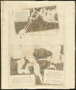
Oyster Bay and Huntington : Huntington Bay
14.
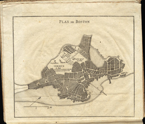
Plan de Boston
15.
Plan de Boston
16.
Plan de la ville et du port de Boston : capitale de la Nouvelle Angleterre
17.
A plan of Boston, and its environs : shewing the true situation of His Majesty's army, and also those of the rebels
18.
A plan of Boston in New England with its environs : including Milton, Dorchester, Roxbury, Brooklin, Cambridge, Medford,...
19.
A plan of the action at Bunkers Hill, on the 17th. of June, 1775 : between His Majesty's troops under the command of Major...
20.
Plan of the battle, on Bunker's Hill : fought on the 17th of June 1775
+
-
Redo search here
Search when I move the map
Leaflet
| ©
OpenStreetMap
contributors, ©
CartoDB
‹ Prev
Next ›
1
2

![[Boston Neck, with the British lines and John Hancock's house]](https://bpldcassets.blob.core.windows.net/derivatives/images/commonwealth:dz010v61c/image_thumbnail_300.jpg)
![[Cambridge with Washington's headquarters]](https://bpldcassets.blob.core.windows.net/derivatives/images/commonwealth:dz010v63x/image_thumbnail_300.jpg)

![[Charlestown Promontory, the ruins of the town after the Battle of Bunker Hill and General Howe's encampment]](https://bpldcassets.blob.core.windows.net/derivatives/images/commonwealth:dz010v65g/image_thumbnail_300.jpg)
![[Dorchester Neck]](https://bpldcassets.blob.core.windows.net/derivatives/images/commonwealth:dz010v59b/image_thumbnail_300.jpg)

![[Map of Boston]](https://bpldcassets.blob.core.windows.net/derivatives/images/commonwealth:z603vw17n/image_thumbnail_300.jpg)
![[Noddle Island and the Mill Pond]](https://bpldcassets.blob.core.windows.net/derivatives/images/commonwealth:dz010v671/image_thumbnail_300.jpg)